Dark Creek
| Rating: | |||||||||||||||||||||||||||||||
|---|---|---|---|---|---|---|---|---|---|---|---|---|---|---|---|---|---|---|---|---|---|---|---|---|---|---|---|---|---|---|---|
| | Raps:6-9, max ↨110ft
Red Tape:No permit required Shuttle:None Vehicle:Passenger | ||||||||||||||||||||||||||||||
| Start: | |||||||||||||||||||||||||||||||
| Parking: | |||||||||||||||||||||||||||||||
| Condition Reports: | 2 Aug 2025
"Great day in the creek! Splashy but not pushy. All were surprised at how cold the water was, and grateful for the frequent sunny areas to warm up in. |
||||||||||||||||||||||||||||||
| Best season: | Jul-Sept
|
||||||||||||||||||||||||||||||
| Regions: | |||||||||||||||||||||||||||||||
Introduction[edit]
A fun, beautiful canyon with excellent access, a bunch of aesthetically-pleasing waterfalls, and a short section of narrows. Destined to become a classic in the Dark Divide Area. Dark Creek generally takes about half a day to run. With an early start, combine Dark with nearby East Canyon Creek or Prairie Creek for a full day of canyoning.
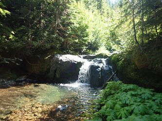
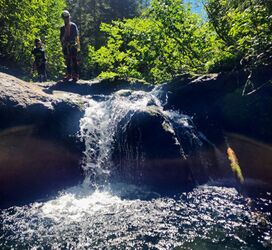
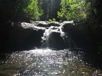
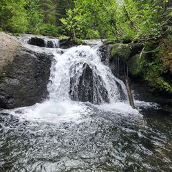
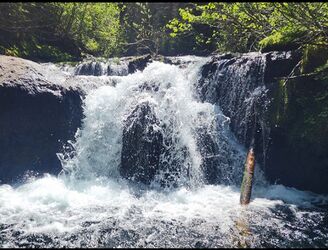
The four mandatory rappels are all of excellent quality giving the rappeller the option to go in the flow. The other six drops provide some of the best downclimbs in WA, with nice chunky handholds and steps from the blocky Basalt walls. A rare opportunity to downclimb in the flow with very minimal consequences with pools at the bottom.
- Checkpoint is at R1 or where the trail crosses the creek. Both of those spots require a lot of time and energy to check the flow. You can also check just north of the approach parking area, you have to walk through the trees and look across the river to see Dark Creek. There are not any flow pictures for this location. If the water looks and sounds high, its going to be high. Moderate flow is going to be more of a soft gentle creek flow.
- Watershed: 4.15mi^2. Predominantly north-facing. Highest areas of the watershed are around 4700-5300ft high.
Approach[edit]
Park at the unsigned trailhead on FR-23. The road here was previously washed out, but was repaired in 2018. There's now a wide area in the road with room for 4-5 vehicles. Note the large berm (aka dam-like construction of logs and chains) put in to keep the road from getting washed out again in winter floods. Ford the creek to the trail on the far side (easily identified by a concrete ramp) and follow it. After about 1.3mi, the trail crosses Dark Creek; this is a good place to check the flow. Continue upwards 0.6mi to a junction around 3500ft (approx. UTM 10N 595991mE 5128029mN) just past Dark's minor western tributary. Follow the trail southwest and keep going to about UTM 10N 596295mE 5127734mN. Leave the trail and thrash northeast down a shallow drainage to Dark Creek. Off-trail section takes ~5min. Don't cut thrash over early or you'll miss some nice canyon.
Other notes:
- Older USGS maps depict the trail looping just above Dark Creek Falls. It doesn't exist. See ropewiki map for actual trail location.
- This is a popular motorcycle use trail. Give way to riders. Getting an early start in the morning might be a good way to avoid them on the approach.
- It might be possible to shuttle up using FR 2325, although this option has not been explored as of 2019.
Descent[edit]
Head downstream through a nice area of bedrock.
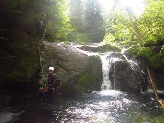
- R1: 8ft. Rappel from tree DCR or downclimb DCL.
Follow the bedrock around a corner and downclimb past several cascades.
- R2: 90ft from tree DCL. Water cascades down a chute from DCL to DCR entering a wonderful pool in the narrows below. R3 is at the pool's exit.
- R3: 25ft from log DCR or downclimb.
- R4: 15ft. Big logjam atop the falls. Rappel from log, or climb over the logs (awkward) for a downclimb DCL.
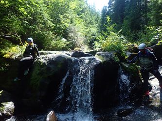
Downclimb a series of short drops. In high flow, a rappel might be recommended on some of these.
- R5: 25ft from log creek center, or downclimb DCR.
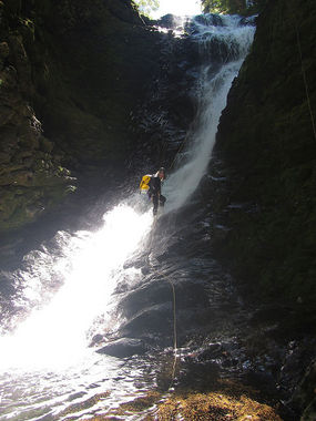
The next three rappels come rapid-fire and are collectively known as "Dark Creek Falls." If the flow proves too high, it's possible to escape DCL above R6.
- R6: 85ft. Anchor on a tree DCL. A smaller tributary enters DCL here.
- R7: 65ft. As of 2022, this is a cairn anchor, which will likely need to be rebuilt every year. An old rotten log spans above the top of the rappel, but it is marginal and cannot be backed up. A cairn anchor is a more reliable solution. Beware a deep hanging pothole partway down the pitch, on DCL (rappeller's right side of the falls). It's fun to rappel in when the flow is low, but could be a trap in high water conditions. The pothole is not visible from above.
- R8: 110ft from two bolts DCL. Recommend extending the pull side ahead of time for an easier pull at the bottom. Falls is a large funnel going into a dark grotto (aka "The Dark Room") and exits through a narrow slot. This area could be dangerous in high flow; there may be a hydraulic present at the bottom. In high water conditions, it may be wiser to rappel from a tree far DCR to avoid the chamber.
Walk out through a short narrows and bypass a logjam DCR (easier than it looks).
- R9: Two tier falls: 20ft, a bit of a horizontal chute, then another 10ft tier. The first tier is usually anchored by a tree DCL. The second tier can be downclimbed or jumped.
Exit[edit]
Walk downstream 5min to reach the trail. Follow it back to your car. Declare victory.
Red tape[edit]
None.
Beta sites[edit]
https://www.canyoningthe406.com/dark-creek-1
Trip reports and media[edit]
Background[edit]
Dark Creek is named for John Dark, a 19th-century gold prospector and speculator.
