Desperado Canyon
| Rating: | |||||||||||||||||||||||||||||||
|---|---|---|---|---|---|---|---|---|---|---|---|---|---|---|---|---|---|---|---|---|---|---|---|---|---|---|---|---|---|---|---|
| | Difficulty:3A III (v3a1 III) Raps:12, max ↨85ft
Red Tape:No permit required Shuttle:None Vehicle:4WD Rock type:Limestone | ||||||||||||||||||||||||||||||
| Start: | |||||||||||||||||||||||||||||||
| Parking: | |||||||||||||||||||||||||||||||
| Condition Reports: | 2 Oct 2023
"The recent storms made the approach road very challenging to navigate. The tunnel under the I15 has waves of gravel running across it. The Tacoma brus |
||||||||||||||||||||||||||||||
| Best season: | Fall to Spring
|
||||||||||||||||||||||||||||||
| Regions: | |||||||||||||||||||||||||||||||
Introduction[edit]
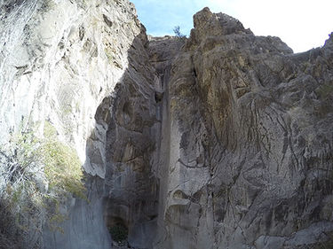
According to Rick Ianiello (author of Las Vegas Slots) this is the most scenic canyons in the State Line Hills.
Approach[edit]
The drive route has changed from the original file which may be accessed by turning right earlier toward Turtle Tears with a turn left and then a turn right on rough road. Optional parking locations along the road for folks that choose not to push their vehicles over the rough grades that are more of a loose wash.
The GPS file shows a variation of the gully route which quickly becomes an exposed climber's route. To avoid this route stay on the ridge line and pay attention to the GPS file.
Descent[edit]
Desperado Canyon uses natural anchors, including cairn anchors. Groups should be competent in building/inspecting/backup of natural anchors/webbing as well as proper technique in rappelling on marginal anchors. The anchors & rappel counts will vary between 7 to 14 depending on the comfort level of group for doing a down-climb or doing a rappel. Rappel lengths are rough estimates. The rappel lengths and locations on the map are approximate and should not be relied upon:
R1: 50ft cliff band from a rock pinch RDC
R2: 80ft cliff band from a cairn anchor
Following R2 there is another cliff band that some rappel, but it has a trivial bypass RDC.
R3: 55ft from a cairn anchor
R4: 30ft from a cairn anchor
R5: 20ft from a rock chock RDC
R6: 20ft from a cairn anchor into a possible knee-deep pool
R7: 40ft from a cairn anchor
R8: 15ft from a cairn into a possible deep pool. This can be bypassed RDC down a chute with a small tree. Rappel 25ft from the small tree to return to the watercourse.
R9: 30ft from a chockstone into a possible deep pool. This can be bypassed LDC by climbing the wall and then rappelling 25ft off a Catclaw tree back into the watercourse.
NOTE: Alternate rappel....I set an alternate, better anchor and rappel for R9 and R10. Instead of climbing the vertical wall LDC, climb the easier climb to the right and go around a small bowl on a ledge that takes you to the last slot beside a wall. It has a tree in it part way down. There is an anchor on that tree. The rap is ABOUT 75ft?? (sorry forgot to measure it).
R10: 40ft from a geo anchor high RDC, or multi-stage from the previous rappel.
R11: 85ft from a large boulder down a beautiful chute into a deep pothole. This pothole does not appear to commonly hold water, but might be challenging to escape under slippery conditions. When dry it requires a minor climb or partner assist that should not be challenging for competent canyoneers.
R12: 70ft down a shallow slope, anchored at a rock chock LDC
Exit[edit]
Traverse a serpentine network of washes to return to your vehicle.
Red tape[edit]
Beta sites[edit]
- https://www.stavislost.com/hikes/trail/desperado-canyon
- Las Vegas Slots Facebook Beta
 Las Vegas Slots Book by Rick Ianiello : Desperado Canyon
 HikeArizona.com : Desperado Canyon
Trip reports and media[edit]
