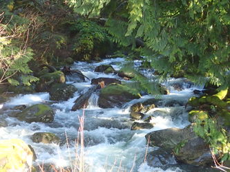
Duncan Creek
| Rating: | |||||||||||||||||||||||||||||||
|---|---|---|---|---|---|---|---|---|---|---|---|---|---|---|---|---|---|---|---|---|---|---|---|---|---|---|---|---|---|---|---|
| | Raps:6-10, max ↨50ft
Red Tape:No permit required Shuttle:None Vehicle:Passenger | ||||||||||||||||||||||||||||||
| Start: | |||||||||||||||||||||||||||||||
| Parking: | |||||||||||||||||||||||||||||||
| Condition Reports: | 6 Dec 2025
"Went to check out Duncan for a high flow run. Water was over the banks at the bridge so we walked in to look at the lower section. Very high water so |
||||||||||||||||||||||||||||||
| Best season: | Apr-Aug, BEST in May-June
|
||||||||||||||||||||||||||||||
| Regions: | |||||||||||||||||||||||||||||||
Introduction[edit]
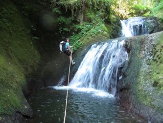
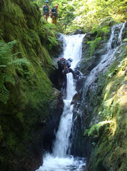
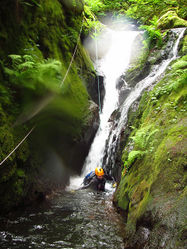
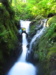
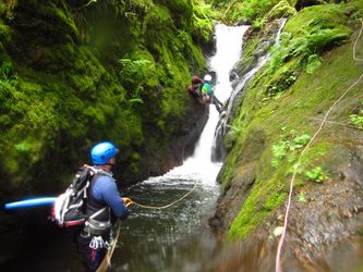
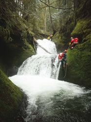
Duncan is the number one best creek in the Portland area for training and practice. It sports everything found in aquatic canyons, but on a smaller scale. There are several short narrows and an unusual number of deep pools. There are lots of short drops for practicing rigging, downclimbs, and a few spots that lend themselves to short jumps and slides. It has a little of everything.
Duncan runs high in the early season (and is great fun if you enjoy swiftwater), but somewhere in May or June the water level drops and becomes beginner-friendly. A good way to estimate flow is to visit the checkpoint (R10) and see how much water, if any, is flowing down the Moss Chasm. If you see more than a trickle, Duncan is running high.
- The lower part of Duncan Creek is popular with (non-canyoneering) locals and can be busy on hot midsummer days when people come to play in the pools. Arrive early for parking. Given Duncan's popularity, please do not leave fixed anchors in the lower canyon.
- Catchment: 1.8mi^2.
Best Practices[edit]
Duncan has been seeing increased visitation by canyoneers and is showing signs of abuse. Please use anchors in or adjacent to the watercourse. Climbing to trees higher up on the sides is attractive, but risks eroding the banks and trampling vegetation.
- Teaching people to rappel for the first time in an aquatic canyon is not a good plan. It's safer to become fully proficient in a dry location outside the canyon.
- Wrapping the rope around trees for a two strand rappel is efficient, but is not good for the tree when you go to pull your rope. Friction damage around the back of the tree cuts into the bark. Done too many times by too many people and the tree will become girdled and eventually die. It's kinder to the tree to set an anchor or use a retrievable system.
- Two strand rappelling (as is done in alpine climbing) can be dangerous in aquatic canyons. Excess rope present at the bottom of the pitch can become an entanglement hazard in deep pools. Taking a class in aquatic canyoning techniques is strongly recommended.
- Beginners "leading" beginners is a major cause of accidents in canyoneering.
Parking[edit]
Park at the end of Duncan Creek Road at a large turnaround under the powerlines. Please park off the pavement and do not block access. This parking area is in earshot, if not visibility, of several private homes. A permit is not required to park at this location.
- There is also parking for a couple cars just up Duncan Creek Rd (now dirt/gravel) at the Nellie Corser trailhead. Parking here requires a Washington State Discovery Pass.
Water Flow[edit]
Approach[edit]
There are many unsigned user trails in the area. Starting at the powerlines, walk up the road to the Nellie Corser trailhead and follow the obvious trail west. Eventually, you'l reach an easy-to-miss junction high above the creek; go right. The trail eventually drops down to the creek. Cross and pick up the trail again on the far side. The trail you want heads off north on the west side. Go upstream about 0.25mi and drop in just above Quad Falls (~1500ft elevation).
- The best checkpoint is to walk up to R10 from the powerline. If there's more than a trickle flowing down the moss chasm (on the left when looking at the falls), then Duncan is running on the high side.
Descent[edit]
This canyon has unlinked anchor stations; please do not add webbing to the bolts. Groups should be familiar with how to rig unlinked anchors.
Jumping is a leading cause of canyon injury. Look before you leap. Always send down a scout to check the depth, look for hidden obstacles, etc.
Upper Duncan[edit]
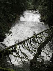
R1-R5 is referred to as Quad Falls.
- R1: 20ft two tier.
- High water: 20ft traverse from single bolt to rappel station DCL.
- Low water: rappel from bolt, tree, or downclimb.
- R2: 20ft into a pool. (Possible jump, but scout it first.)
- High water: extend rope from R1 as rebelay / traverse to single bolt DCL. Rappel from the bolt into a chest-deep pool.
- Low Water: rappel from bolt station DCR. (Update 2023: one of these bolts is bad and spins.)
- R3: 10ft from single bolt DCL into a pool. (Possible slide.)
- R4: 25ft into a punchbowl from bolt station DCR. There is a large log underwater in the middle; do not jump.
- High water: the punchbowl is a roiling hydraulic that will push you DCR out against the canyon wall. Beware getting swept at the exit.
- R5: 50ft from bolts DCL immediately above the exit of the R4 pool. There is a small hanging pool (shallow) just above the drop.
The canyon opens below R5 with an escape trail DCR.
- Short optional slide DCL.
- R6: 40ft from single bolt boulder DCR.
- 12ft drop. Downclimb large log center or rappel DCR.
Walk downstream 5-10min.
- R7: 20ft from logjam creek center. Beware walking around above the logjam as you may be on a "false floor" that's undercut and subject to collapse.
- R8: Two-stage 18ft drop (8ft, 10ft). Both drops go into deep pools. The upper pool is narrow, but very deep. In high flow, it becomes a horizontal recirculation that can be difficult to escape from.
- High water: Bypass via dry rappel from large tree high DCL.
- Low water: Rappel via two bolts DCR in the canyon wall. Both stages have been jumped (carefully).
- Just ahead is a 3ft drop from a chockstone into a deep pool. Downclimb, slide or jump, but check the depth first.
Just ahead is a big logjam that looks daunting. Skirt around DCR side, then climb up over / down through the logs to the next obstacle. Escape is also possible DCR.
- 10ft drop partially blocked by the same log jam. Downclimb DCR (easier than it looks) or rappel, and swim out the bottom.
- 12ft drop. Downclimb DCL.
- Watch for possible dipper nest in the vegetation creek center. Please take care not to disturb.
Continue downstream on bedrock slabs to the Crossing. Optional exit here on the trail you hiked in on.
Lower Duncan[edit]
Below the crossing is a high tourist area. Please do not leave fixed anchors below this point.
- Logjam. Downclimb or rappel 12ft. Use caution as it shifts every year and may be unstable. Check out "waterfall room" under the logjam for extra bonus points.
- R9: 20ft. Walk down slabs to the top of the falls DCR. Drop into the pool and climb out the other side (tricky). Anchor is DCL tree for dry rappel.
- Several downclimbs / short slides come in quick succession. Eventually, the creek narrows to a body-width channel before exiting into a deep pool above the finale.
Ahead is the finale. In high water, the creek splits around a rocky island. In low water, it all pours down the DCL side. Some options:
- High water: Rappelling DCL would be dangerous in high flow, so downclimb the Moss Chasm DCR instead. This is a fun downclimb when there's water in the chute. This is the narrowest spot on Duncan.
- Low water: R10 - rappel two stages 25ft DCL. There is potential for foot entrapment in a V-shaped groove on the first tier. For safety, it may be good to position someone in the mid-tier pothole (not that deep) to assist. Both of the tiers on this rappel are awkward and skill is required to navigate them gracefully. We usually send someone back to the top to remove the anchor after everyone has rappelled.
- Bypass: take a trail DCL or down the island creek-center.
Exit[edit]
Below the last rappel, exit the creek immediately DCL to a user trail. Follow this up and take a shortcut back to the parking area.
- Do not keep going down the creek or you'll end out on a parcel of private land just before the road.
Red tape[edit]
- See "Approach" above. A Washington State Discovery Pass is required ONLY at the Nellie Corser trailhead.
- There is a small parcel of private land on the east side of the creek (DCL) immediately before the it passes under Duncan Creek Road. There is a small campsite here. This area is signed "No Trespassing" as of July 2022. To avoid trespassing: exit the creek immediately DCL at the finale. Follow the user trail back to the parking area.
Please be respectful of locals and private property. Help us keep the area clean and the neighbors happy. It is fairly common to encounter hikers. In summer, it may be a good idea to arrive early for parking.
Beta sites[edit]
 Super Amazing Map : Duncan Creek
Trip reports and media[edit]
 Karl Helser's NW Adventures : Duncan Creek Canyoneer 6-5-16
- https://youtu.be/PduFN6j9BNY - November 2023
Background[edit]
This creek was first descended by Kevin Clark, Karin Mullendorf, and Annyela Klocker in August 2014.
There are two other falls much further up Duncan Creek (Apron Falls and Railcar Falls), but they may not be worth your time. The first party to run Railcar Falls vowed never to go there again. The west fork of Duncan has also been explored, but only sports three short drops.

