Dutch Creek
| Rating: | |||||||||||||||||||||||||||||||
|---|---|---|---|---|---|---|---|---|---|---|---|---|---|---|---|---|---|---|---|---|---|---|---|---|---|---|---|---|---|---|---|
| | Raps:7, max ↨130ft
Red Tape:No permit required Shuttle:None Vehicle:Passenger | ||||||||||||||||||||||||||||||
| Location: | |||||||||||||||||||||||||||||||
| Condition Reports: | |||||||||||||||||||||||||||||||
| Best season: | Jul-Sep
|
||||||||||||||||||||||||||||||
| Regions: | |||||||||||||||||||||||||||||||
Introduction[edit]
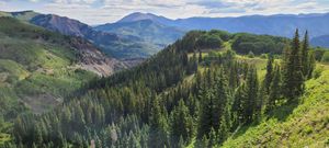
A longer, but easy hike into the really pretty Coal Basin east of Grand Mesa, Dutch Creek drains snow accumulated high above by Huntsman Ridge for some large fanned out and stepped rappels.
The coal mining origin of this area started in the late 1800s and a rail line carried coal from this basin to the coking ovens across from Redstone. Today, restoration is underway in collaboration with mountain bike trails being built at Coal Basin Ranch. https://www.mtbproject.com/trail/7019447/coal-basin-trail
Approach[edit]
Driving:
From the town of Redstone and CO 133, drive west on the paved Coal Creek Rd for 4 miles. (turn at the coking ovens, an obvious landmark)
Park at the end of the road in a designated parking lot with pit toilet.
Hiking:
From the parking lot, walk over the cattle guard and past the gate to the south on USFS Rd 307 / Coal Basin Trail 1953, which is an old road bed used by hikers, horses and mountain bikers to gain the downhill-only Bear Ridge and Flying Dutch Boy trails.
At the first intersection with a large old building, head left following signage toward waterfalls.
The trail switches back sharply to gain the ridge separating Dutch Creek and an unnamed creek draining Huntsman Mountain. A short waterfall can be seen at this switchback.
Gain the ridge and a flat saddle before contouring into Dutch Creek on the trail.
Despite the numbers, the hike to the intersection with Dutch Creek is easy going on a gentle consistent uphill grade.
Approach to Lower Dutch Creek: 4.3 miles +1900ft
At least four more rappels exist upstream in Upper Dutch Creek, but getting there is harder.
Cross Dutch Creek and continue on the old road grade to the north. Veer left on the less-used trail hugging the mountainside when a Y-split occurs in the trail/old road. This continues to a switchback very close to the next drainage. A game trail connects back to the ridge toward Dutch Creek. The path deteriorates wrapping the corner with angled trail-less and semi-loose dirt hiking on the hillside for the rest of the way. Contour to an entrance tributary to walk into Upper Dutch above the higher drops.
Additional approach to Upper Dutch Creek: 1.1 miles +680ft
Total approach to Upper Dutch from the Parking: 5.4 miles +2580ft
Descent[edit]
Upper Dutch Creek
Dutch Creek starts with a few easily downclimbed narrows.
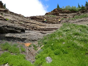
The first 12 ft waterfall obstacle can be bypassed on Canyon Left by using a ledge and a dirt slope.
R1: 30 ft from a slung rock in Canyon Center for a 15 ft drop
R2: 35 ft from a rock stack in Canyon Center
R3: 85 ft from a slung boulder on Canyon Left
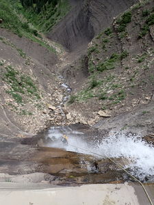
R4: 120 ft from a rock stack on a wide shelf in the waterfall. In higher flow, this anchor may not be available.
Snow bridge
Cross the approach trail
Lower Dutch Creek
Downclimb on Canyon Left
R5: 130 ft from a large group of willows in Canyon Center
R6: 65 ft from a rock stack
Walk a third of a mile
R7: 130 ft from an Aspen higher on Canyon Right above the roostertail into the first small pothole
Downclimb a 20 foot waterfall on Canyon Left
Round the corner and walk down flat carved rock
Exit when the canyon curves to the right around a low ridge of aspens. The rest of Dutch Creek is largely unremarkable stream walking.
Exit[edit]
Hike +220ft uphill in the aspen forest to gain the old road bed on the north side of Dutch Creek.
Follow this trail downhill to the large old building and retrace the first part of the approach back to the cars.
Red tape[edit]
Beta sites[edit]
Trip reports and media[edit]
23Jul2022 explored by Ira Lewis, Wayne Herrick, Andrew Tanasescu & Kati Wright


