East Inlet Narrows (RMNP)
| Rating: | |||||||||||||||||||||||||||||||
|---|---|---|---|---|---|---|---|---|---|---|---|---|---|---|---|---|---|---|---|---|---|---|---|---|---|---|---|---|---|---|---|
| | Raps:4-5, max ↨80ft
Red Tape:No permit required Shuttle:None Vehicle:Passenger | ||||||||||||||||||||||||||||||
| Location: | |||||||||||||||||||||||||||||||
| Condition Reports: | 30 Jul 2016
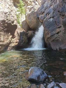
"Water Reference (estimation): More water than the banner photo (see our photo from a similar location below), but less than the photos in the Descent |
||||||||||||||||||||||||||||||
| Best season: | Aug-Sep
|
||||||||||||||||||||||||||||||
| Regions: | |||||||||||||||||||||||||||||||
Introduction[edit]
The East Inlet flows into Grand Lake on the West side of Rocky Mountain National Park, forming some of the highest headwaters of the Colorado River Basin.
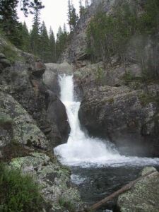
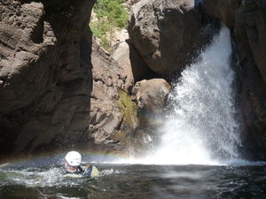
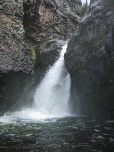
Four impressive waterfalls form through a series of rock bands with some pools and narrows. Depending on the amount of water, this canyon can present a straight forward aquatic descent or in higher flow may require bypassing obstacles and creating new anchors.
While a USGS monitoring location does exist for East Inlet, it currnetly does not measure CFS. A nearby gauge exists at North Inlet which has a similar drainage basin. While this cannot predict increased flows caused by more localized weather events, it can give a general idea of where the flows might be in the region. Gauge flows before entering this canyon at Adams Falls and at the start of the canyon
East Inlet Gauge (For Reference): https://waterdata.usgs.gov/monitoring-location/09013500/#parameterCode=00010&period=P7D
North Inlet Gauge (CFS Data): https://waterdata.usgs.gov/monitoring-location/401530105475401/#parameterCode=00060&period=P7D
Approach[edit]
Driving: The hike starts at the East Inlet trailhead. From the main street in downtown Grand Lake, continue heading east. At the end of the downtown area, the street becomes a dirt road, passing through a series of cabins and homes. Follow signs to Adams Falls and the East Inlet trailhead.
Driving south on Highway 34 (Trail Ridge Road) towards Grand Lake, take the business bypass (not marked left turn onto a paved road a few hundred feet from Highway 34, but an obvious fork to the left). Follow this road to the end, which is the East Inlet trailhead.
Hiking: Hike up the east inlet trail 3.3 miles. Stop at the Adams Falls overlook near the beginning of the trail. This narrow section is not part of described canyon route due to being more narrow than waterfalls upstream. depart the trail when it nears the watercourse after 3.3 miles, dropping over glacial bedrock, along a very well used trail, to the river. Upstream looks calm. Downstream several small drops begin. Suit up here.
Descent[edit]
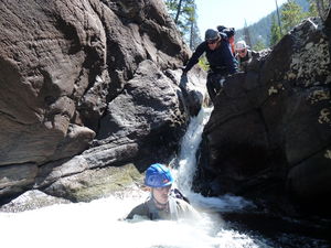
Find a calm spot upstream and swim across. Note, the current can be strong even in the calm sections, so be sure to cross well above the drops. Stay along the southern shore and hike, boulder hop, and occasionally wade along the southern bank of the stream to get below the cascades. Below you may see the dropoff for the first falls. Cross the river above the falls in a calm area - and be careful! You should now be back along the northern bank. Note, it may be possible to avoid swimming across the river, by staying along the bedrock of the northern banks of the stream. You may need a rope as a handline, but it could save you some swimming.
The first falls has two tiers. The upper is a raging torrent of whitewater, and the lower is a giant fan. Climb down the cliffs on the north side of the first tier - a handline around a tree will be helpful. Continue down the river, past the falls, following the shore. The river will follow a small S-curve, then the canyon will begin to narrow. At the end of the short narrow stretch is the second falls, but it can be tricky to get to.
On the north shore, below the cliff faces is a small ledge with a large pine tree. Place a handline to one of the trees above and climb down to this ledge. You must enter the river at this point, below the ledge, staying against the north side of the stream. If the water is running heavy, use the tree on the ledge to set up a lowering system. The person lowered will then anchor the rope, and a tyrolean can be set up (be sure to use a retrievable rope system - don't leave a fixed rope!).
(Low Flow) R1 First Falls: 65' from a tree on Canyon Left
(Low Flow) R2 First Falls: 55' from a tree on Canyon Left
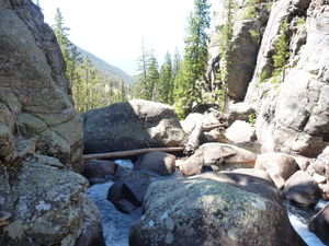
(Low water) R3 Second Falls: 80' from a log in Canyon Center
High Flow Second Falls Bypass by climbing on top of the cliffs on canyon Right, which is the north rim. Proceed down the ledge system, utilizing a handline if required. Target returning to the river at the base of the second falls.
Soon the canyon narrows once again. The third falls is at the end of this stretch of narrows.
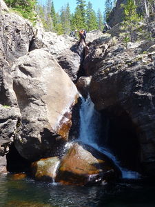
High Flow Third Falls Bypass on Canyon Right and climb the northern rim, up several benches and ledges to a large bench with plenty of trees for use as anchors. The cliffs continue above, but the bench is sufficient. Walk to the base of the cliffs, and follow the base until it drops off. Return to the river after the ledges and hike upstream to the view the Third Falls, which alone is worth the price of admission: similar to Ouzel Falls, but more picturesque.
(Low water) R4: 80' from a rock pinch in Canyon Center in the Narrows above the Third Falls to negotiate slippery drops caused by large boulders in this section
The canyon narrows again at the Fourth Falls. Downclimb or rappel the cliffs next to the falls.
Low water: R5: 60' from a rock in Canyon Center
Exit[edit]
Continue to hike down the stream. Shortly the cascades end, the river becomes placid, and it is easier to hike in the water rather than bashing through the bushes on the shore. Hike until the rapids begin again - about 10 minutes or so. Then turn north (left, looking up canyon) and hike cross-country until you reach the east inlet trail. Do not continue down the river, as you'll pass by several backcountry camp sites, and these folks should not be disturbed. Your hike back will likely include steep routefinding with fallen timber, so take your time and be careful. Take the trail back to your car, smiling all the way!
Red tape[edit]
In 2021, Rocky Mountain National Park initiated a Timed-Entry Permit System between 9am and 3pm for all areas of the park between late May and early October.
https://www.nps.gov/romo/planyourvisit/timed-entry-permit-system.htm
Book Timed-Entry Permit here: https://www.recreation.gov/timed-entry/10086910
Beta sites[edit]
Trip reports and media[edit]
early 2000s: High Flow photos and initial write up by Michael Dallin
25Aug2012: Low Flow photos and modified write up by Ira Lewis (beta modified Aug 2022)
30Jul2016: See conditions reports for details and photos. "We both agreed that the narrows and the third falls make this canyon an absolute must-do in the Front Range."


