Elk Creek
Jump to navigation
Jump to search
| Rating: | |||||||||||||||||||||||||||||||
|---|---|---|---|---|---|---|---|---|---|---|---|---|---|---|---|---|---|---|---|---|---|---|---|---|---|---|---|---|---|---|---|
| | Raps:4-5, max ↨120ft
Red Tape:No permit required Shuttle:None Vehicle:Passenger | ||||||||||||||||||||||||||||||
| Start: | |||||||||||||||||||||||||||||||
| Parking: | |||||||||||||||||||||||||||||||
| Condition Reports: | 16 Aug 2024
"R1 was clogged with fallen trees, I ghosted off a tree in the forest into the canyon and skipped R1. Use caution it looks like you could walk down to |
||||||||||||||||||||||||||||||
| Best season: | Mar-Jun
|
||||||||||||||||||||||||||||||
| Regions: | |||||||||||||||||||||||||||||||
Introduction[edit]
A lesser tributary of the Coquille River in southwestern Oregon.
- The watershed is 5.2mi^2. The highest point of the drainage is about 3750ft elevation. A good section of the headwaters has been clearcut.
Approach[edit]
The trail from the parking area divides almost immediately:
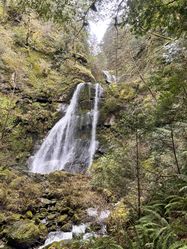
- Left: This is a two minute walk to a viewpoint of the lowest falls and a good checkpoint on flow conditions. There is an oddly situated bench here.
- Right: This trail climbs steeply uphill to the Big Tree. After the 10th switchback, the trail turns sharplly right. There is a small dip in the trail before it turns and reaches the top of the ridgecrest. You will pass a large fallen log on the left side of the trail (42.81435, -124.01218). Break off here and bushwhack down the hill on your left to the creek. With a little luck, you might find a boot path that leads right to the top of the first falls. The hike is about 30min from the parking area.
Descent[edit]
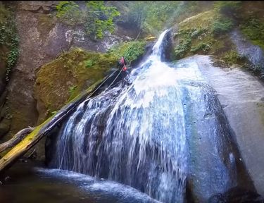
- R1: 20ft from a tree set about 20ft back from the edge of the falls.
- R2: 120ft from tree DCL.
- R3: 30ft from small tree DCR.
- R4: 100ft from tree DCL (tree is set back some distance from the edge). A 60m rope (doubled??) is barely long enough to reach.
- Chute: ??ft. You could rappel this from a shaky tree. Discretion is advised (?).
Exit[edit]
Just downstream from the last falls, look for a small viewing area DCL with the oddly-situated bench. Follow the trail back out (2min).
Red tape[edit]
None.
Beta sites[edit]
 CanyoneeringNorthwest.com (archive.org) : Elk Creek
Trip reports and media[edit]
Background[edit]
Further Explorations[edit]
- The north, middle, and south forks of Elk Creek may sport additional waterfalls. These might be considered separate objectives, however, per the distance between them and the main section of the creek described above.
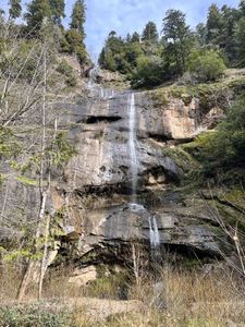
- Immediately north of the Elk Creek parking area is a very small seasonal drainage and a big waterfall that comes all the way down to the road. It looks like it'd be a fun rappel when it has some water. Might need to be bolted for anchors. Best access is likely via a shuttle up FR 3358.


