Elkhound Creek
| Rating: | |||||||||||||||||||||||||||||||
|---|---|---|---|---|---|---|---|---|---|---|---|---|---|---|---|---|---|---|---|---|---|---|---|---|---|---|---|---|---|---|---|
| | Raps:6, max ↨140ft
Red Tape:No permit required Shuttle:None Vehicle:High Clearance Rock type:Grandiorite | ||||||||||||||||||||||||||||||
| Location: | |||||||||||||||||||||||||||||||
| Condition Reports: | |||||||||||||||||||||||||||||||
| Best season: | Jul-Sep
|
||||||||||||||||||||||||||||||
| Regions: | |||||||||||||||||||||||||||||||
Introduction[edit]
Elkhound has interesting geology and would be worth doing, if it didn't require such effort to get there. The approach is a very long trail combined with a steep off trail hillside for a series of mild rappels and downclimbs.
Nearby Sheepdog Creek has better stream walking as well. This canyon was easy enough to negotiate, but had a lot more avalanche debris to contend with. If deciding to make an overnight trip, consider tacking this one on to Sheepdog Creek, but only if completing everything is part of the mission.
On the initial early July descent, days were warm and water flow was already low; wetsuits were not required.
Approach[edit]
Hiking time from Trailhead: approx 3.5 hrs, 7.2 miles +2200ft
Elkhound approach: 1hr 45min, 0.85mi +1260ft
Park at the Avalanche Creek Trailhead at the end of Avalanche Creek Road. The Avalanche Creek Campground is first-come, first-serve with 9 sites.
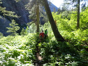
Hike 7.2 miles +2200' along Avalanche Creek with a gentle incline to where it passes Elkhound Creek (unnamed on topo maps). The Avalanche Creek Trail is well worn, but overgrown.
Camping in one of the meadows beyond the Gift Creek trail junction west of the Avalanche Creek Trail is an option to be in the area long enough to also descend nearby http://ropewiki.com/Sheepdog_Creek.
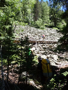
From where the Avalanche Creek Trail crosses Elkhound Creek, continue another ~750 feet on the Avalanche Creek Trail to the south, then depart the trail to the east and begin the 0.75 mile +1220 ft approach directly up the steep hillside. The gps track takes advantage of a few talus slopes that give reprieve from the thicker foliage and looser dirt slopes in the forest full of downed trees.
R0: 80' entrance rappel to manage a final steep slope after contouring the hillside
Descent[edit]
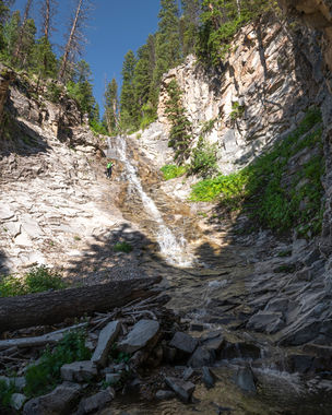
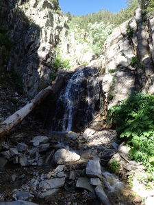
The Grandiorite rock layer forms low angle rappels that in some places are conducive to downclimbing and in others a rope adds security in terms of steeper angles or slippery algae growth. Grandiorite is akin to granite, but contains a higher percentage of feldspar, which gives it an off-white color.
R1: 105' low angle rappel from a stand of willows in Canyon Center
R2: 140' from a small tree on Canyon Right, better on rope than as a downclimb
R3: 50' for 20' falls from willows on Canyon Right
R4: 60' from a boulder for two short tiers
several downclimbs
R5: 115' from a small pine tree on Canyon Right
several downclimbs
R6: 65' from a tree on Canyon Left
Exit[edit]
Exit on the Avalanche Creek Trail to Canyon Right when the trail crosses the creek.
Red tape[edit]
This is in the Aspen/Snowmass Wilderness Area.
- Bear canisters are required
- A backcountry use permit must be filled out at the trailhead
Beta sites[edit]
Trip reports and media[edit]
09Jul2022 explored by Ira Lewis, Wayne Herrick, Andrew Tanasescu & Kati Wright


