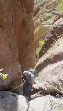
Ermahgerd Canyon
| Rating: | |||||||||||||||||||||||||||||||
|---|---|---|---|---|---|---|---|---|---|---|---|---|---|---|---|---|---|---|---|---|---|---|---|---|---|---|---|---|---|---|---|
| | Difficulty:3B III (v3a2 III) Raps:6, max ↨270ft
Red Tape:No permit required Shuttle:None Vehicle:Passenger Rock type:Volcanic | ||||||||||||||||||||||||||||||
| Start: | |||||||||||||||||||||||||||||||
| Parking: | |||||||||||||||||||||||||||||||
| Condition Reports: | 30 Dec 2023
"Approach is long but isnt bad, brush was minimal and not annoying. Took us about 2.5hrs to get to 1st rap. We rappelled in from the far East side whic |
||||||||||||||||||||||||||||||
| Best season: | Late Autumn;BEST in Nov;Dec;Jan;Feb
|
||||||||||||||||||||||||||||||
| Regions: | |||||||||||||||||||||||||||||||
Introduction[edit]
A rugged Superstition Wilderness canyon with a few big rappels.
Approach[edit]
Follow Hieroglyphic Trail about one mile. Exit trail right (east) up steep ridge. Contour around Superstition Peak. Head down drainage.
Descent[edit]
The canyon starts with some brush and a few downclimbs.
Be aware that much of the volcanic rock in the Superstition Wilderness is poor quality - use caution, particularly when downclimbing.
R1: 50’ off of tree.
R2: 225' off of large boulder.
R3: 80' off of large boulder. First section can be down climbed to thick grass, but nothing to anchor off of on second drop.
R4: 20' into pool. Possible to bypass LDC or depending on water level may be avoidable with some bridging skills.
R5: 135' off of rock pinch into pool. Drops to first section about 60', but continues down a second drop around a corner about 50' (into another pool).
R6: 270' off of bush backed up by boulder. Extend webbing to lip for a smooth pull. Feet are on wall for the entire rappel.
Exit[edit]
Follow canyon down. There is less brush outside of the drainage. A trail with cairns meanders RDC. You may follow it a short distance to avoid some brush, but do not stray too far as it leads up and away from the drainage.
The drainage eventually crosses Lost Goldmine Trail. Follow the trail back to the parking area.
Red tape[edit]
Beta sites[edit]
 HikeArizona.com : Ermahgerd Canyon
Trip reports and media[edit]
https://youtu.be/Rk1_Kq9muC4?si=rbIIyZ3cCmG-Lao3
