Escalante Potholes
| Rating: | |||||||||||||||||||||||||||||||
|---|---|---|---|---|---|---|---|---|---|---|---|---|---|---|---|---|---|---|---|---|---|---|---|---|---|---|---|---|---|---|---|
| | Raps:0
Red Tape:No permit required Shuttle:Optional 0.6 miles Vehicle:Passenger Rock type:Granite | ||||||||||||||||||||||||||||||
| Start: | |||||||||||||||||||||||||||||||
| Parking: | |||||||||||||||||||||||||||||||
| Shuttle: | |||||||||||||||||||||||||||||||
| Condition Reports: | |||||||||||||||||||||||||||||||
| Best season: | Jun-Sep
|
||||||||||||||||||||||||||||||
| Regions: | |||||||||||||||||||||||||||||||
Introduction[edit]
The potholes of Escalante Creek at the Potholes Recreation Area and Campground provide a short carved section of Precambrian Granite. One waterfall is easily avoided.
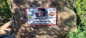
Beware, this area has claimed several lives of people who entered the potholes in dangerously high water levels. In 2024, the Escalante Creek stream gauge hit a max of 250cfs near the end of April.
A stream gauge reading of 8 cfs on June 8, 2024 felt very manageable if bypassing the waterfall.
Approach[edit]
From the Parking on the West side of the Campground, follow a social trail down to Escalante Creek below.
Descent[edit]
Float, swim and walk through the carved potholes
Exit[edit]
Exit Canyon Left up a tributary after the last interesting feature: swimming across a pool under a slight overhang. Enter the Campground by hiking West and return to the parked car.
Alternatively, continue downstream another quarter mile exiting up another tributary to cars parked at a dispersed campsite off 650 Rd.
Red tape[edit]
Beta sites[edit]
Trip reports and media[edit]
2024-06-08 beta entry created. Trip by Ira Lewis, Andrew Tanasescu, Cassie Taylor, Jim Rickard. Photo credit: Ira, Andrew, Cassie.


