Excelsior Canyon (Punalau Stream)
| Rating: | |||||||||||||||||||||||||||||||
|---|---|---|---|---|---|---|---|---|---|---|---|---|---|---|---|---|---|---|---|---|---|---|---|---|---|---|---|---|---|---|---|
| | Raps:9-10, max ↨150ft Metric
No Red Tape: Shuttle:Required 30min Vehicle:Passenger | ||||||||||||||||||||||||||||||
| Location: | |||||||||||||||||||||||||||||||
| Condition Reports: | (log in to submit report) |
||||||||||||||||||||||||||||||
Weather: |
|||||||||||||||||||||||||||||||
| Best season: | Nov-Apr
|
||||||||||||||||||||||||||||||
| Regions: | |||||||||||||||||||||||||||||||
(log in to submit reference picture)
Introduction[edit]
A fantastic canyon with small rappels until the last two. This canyon is run fairly regularly by locals as of 2025, with an easy access trail, excellent bolted anchors, and an exit right on the highway. Supposedly, there are no private property issues, but there are locked gates to access the approach from the highway. It's best to not leave your vehicle parked on the highway, and also to not get spotted by locals when doing this canyon.
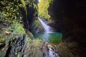
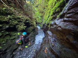
Although flow can be tame compared to many in the vicinity, Excelsior is considered to be top-tier due to the narrows, a rarity on the island. It's sporty and committing at higher flows, with one brief narrows (~50 meters) that can be difficult and committing in high flows. Be aware that this canyon can flash flood in an instant (like most Hawaii canyons). Monitor weather patterns and forecasts in the days leading up to your descent, as ground saturation is one predictor of flash flood risk. Stay away in rain. Several sections have no escape in high water. It can become dry in summer after long periods without rain.
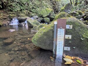
If in doubt, you can check the stream gauge at the end. At a level of 5.3, the canyon is still considered medium-low (C1). There are no hydraulic issues at this flow. This flow corresponds to 'Below Normal' on USGS's Hawaii webpage.
Approach[edit]
There are two approaches to reach the canyon. Your best bet is to reach out to local canyoneers via social media and find out the current recommendations.
1) The Hana Highway Approach. There is a locked gate on the Hana Highway that you can climb through and then start walking on a hunting road owned by the government for the forest reserve. However, do not get caught here - locals will likely get mad at you and tell you to go away, even though this is supposedly public land. Vehicles have been burnt while parked here - do NOT park here. You're better off getting dropped off and then 'sneaking' through this gate.
2) Garden of Eden Approach. The Garden of Eden will let you enter as a tourist for $20/person. From here you can sneak out onto the forest service road by bushwacking about 5 meters through thick bamboo and then crawling under a barbed wire fence, following the GPS route. However, it's not clear if Garden of Eden allows this. Staff may deny your request to do this. Importantly, Garden of Eden closes at 4pm - if you are not back to your vehicle in time, it's unclear if they will tow your car or lock it inside.
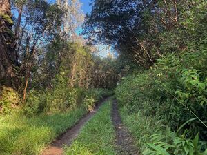
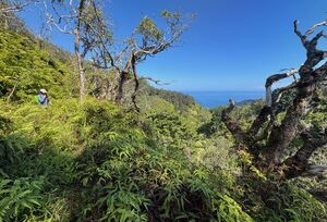
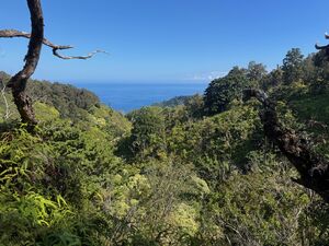
From either approach, follow the GPS track, which is entirely on hunting roads/paths. There will be some bushwhacking, though nothing too intense. Long sleeves and long pants are recommended. Plan on at least one hour to cover the ~3 mile approach. You'll cross several small streams, and pass at least one cave with an irrigation canal diverting into it - it's worth bringing a headlight to poke around in this cave.
Again, please don't get caught. Canyoning this route is theoretically legal and on public property, but locals still are distrustful of canyoneers, saying we contaminate 'their' stream water (an absurd accusation, because there are frequently dead pigs and cows floating in many Maui canyons), and may try to threaten you or further lock up the route. If you see or hear anyone coming on the approach, which is very unlikely, hide in the woods, or simply tell them you are hiking to go birdwatching or meditate or similar. There may be hunters with aggressive dogs. It's best you don't openly display your canyoneering gear; putting a raincover over your pack is an excellent way to stay modest.
Descent[edit]
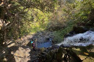
There are around eight to nine rappels in this canyons, all with excellent bolted anchors with the exception of the first rappel. Anchors can be hard to find, as they are often overgrown with brush.
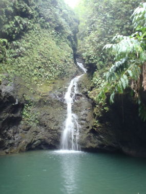
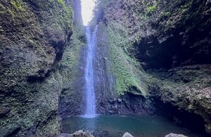
Most rappels are small, until the last two, which are about 110 and 155 feet.
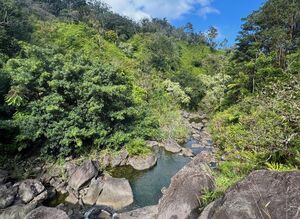
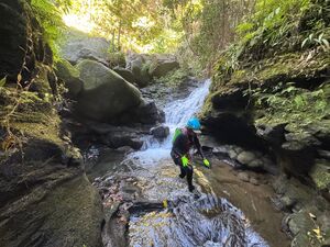
There is a fair amount of creek walking and boulder hopping in this canyon. The route doesn't quite 'get good' until the final third of the distance.
Due to the ample boulder hopping and slippery creek walking, it's recommended to wear grippy and protective canyoning boots.
At least once, the canyon narrows up enough that you can stand in the middle and touch both walls. This section generally has fast-flowing ankle-deep water, with a tricky one-meter downclimb into a frothy pool with uneven rocks. In high water, this could prove difficult. In an emergency, it is possible to backtrack and climb out of this section, but the brush is extraordinarily thick and escape back to a trail is not quite realistic.
Overall, Excelsior ranks as one of the best canyons on Maui and one of the narrowest slots in all of Hawaii to date. Most canyoneers will have a blast with this one.
Exit[edit]
From the final rappel, walk down the creek a few minutes and exit on the left side for a one-minute walk to the road.
As a reminder, please take off all your canyoneering gear and store it in your backpack before getting back to the road and being in-sight of traffic. This will prevent fostering local resentment towards canyoneers.
If hitchhiking back to the start, it may be wiser to hitchhike with tourists than locals - again, most locals have no issue, but some become upset at canyoneers for 'contaminating' 'their' streams. It's a shame local culture is this way, but canyoneering on this route is technically legal and allowed, despite what some locals may insist.
Red tape[edit]
Beta sites[edit]
Trip reports and media[edit]
Background[edit]
Incidents
Credits
In all habitats live animals and plants that deserve respect, please minimize impact on the environment and observe the local ethics. Canyoneering, Canyoning, Caving and other activities described in this site are inherently dangerous. Reliance on the information contained on this site is solely at your own risk. There is no warranty as to accuracy, timeliness or completeness of the information provided on this site. The site administrators and all the contributing authors expressly disclaim any and all liability for any loss or injury caused, in whole or in part, by its actions, omissions, or negligence in procuring, compiling or providing information through this site, including without limitation, liability with respect to any use of the information contained herein. If you notice any omission or mistakes, please contribute your knowledge (more information).
