Fir Creek
| Rating: | |||||||||||||||||||||||||||||||
|---|---|---|---|---|---|---|---|---|---|---|---|---|---|---|---|---|---|---|---|---|---|---|---|---|---|---|---|---|---|---|---|
| | Raps:5 + 1 Jump, max ↨95ft
Red Tape:No permit required Shuttle:None Vehicle:Passenger | ||||||||||||||||||||||||||||||
| Start: | |||||||||||||||||||||||||||||||
| Parking: | |||||||||||||||||||||||||||||||
| Condition Reports: | |||||||||||||||||||||||||||||||
| Best season: | June-Aug
|
||||||||||||||||||||||||||||||
| Regions: | |||||||||||||||||||||||||||||||
Introduction[edit]
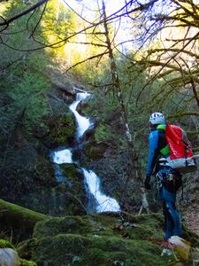
A fun half-day canyon that pairs well with Rock Creek up the road. This canyon features some cool carved potholes and, at higher flows, some technical whitewater that adds some sporty fun. The canyon is short with back-to-back rappels in the main sequence. While technically straightforward, there are multiple hanging potholes, potential foot entrapments in the rock that require caution and confident rappelling in higher flows.
- Watershed: 2.5mi^2.
Approach[edit]
Driving Directions
From US-101, drive west on Skykomish Valley Road for ~5.6mi before bearing right at a junction onto Govey Road (aka FR 23 or FR 2353). Follow the road steeply uphill; it becomes a good dirt road shortly. From the junction, continue another 2.5mi. After a hairpin turn in the road (where the road crosses Fir Creek), park at a pullout next to a gate on the left. Do NOT block the gate; you will be ticketed or towed.
Foot Approach
Walk through the gate about 100 meters, and, when the slope looks less steep, bushwhack east down to the creek.
Alternatively, walk down the road past the hairpin turn and find a spot along the straight stretch of road to cut into the brush down to the creek, spending about 20mins. creekwalking to the first rappel.
Descent[edit]
- R1 - 12’ from a tree DCR. If this rappel is dry, that is an indicator that the technical section will be easily navigable without any whitewater challenges.
- J1 - 15’ jump DCR. If needed, a human anchor can be provided from a convenient pothole atop the drop.
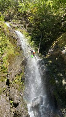
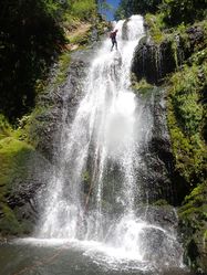
- R2 - 85’ off unlinked bolts canyon center. Please leave these bolts unlinked.
- R3 - 45’ DCL webbing on a challenging-to-access tree. Rappel from the right side of the pool edge (under or over) a large log. (This begins the zigzag sequence of chutes and potholes (with lots of bonus hidden potholes as well!).
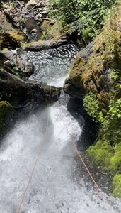
- R4 - 95’ DCL from a linked chain anchor. This drop is a two-tier rappel down a committing chute. In the middle of this rappel is a hanging pool/pothole in a large cave-like space. At higher flow, the pothole recirculates, but will push you in the direction you want to go. Climb out of the pothole and continue the rappel down to “The Patio.”
- R5 - 80’ DCL from a linked chain anchor. The water at the top of this rappel can be very pushy at higher flows. It is possible to come off rope at the bottom of this rappel and jump the last 10' into the pool below. The pull for this rappel is best from across the pool.
Exit[edit]
Depending on your preference there's a couple of exit options to choose from:
1. Longer, but easy and relaxed. (Vance Creek)[edit]
Continue down Fir, and change out of canyon gear near the junction of Vance Creek. Then follow it upstream about 0.8mi to a bridge. Then hike the road 1.2mi back to your car. This route may not be possible when Vance Creek is running high. In summer, the creek runs quite low and it is easily waded. There are many dry braided channels on either side of the main watercourse.
2. Short & tough. (2024 shortcut exit)[edit]
Half way to Vance Creek exit Fir on the right, and bushwhack uphill to meet the road. It's steep and bushy, but creek-to-road is 25mins.
3. Disliked disused road[edit]
A short bushwhack from Vance Creek up to an old logging road. Note: this is a very thorny option, and takes as long as the Vance Creek exit.
Red tape[edit]
This canyon is on Green Diamond property, which does not require permits as of July 2024. Green Diamond is known to change where permits are required on their land from time to time. Be sure to check their website to ensure permits are not required before your trip.
Beta sites[edit]
Trip reports and media[edit]
Background[edit]
The first known exploration descent of this canyon was in December 2020 by Jake Huddleston, Joe Cruikshank, Becca Polglase, and Dave Hawkins. Subsequent contributions were made by Logan DeGrand, Brent Roth, and Kevin Steffa.


