Fools Canyon (Olympic Peninsula)
| Rating: | |||||||||||||||||||||||||||||||
|---|---|---|---|---|---|---|---|---|---|---|---|---|---|---|---|---|---|---|---|---|---|---|---|---|---|---|---|---|---|---|---|
| | Raps:0
Red Tape:No permit required Shuttle:Optional 5min Vehicle:Passenger | ||||||||||||||||||||||||||||||
| Location: | |||||||||||||||||||||||||||||||
| Condition Reports: | 23 Jul 2022
"Flow was moderate, but water still cold. Rapids were easier to navigate around, but the down climb around the dam at the end was still sketchy, but mo |
||||||||||||||||||||||||||||||
| Best season: | Jul-Sept
|
||||||||||||||||||||||||||||||
| Regions: | |||||||||||||||||||||||||||||||
Introduction[edit]
A fun non-technical narrows on the Middle Fork Statsop River. Looking for a chill day with some swimming and jumps between technical outings? Go no further.
Have your flotation dialed on this one as there are some long swims. Wetsuit definitely a good idea as you will be spending a lot of time in the water. Harness, ropes, etc. not necessary as of 2021, but bring a helmet per scrambling about on slippery rock.
- There are several areas in Fools Canyon which would be dangerous in high flow. Use caution in the early season.
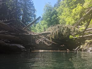
- For the first descent in a given year, it may be wise to bring a short rope and harness. Logs washed downstream can get jammed in constrictions. More debris fills in behind them to create a natural dam. Sometimes, they can get quite large. Technical gear provides options should you need them.
Approach[edit]
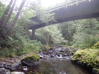
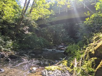
Park at a pullout on either side of the bridge (47.31275, -123.45230) and hike down into the creek. Suit up and walk in. There's an easy way down on the south side just upstream of the bridge.
- Checkpoint is the creek just under the bridge.
- Optional: drop a shuttle car at the exit (47.30299, -123.46395). There were a couple of pull-offs with room for one or two vehicles.
Descent[edit]
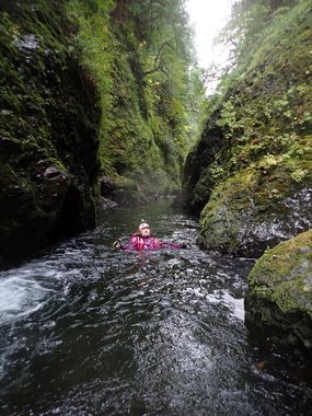
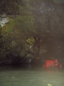
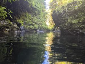
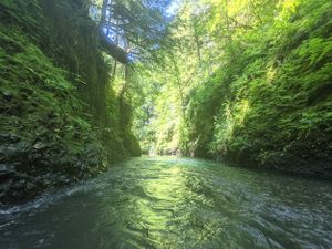
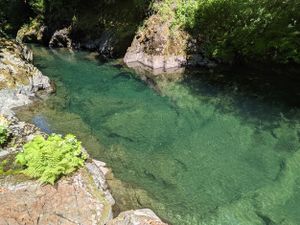
Just head downstream. It's your typical creek walk at first, until the Statsop River enters DCR. The flow will double. Just below this, suddenly the creek narrows up. You are entering the Fools Canyon. For the next 1.3mi, pass through some lovely narrows. You'll be walking, wading, rock-hopping and swimming. Scenery is great with sections of beautiful polished bedrock. There are some long water-filled corridors, where, with sufficient flotation, you can jump into the current and ride the flow. You'll occasionally have to hop out to warm up, bypass some small rapids, or climb up and over obstacles. There's lots of jump potential.
Here are some way-points to mark your progress:
- Some distance into the canyon, watch for a small waterfall DCL. Immediately after it is a chimney-like natural arch on the same side. Might be fun to climb up above and rappel down through it.
- Floating directly under a bunch of large blown-down trees.
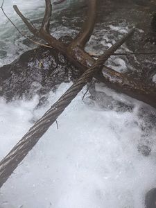
- A long thick steel cable lays in the water. Avoid the temptation to investigate too closely - it has lots of wetsuit ripping spurs on it!
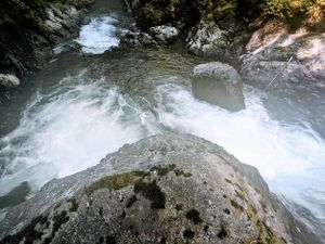
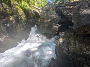
- A large boulder blocks the entire creek with water flowing past it on both sides. This could be a spicy spot in high water.
- Swim down a long narrow corridor.
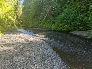
- The canyon opens a bit with gravel bars on both side, making a nice lunch spot.
- Then the canyon takes a left and enters another narrows. This narrows is a very long and very deep.
- When you get to the far end, you'll realize why the narrows were so deep. The entire canyon is blocked by rockfall that must have taken place in the last couple of years judging from the lack of moss (pre-2020). The pool just before reaching this natural dam must be 20ft+ deep. The dam is easily bypassed on the DCL side next to the cliff. You can alternately scramble your way through the (short) boulder maze to reach Fools Falls - an easy 3ft cascade.
Below the dam, make your way through an area of slippery rocks and one last swim before the canyon walls fall back.
Exit[edit]
Suggested exit: Upon swimming the last pool in the narrows, the canyon opens up. Climb out onto the rocks DCL and locate a gully/drainage entering here. Start your way up the climber's right side of the gully, breaking off almost immediately to climb up the nose of a ridge. Follow game trails upwards (easy) for 100ft or so to a relatively flat bench. Bear left a bit on a gentle ascent until you reach the road. Mostly open forest and few obstructions. Once on the road, walk (or shuttle) 1mi back to your car at the bridge.
(Jun 2021 - couldn't identify drainage. Bushwhacked straight up from ~150ft after the canyon exit, steep but after not too long it drastically plateaus-off, as you head into the forestry trees trend slightly left and up a easier climb to meet the road at the closest point. 20mins - much quicker than I had expected).
Alternative exit, taken from original beta:
When you emerge from the lower end of the canyon continue downstream about a quarter mile. There is a very crude road (too rough even for four wheel drive) running closely along side the left side of the river. This road is not readily visible from the river so you will have to scramble a very short distance up the river bank to find it. Once on the road, follow it upstream as it parallels the river. It soon goes uphill and turns east. When you come to a good dirt road bear right, and you will be back to Forest Service Road 2341 in a quarter mile. Turn left to return to your vehicle.
Either way, by the time you're back at the road you'll be missing that cool canyon water!
Red tape[edit]
None, but be aware of active logging in the area. No issues with parking at the approach or exit.
Beta sites[edit]
 CanyoneeringNorthwest.com (archive.org) : Fools Canyon
Trip reports and media[edit]
https://www.facebook.com/groups/pnwcanyoning/permalink/10160090983180789/
Background[edit]
From canyoneeringnorthwest:
The name “Fools Canyon” was coined by Gary Korb, the author of “A Paddler’s Guide to the Olympic Peninsula”. Due to the dangers of kayaking the canyon he writes, “I’d recommend NOT running this stretch, but once you see the gorge entrance you’ll be drawn in by its mysterious beauty.” How true.
Other Info[edit]
There’s a good campsite just up the road from the approach parking in a big pullout area.
