Fortknocker Falls
| Rating: | |||||||||||||||||||||||||||||||
|---|---|---|---|---|---|---|---|---|---|---|---|---|---|---|---|---|---|---|---|---|---|---|---|---|---|---|---|---|---|---|---|
| | Raps:3, max ↨80ft
Red Tape:No permit required Shuttle:None Vehicle:Passenger Rock type:Granite | ||||||||||||||||||||||||||||||
| Start: | |||||||||||||||||||||||||||||||
| Parking: | |||||||||||||||||||||||||||||||
| Condition Reports: | |||||||||||||||||||||||||||||||
| Best season: | May-Oct
|
||||||||||||||||||||||||||||||
| Regions: | |||||||||||||||||||||||||||||||
Introduction[edit]
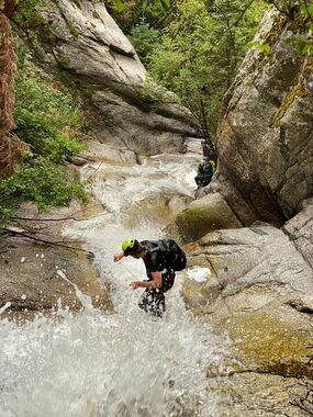
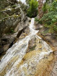
Fortknocker Falls is a quick/worthwhile outing, with plenty of in creek bushwhacking and downclimbs. Not nearly as good as the adjacent "Three Falls" canyon, but worthy to check out nonetheless.
Approach[edit]
The best place to start is where the three falls hiking/biking trail crosses North Three Falls Drive. Park on the side of the road here. After a few switchbacks you will cross over the bridge to Fort Creek (Three Falls). You can gain the ridge there between the two forks, or continue hiking a little ways before you reach the second bridge (your takeout). Gain the ridge and continue upwards and onwards for about 1000' vertical and about an hour of hiking. Watch out for nesting bees on the approach (we met a few on our way). Once you're up to the right elevation, you'll come to a small clearing with a tree in the middle. Continue NW over to the drainage for Fortknocker.
Descent[edit]
The canyon features considerable bushwhacking, logjams, and slippery downclimbing. There are 3 mandatory rappels (from natural anchors) depending on your group's experience and downclimbing capabilities. You may want to provide a handline for the more challenging and slippery downclimbs, or they can be easily rappelled, provided natural anchors are available.
Prior to rap 1 there are a few sections that look like possible slides, Don't Do It! Shallow endings, fast moving, and dangerous. We tested the last/biggest of them all, no go. Sling the tree for a handline down, or bypass LDC.
r1: 30'
r2: 80'
r3: 70' (2-stage)
Following the rappels, you will still have some distance of bushwhacking and downclimbing. Before too long, it's over.
Exit[edit]
Take out at the bridge (go left) to return to your car.
You will hike over the Three Falls Bridge and follow the biking trail back to the road.
Red tape[edit]
North Three Falls Drive is currently a public road, so you can legally park there. However, the city plans on putting no parking signs near where the trail crosses the road. This will likely push back parking on the road by a few hundred feet to up to 1000 feet away from the trail. The developers/HOA in the area is attempting to have the city privatize the road so that the public are no longer allowed to park on North Three Falls Drive. If the road is privatized this will mean that the public will need park miles down the trail at the Three Falls Trailhead. This would make the route much longer for canyoneers unless you have a mountain bike, and even then it would be a full day. The developers don't currently have the votes on city council to get the road privatized, but that could easily change at the next election cycle. If you want public access to continue at the upper trailhead along North Three Falls Drive, let the city know.


