Fossil Creek (Mt. St. Helens)
| Rating: | |||||||||||||||||||||||||||||||
|---|---|---|---|---|---|---|---|---|---|---|---|---|---|---|---|---|---|---|---|---|---|---|---|---|---|---|---|---|---|---|---|
| | Raps:8-13, max ↨100ft
Red Tape:No permit required Shuttle:Optional Vehicle:High Clearance | ||||||||||||||||||||||||||||||
| Start: | |||||||||||||||||||||||||||||||
| Parking: | |||||||||||||||||||||||||||||||
| Shuttle: | |||||||||||||||||||||||||||||||
| Condition Reports: | 15 Jun 2025
"Returning to Fossil, we descended the west trib, jumped out, then went over to descend the east side. Wow, a couple nice technical sequences, waterfal |
||||||||||||||||||||||||||||||
| Best season: | Apr-Jun
|
||||||||||||||||||||||||||||||
| Regions: | |||||||||||||||||||||||||||||||
Introduction[edit]
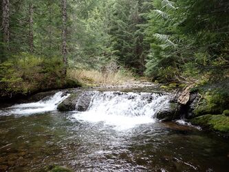
Fossil Creek is a significant tributary of the Kalama River. This page describes two canyon destinations in upper headwaters, located southwest of Mt. St. Helens. The two tributaries can be run individually or combined for a full day out. East Fossil is a bit more technical and has more water. Access to both is easy, minimal creek walking, and with two high-clearance vehicles you can even shuttle it. Water can be very cold early in the season.
- West Fossil watershed: 1.5mi^2. Highest point in the drainage is ~4600ft elevation.
- East Fossil watershed: 2.9mi^2. Highest point in the drainage is Goat Mountain (4965ft). Expect 2x the water found in West Fossil.
Visit earlier in the season for more water. Water levels dropped by 50% or more between early May and mid-June 2025. East Fossil might need some high water anchors to run earlier in the season.
Approach[edit]
Drop a car at the bottom and shuttle (or walk) the road up to the top. 2.3mi, +650ft elevation. High-clearance vehicles recommended per water damage and some car-sized potholes. Note that the road may be blocked by snow into April. Subaru-friendly in 2025.
From the junction (~2700ft elevation), bushwhack southwest for two minutes and drop into West Fossil just above R1. Creek is brushy for a moment or two.
Descent[edit]
West Fossil[edit]
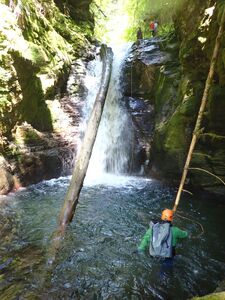
This section of the creek is entirely within Gifford Pinchot National Forest. The upper creek is fairly action-packed with minimal walking between rappels. Some of the drops look like potential jumps, but scout them first.
- R1: 20ft from tree DCR or DCL.
- R2: 15ft from tree set ~20ft back DCR. Beware possible foot entrapment spot DCR near the top (easily avoided).
- R3: Crawl under fallen tree DCR to find anchor for nuisance rappel: 15ft to shallow pool. Climb out onto platform and rappel (or downclimb - don't slip) second short pitch (~4ft).
- Downclimb through a log and boulder jumble. There are some huge old-growth logs in the creek.
- R4: 5ft nuisance rappel from log spanning creek. R5 comes immediately.
- R5: Fun 20ft rappel from log spanning the top of the falls.
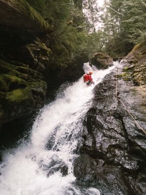
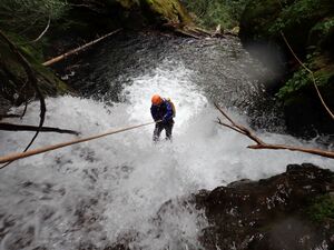
- R6: 45ft down inclined cascade from logjam. Use caution in high flow as the flow can be feisty.
- R7: 30ft down a chute from an tree 20ft back DCR. (Needs ~50ft of rope for the rappel.)
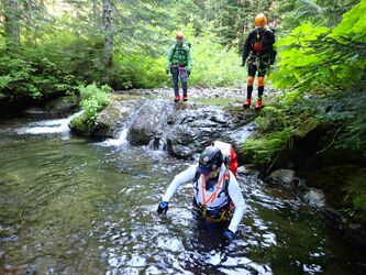
Creek-walk downstream ~500ft to the next rappel.
- R8: Two tier from very large tree root DCR. Need ~50ft of rope per the horizontal distance. Will be out of the water in low flow.
Creek-walk downstream ~400ft to the final rappel. Partway down pass someone's homemade bridge crossing the creek with a rope to hang onto. What's this about? Presumably intended for use in high flow or you could just rock-hop across. Potential exit by clambering up handline ropes DCL here, but it's probably easier 100ft downstream. Downclimb a final cascade to:
- R9 (optional): 15ft?
Exit the creek DCL above or below R9 and ascend ~100ft to old decommissioned logging grade. Follow right/downhill to the road (~1min). Continue to follow the road downhill for 0.5mi and drop into East Fossil at the crossing.
East Fossil[edit]
This section of the creek is on land owned by Tall Corn Forestry. Please respect all postings as access could be restricted any time. Check out the enormous culvert (big enough to drive a car through) underneath the road. Clearly this creek sees enormous floods from time to time. Water levels will likely be twice that of West Fossil, so evaluate carefully if you want to continue.
- Downclimb a couple of short drops immediately before R10. The lower one is a mini-slide.
- R10: Two-tier drop. First is 45ft from single bolt DCL into a pool. Second is down a narrow chute (likely dangerous in high flow). Extend rope from the anchor to run both tiers. (In future, an independent bolt for the chute might be a good idea.)
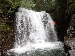
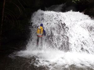
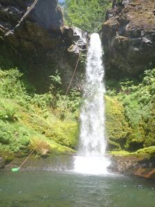
- R11: Fossil Falls - 65ft from tree DCL about 35ft back. Need 100ft of rope. The notch DCR of the falls provides a lovely rappel line straight down behind the waterfall into a big amphitheater. Might need bolts for high flow.
- Slide or short jump into a curiously deep pothole.
- R12: On reaching a logjam barricading the creek, climb down DCL and (nuisance) rappel 20ft from convenient log above the creek. (It might be better to climb up DCR for a clean rappel from a tree to avoid the logjam.)
- R13: 40ft from tree DCR.
Exit[edit]
From the final rappel, continue downstream ~300 yards. Watch carefully for a large Doug Fir, still living, that's fallen across the creek. On the far side, scramble out DCL (easy) onto an abandoned logging road. There used to be a bridge here once, but it appears to have either been removed or destroyed. Follow the abandoned road grade south about 0.7mi on a gentle rising traverse to the gate and your waiting car. Admire the fine collection of giant culvert pipes along the way. Declare victory.
Red tape[edit]
A sign the lower gate seemed to indicate the area was Weyerhaeuser timber land. However, per parcel data, the abandoned exit road is actually on land owned by Tall Corn Forestry. FR 8117 may be an easement to access public land to the north.
Beta sites[edit]
Trip reports and media[edit]
Background[edit]
West Fossil was first descended in May 2025 by Wade Hewitt, Ashley Driscoll, and Kevin Clark. A second group: Kevin Clark, Trey Schutrumpf, Keith Langenwalter, and Eric Rutz returned in June to descend both forks.
How Fossil Creek gets its name is unknown.
