Four Boulders Canyon
| Rating: | |||||||||||||||||||||||||||||||
|---|---|---|---|---|---|---|---|---|---|---|---|---|---|---|---|---|---|---|---|---|---|---|---|---|---|---|---|---|---|---|---|
| | Difficulty:3A II (v3a1 II) Raps:6, max ↨200ft
Red Tape:No permit required Shuttle:None Vehicle:High Clearance Rock type:Sandstone | ||||||||||||||||||||||||||||||
| Location: | |||||||||||||||||||||||||||||||
| Condition Reports: | 19 Jul 2025
"Great canyon, not so great exit. Exit chute has many loose rocks and a high chance for rockfall. Recommended canyon to get into west clear creek, then |
||||||||||||||||||||||||||||||
| Best season: | Spring Summer Fall
|
||||||||||||||||||||||||||||||
| Regions: | |||||||||||||||||||||||||||||||
Introduction[edit]
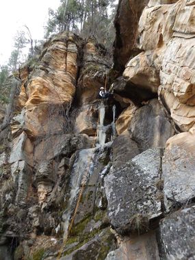
A short, normally dry canyon at West Clear Creek next to Shamrock with 6 rappels in quick succession down moss covered walls through a lush green drainage. The forested drainage eventually opens up to a spectacular view point atop a deep narrow fault line (can be seen DCL) with a wide open 200' rappel.
Named "Four Boulders" due to the 4 car size boulders stuck in a huge crack up high after the last rappel.
Approach[edit]
Option to follow dirt road all the way down and park at the end of peninsula for longer approach/shorter exit. Only room for 1 vehicle at end.
After parking, a quick 15 minute hike down to the drainage brings you to first rappel.
Descent[edit]
R1: 30' tree high DCL
R2: 30' tree center
R3: 30' tree center
R4: 60' tree DCR
R5: 70' tree DCL
R6: 200' tree high DCR
Exit[edit]
Follow well beaten path through woods, along river for a short ways before turning back and heading up loose slope, following rock wall on left. Multiple 4th class scrambles. Eventually about 3/4 way up you come to large rock faces where you cut across ledge to the left and around other side of ridge to continue up for easier travel.
Red tape[edit]
Beta sites[edit]
Trip reports and media[edit]
Background[edit]
First descent by Jay Wisocki and Dinna Marquez
