Fulton Creek
| Rating: | |||||||||||||||||||||||||||||||
|---|---|---|---|---|---|---|---|---|---|---|---|---|---|---|---|---|---|---|---|---|---|---|---|---|---|---|---|---|---|---|---|
| | Raps:3, max ↨110ft
Red Tape:No permit required Shuttle:None Vehicle:High Clearance | ||||||||||||||||||||||||||||||
| Start: | |||||||||||||||||||||||||||||||
| Parking: | |||||||||||||||||||||||||||||||
| Condition Reports: | 31 Aug 2024
"Full Fulton was fun and totally worth running. We went a day early to scout the lower exit and work on the trail. We found a game trail and did a lot |
||||||||||||||||||||||||||||||
| Best season: | Jun-Jul-Aug
|
||||||||||||||||||||||||||||||
| Regions: | |||||||||||||||||||||||||||||||
Introduction[edit]
This page describes the upper section of Fulton Creek. This a short and sweet canyon with 3 scenic rappels, 3 short jump possibilities, and a 3-room cave. Great for a first or last day of a weekend trip in the Olympics, or as a full day combined with other canyons in the area.
- Lower Fulton Creek has its own page on this site. It is possible to run both Upper and Lower Fulton in one trip, but expect a much longer day. (See "Middle Fulton" below for more information.) Lower Fulton has about twice the water of Upper Fulton.
- Watershed: 4.1mi^2. Highest point in the watershed is North Rock at ~4200' elevation.
Approach[edit]
Just north of Triton Cove State Park, turn left off Hwy 101 onto Seamount Dr. Follow the road upwards ~0.9mi where the pavement ends. The road gets very rough after this point. High clearance recommended (maybe 4WD); use extreme caution with low-clearance 2WD vehicles.
- Please do NOT park in the pullout at the end of the pavement. While technically legal, there are several homes very close by. Some canyon groups parking here and hiking/carpooling up the road has led to conflicts with the local residents. To avoid problems and keep them happy, it's recommended to park elsewhere (ex: Triton Cove State Park - Discovery Pass required) and carpool to Fulton in a high-clearance vehicle.
At the end of the pavement, continue up the rough dirt road for another 1.1mi to an obvious junction. Park here. There's room for a number of vehicles. (As of 2022, a large berm/ditch blocks the road and it is no longer possible to drive to the drop-in.)
Hike In[edit]
At the junction, take the leftmost road (blocked by a large berm) and hike about 0.5mi to the creek marked by the remains of an old bridge. There are cement steps leading down to the creek just before the creek. It's about a 20min hike down to R1.
- Alternatively, check the map for a shortcut route that drops you in just above the technical section. This cuts off about 0.5mi of hiking and is an easy bushwhack.
Descent[edit]
DCR = Down Canyon Right
DCL = Down Canyon Left
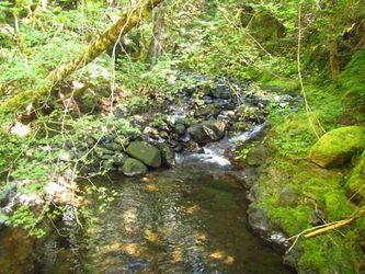
Use caution as this creekbed is slippery. While hiking between rappels, beware of leg-eating gaps between rocks that can be hidden under the water.
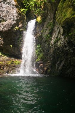
- R1: 60' DCL from 2 unlinked bolts into a beautiful amphitheater and deep pool. DO NOT ADD WEBBING TO THESE BOLTS Debris from floods can catch on linked bolts and severely damage them. Groups should be familiar with rigging unlinked bolts. At the bottom, there is a 6-8' jump possibility from an outcropping on the downstream side of the pool.
- R2: 80' DCR on the top of a logjam from a rootball. There is a small hanging pothole at the top of the rappel. The rappel exit features a small cave and a semi-deep pool. At the bottom, there is an 8-10' jumping possibility from a ledge DCR. There is a deep undercut in the rock wall on the downstream side of the pool which could be dangerous in high flow.
- R3: 110' DCR off a log. 2-stage rappel with a large pool in the middle. There is a log in the watercourse at the bottom that is easy to avoid while on rappel, but may cause an issue with the rope pull. There is also a small crack in the middle of the main flow near the top of the 2nd stage that a rope could get stuck in.
Creek walk for a bit.
- DC1: a 15' downclimb through a mini-slot. A technical jump from the DCL rim may be possible. This DC is formed a boulder of conglomerate.
- DC2 and Cave: A short distance further down canyon is a large logjam. At the bottom, there is a two-room boulder cave on DCR with room for 4-5 people. Epic alcove made of some pillow basalt above the DC.
Exit[edit]
Below the log jam, creek walk approximately 15 minutes until you reach a shallow draw DCL and it becomes relatively easy to climb out. If it's steep & brushy, you're in the wrong place. Make your way uphill on a faint use trail to the canyon rim (~300ft gain). The going is relatively easy until you reach the top where the terrain abruptly levels out and you enter an old clear-cut. Don't try to cross the clear cut directly as it's a major bushwhack. Instead turn left and follow along the canyon rim as best you can. It's a little brushy, but not bad. After a few minutes, pop out on the road and walk back to your car. (2min).
Middle Fulton[edit]
For a longer canyon day, it's possible to continue on down the creek and run Lower Fulton Creek. From the exit of Upper Fulton creek walk 0.5 miles. Several minor downclimbs and logjams must be negotiated. There are two short sections of narrows along the way. The creek constricts abruptly with a big logjam completely blocking passage.
First Narrows
- M-R1: 10ft. Climb up onto the logjam and rappel off a log into a short narrows below.
- Short drop. Downclimb or jump into the next pool.
- Short sequence of pools/channels ahead that looks like it could be fun, but it was barricaded by a strainer in 2022. Can be bypassed DCR.
- M-R2: 20ft from log.
Hike about 0.2mi.
Second Narrows
- Short drop which can be easily downclimbed on the left. Pool was too shallow to jump.
On exiting the second narrows, it's about 0.15mi to the entrance of Lower Fulton. Watch for a tributary entering DCR as a sign that you're almost there. Note that the water will about double below this point.
Red tape[edit]
Be aware: the parking area, the exit to Upper Fulton, and Middle Fulton are all on private timber company land. Access could be rescinded at any time, so please treat the area with respect and practice your best Leave No Trace.
Beta sites[edit]
Trip reports and media[edit]
Background[edit]
Upper Fulton was first descended by Jake Huddleston, Kevin Steffa, Becca Polglase, Michelle Nilles, and Tiffanie Lin on July 5, 2020.
Middle Fulton was explored by Kevin Clark, Hereward Cooper, and Alex Danielson in Sept 2022.

