Fusier Canyon (Lower)
| Rating: | ||||||||||||
|---|---|---|---|---|---|---|---|---|---|---|---|---|
| | Difficulty:3A I (v3a1 I) Raps:2, max ↨70ft
Red Tape:No permit required Shuttle:Required 2 min | |||||||||||
| Location: | ||||||||||||
| Condition Reports: | 24 Nov 2015
"The pool after the 2nd rappel is currently about 6 deep and will require a short (8 long?) swim |
|||||||||||
| Best season: | ||||||||||||
| Regions: | ||||||||||||
Introduction[edit]
Easily accessible canyon from the road.
- As with all the Big T canyons your help is needed to keep access open. This entire area is still seeing a slow recovery from the old station fire which means lots of invasive plants and overgrowth in general can quickly close off access to these areas and/or make your time in them miserable. Consider adding a pair of hand shears and/or small bypass loppers to your gear list when descending these places.
Educate yourself on how and why [1]
BIG TUJUNGA CANYON RESTORATION
Approach[edit]
After parking, cross the road to the north side. Head down the trail towards the steel beam structure and turn right to enter the drainage tunnel.
Descent[edit]
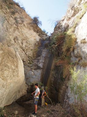
The first rappel used to be very straight forward with two good condition bolts DCR. Those bolts are missing/damaged beyond use due to floods (April 2018). There is also a conveniently located 3' tall, 3" diameter metal pole cemented into the rock that can be used, but a body belay could be considered for a backup. The rappel is about 50 feet. After rappelling down hike about 0.35 miles to the second rappel. The hiking to the second rappel can take time with a large group due to the bushwhacking involved. The second rappel is straight forward with two good bolts DCR. The rappel is about 70 feet into varying depths of water, depending on the season. This can be dry, several inches deep or a short swim (the pool is silted up to about knee level April 2018). The second rappel is beautiful with the low flow of water spraying you.
Exit[edit]
After the rappel hike south to Big Tujunga creek. Once at the creek continue UP-stream to the east. The north side of the creek has partial trails. A couple of places require a knee to waist deep wade. Much of the trail is washed away and hard to follow. Walking through the creek may be the fastest way.
It is also possible to set up a shuttle vehicle at the Stonyvale/Vogel Flats parking lot. Hike out of the canyon and turn to the west and hike Big TJ Creek DOWN-stream to the parking area.
Red tape[edit]
There are currently a few "No Parking Any Time" signs in the area at various pullouts. Make sure you check carefully to avoid getting a ticket.
Beta sites[edit]
 Chris Brennen's Adventure Hikes (St Gabriels) : Lower Fusier Canyon
 Super Amazing Map : Fusier Canyon (Lower)
Trip reports and media[edit]
August 2, 2019 - Removed poor bolts (short, loose, drilled into cracks) at the end of the tunnel (1st rappel). Replaced with new, better, longer and more solid ones.
Eshed
Background[edit]
First canyoneering descent February 5, 2006 by Mark Fitzsimmons and Jane Fontana.


