Fusier Canyon (Middle Fork)
| Rating: | ||||
|---|---|---|---|---|
| | Difficulty:3A II (v3a1 II) Raps:3, max ↨140ft
Red Tape: Shuttle: | |||
| Location: | ||||
| Condition Reports: | ||||
| Best season: | ||||
| Regions: | ||||
Introduction[edit]
Parallel drainage just east of "Fusier Canyon (Left Fork)", located west of Fusier canyon (Main) and east of the "Left Fork."
Approach[edit]
Consult the beta for "Fusier Canyon (Left Fork)" for approach and logistical beta. From where that beta leaves off: continue across the prominent saddle at the "Left Fork" drop in, uphill to the east/NE. In several hundred feet the trail turns left (north) and the Middle Fork including the first rappel is in view as the trail parallels the Middle Fork on the (Middle Fork) canyon right side. The trail then crosses the obvious drainage where all the sand and gravel is washed away to bedrock, drop in here: 34.299487 -118.211881
Descent[edit]
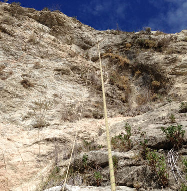
Short sections of unpleasant bushwhacking from the drop-in to the first rap. No poison oak, minimal thorns, mostly just brush. The first rappel is 25' and is anchored to a bush on canyon left.
When you get to the confluence with the Main canyon, at about 34.296993 -118.210504, there is an impenetrable 'Yucca grove' that you will want to bypass on the canyon right side. Shortly after the confluence you come to the second rappel There are several options for this rap. From the point of no exposure at the very top, it is approx. 210' to the bottom. There are numerous anchoring options here; several huge bushes and boulders sit about 20' back in the center of the canyon, there is a 3' deep pothole (3' diameter?) right at the drop that would facilitate a Sandtrap or deadman/cairn nicely. From this point it is possible to down-climb approximately 70' to the pour-over and 'the point of no return'. There is some exposure on this down-climb, it is polished granite and is very greasy in sections. On the canyon right side is a bush about 5' back that can be anchored off of. From this anchor point to the ground it's 140', with about 30' of that free-hanging. A short section of bushwhacking greets you and the bottom of the rappel.
A short distance down canyon you will reach the third rappel. It is about 20' and could likely be down-climbed with caution. There are numerous bushes canyon left and right suitable for anchorage, using the canyon left ones will necessitate you retrieving your rope through some poison oak.
The "Left Fork" joins from the canyon right side at 34.294581 -118.211068.
Continue down canyon until Big Tujunga Road, where you could combine this trip with Fusier Canyon (Lower) by entering the old rail tunnel on the canyon left side right below the road on the north side.
