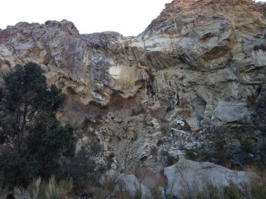
Guadalupe Creek
| Rating: | |||||||||||||||||||||||||||||||
|---|---|---|---|---|---|---|---|---|---|---|---|---|---|---|---|---|---|---|---|---|---|---|---|---|---|---|---|---|---|---|---|
| | Difficulty:4A IV (v4a1 IV) Raps:14, max ↨270ft
Red Tape:No permit required Shuttle:Required 60 min Vehicle:Passenger | ||||||||||||||||||||||||||||||
| Location: | |||||||||||||||||||||||||||||||
| Condition Reports: | 28 Nov 2025
"Started just before sunrise. The approach trail was easy to follow and took us through a network of beautiful canyons before following washes to the d |
||||||||||||||||||||||||||||||
| Best season: | Winter;Fall
|
||||||||||||||||||||||||||||||
| Regions: | |||||||||||||||||||||||||||||||
Introduction[edit]
The canyon is beautiful and unique as it was brutal. It took us 15hrs and 7min to complete it, 6am to 9:07pm. It should be treated as an 17hr+ canyon. Tried it as a two day, not any better; the bigger packs made the bushwhacking impossible. Better to pack light and plan on one long day. The canyon was dry with the occasional pool or puddle that was all avoidable.
Approach[edit]
The upper parking lot is off the 74, just south of Pinyon Flat campground. Here lies the TH for Sawmill but you are looking for the Cactus Spring trail. Head east from the parking lot to a dirt road, Pidgeon Spring Rd, and make a right (south) for about 315 yards. Make a left at the next trail and you'll see a registry. This is Cactus Spring trail and you will be on this trail for the largest portion of the approach. After about 5.4mi or where Cactus Spring trail and the wash in sector 17 cross, leave the trail and head in a north east direction. There was a post with a "Q" at this location. Follow the wash until it makes a turn west, leave the wash and continue north east until you meet another faint gully.
This small indentation on the earth is the very beginning of Guadalupe Creek. Follow this as it gradually becomes deeper and more overgrown. You will come to a old "cowboy camp" where you can find a cache in the stove. Soon after you will come across some brush that you must negotiate. Descent description begins at this point. Note however that it seems there is a trail that bypasses all of this RDC but we didn't see it. Look for it at or around the camp.
Descent[edit]
Note that we down climbed several falls that probably should have been rappelled. I point out the bushwhack sections only because they are brutal here. Unlike anywhere else. That way you know when to expect them.
DC: 30' fall can be bypassed RDC
DC: 30' fall can be bypassed RDC
DC: 40' fall can be bypassed RDC
Bushwhack Section
R1: 50' anchored LDC from a pointy boulder
Bushwhack Section
R2: 270' anchored from a large boulder in the watercourse extended 50' to the edge. [We were able to descent with 200' rope and 200' pull. Please refer to this image if you're not packing a 300' rope and planning on only using 200'. With the anchor extended to the lip, 200' will deposit you at a series of ledges (red circle). It's about 50' to get down and it is exposed. The big prominent ledge (red arrow) about 3/4 of the way down, looks like an ideal spot for a second anchor, but we could not find anything reassuring. Pull from this stance is not easy. ]
Bushwhack Section (really thick)
R3: 50' sloping fall
DC: 20'
R4: 30'
R5: 50'
DC: 70' We bypassed this LDC
R6: 190' A 200' rope will get you down the first 150' and the second 30'. Pull isn't an issue.
R7: 45' from tree in watercourse. Stagnant pool can be avoided RDC
R8: 60' from tree. Awkward with an overhang
R9: 120' another two stage, 120' or rope will suffice for both of these
Some bushwhack
R10: 120' anchored from boulder LDC
R11: 200' from crack ~50' from the edge. This rappel was exactly 200', our rope was about a foot off the ground, but plenty once weighed.
R12: 35' sloping rappel
DC: 30' LDC
R13: 180' from boulder LCD
DC: 20'
DC: 15'
R14: 30 from small boulder in watercourse
Exit[edit]
After the last rappel, human presence will be evident. Hikers often hike up to this waterfall. From here, simply keep following the water course until you reach your vehicle.
Red tape[edit]
No permits or land issues as far as I know. The approach lies on the San Bernardino National Forest, with the descent and exit passing through a checker board of BLM and state land.
Beta sites[edit]
 CanyonCollective.com : Guadalupe Creek
Trip reports and media[edit]
- Gallery - December 29, 2012 by Christian Lupercio
