Hamm Canyon
| Rating: | |||||||||||||||||||||||||||||||
|---|---|---|---|---|---|---|---|---|---|---|---|---|---|---|---|---|---|---|---|---|---|---|---|---|---|---|---|---|---|---|---|
| | Difficulty:4A III (v4a2 II) Raps:2-3, max ↨160ft
Red Tape:No permit required Shuttle:Optional 50min Vehicle:High Clearance Rock type:Sandstone | ||||||||||||||||||||||||||||||
| Start: | |||||||||||||||||||||||||||||||
| Parking: | |||||||||||||||||||||||||||||||
| Shuttle: | |||||||||||||||||||||||||||||||
| Condition Reports: | |||||||||||||||||||||||||||||||
| Best season: | Feb-May; Sep-Oct
|
||||||||||||||||||||||||||||||
| Regions: | |||||||||||||||||||||||||||||||
Introduction[edit]
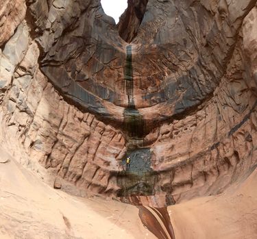
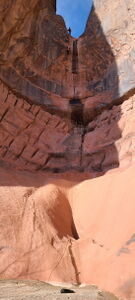
The Class 4 rating is for the final rappel which requires setting a traverse line to reach the bolts for the final rappel.
- Trailhead: 38.09793, -108.81239
- Drop In: 38.10765, -108.80267
- First Rappel: 38.10236, -108.80724
Approach[edit]
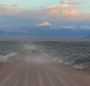
Drive Gypsum Valley Road 8 miles northwest from CO 141. Turn right onto a high clearance dirt road toward the large dryfall in Hamm Canyon. Park at the end of the road closest to the final rappel.
Shuttle 9.2 miles back to CO 141, turn left onto CO 141 for 5.3 miles. Turn left on 25R Rd to County Rd 029W. Right on U29 Rd until reaching an 4-way intersection. Turn Left on 16Z Rd to the start of Hamm Canyon. Park at (38.10970, -108.80154). The shuttle takes 50min one way.
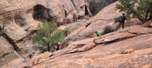
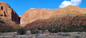
Hike from the Trailhead/Lower Parking, follow a faint trail north along the dry creekbed for about 500 feet, then veer right and up a large ramp and to a very unique sandstone tower that looks like two dog-head towers. Flank these towers to the right at their base at (38.09952,-108.80772) and gain a flat area at (38.09768, -108.80560). From the flat area work your way east along the bottom of the red sandstone wall and find a crack to climb up at (38.09740, -108.80424). Once on top of the red layer you need to find a way up through the white layer to gain the top of the cap rock. Just to the right is a crack that is not too difficult but slightly exposed. Once on top, head due north for about 1/2 mile and you will run into an old dirt road at (38.10387, -108.79978). Take the dirt road west about 1/4 mile to the head of the canyon.
Descent[edit]
The descent begins with several interesting pool crossings, which can be avoided on Canyon Right. Some simple stemming and down climbing is required.
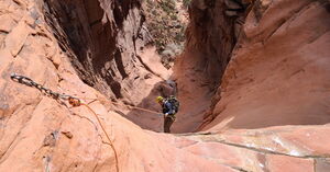
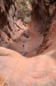
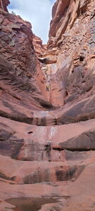
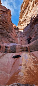
R1: 200' from bolts on Canyon Left will take rappellers all the way to the bottom of the apron shelves, which may be slick depending on conditions, near the start of the R2a traverse line. Alternatively, walk off at 150' on R1 and downclimb the rest. A small water-filled pothole at the bottom of the rappel can be avoided.
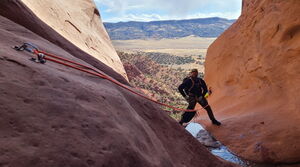
R2a: 45' traverse line from bolts on Canyon Left crossing the watercourse to the final rappel anchor.
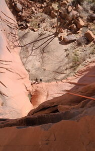
R2b: 160' from bolts on Canyon Right for the free hanging final rappel.
Original 2017 Beta:
The first rappel is 150 feet and is bolted on the left. There is a small pool at the bottom of the rappel that can be easily avoided under most conditions. From the bottom of the first rappel to the second rappel is a multi-tier ramp with water or ice in the middle. It can be downclimbed but setting up a handline may be needed. The bolts for the second rappel are out on the right in a position suitable for ice-climbing. To reach these bolts there may be a safety line in place, or you can self-belay the first person out from a set of bolts about 30 feet back on the left. The second rappel is 160 feet and is free-hanging for about 100 feet. In winter these ledges can be icy and the degree of difficulty and danger is much higher.
Exit[edit]
Boulder hop down the drainage and around several pools for about 20-30 minutes, then pop out left to the trail you came in on.
Red tape[edit]
Beta sites[edit]
Trip reports and media[edit]
2.16.2017: group of 7, sunny and dry, 5 hours. No ice. Upper section pools were full. Pool at the bottom of the final rappel was dry. Someone had left a long piece of webbing as a safety line to get to the bolts for the final rappel.
6Apr2024: beta update, kml map added. Done via car shuttle.
