Hand-over-Hand
| Rating: | |||||||||||||||||||||||||||||||
|---|---|---|---|---|---|---|---|---|---|---|---|---|---|---|---|---|---|---|---|---|---|---|---|---|---|---|---|---|---|---|---|
| | Difficulty:1B II R (v2a2 II) Raps:2, max ↨4ft
Red Tape:No permit required Shuttle:None Rock type:Sandstone | ||||||||||||||||||||||||||||||
| Location: | |||||||||||||||||||||||||||||||
| Condition Reports: | |||||||||||||||||||||||||||||||
| Best season: | Oct-Apr (avg for this region)
|
||||||||||||||||||||||||||||||
| Regions: | |||||||||||||||||||||||||||||||
Introduction[edit]
Hand over Hand canyon is a short, easy canyon near to Mt Wilson. Access is reasonably easy, though no defined track from the power lines track into the creek currently exists. A defined exit track exists to return to the power lines track. Should be able to do this in half a day or less, car to car. Worth doing once.
Approach[edit]
Park at the start of Red Hill Fire trail, walk approx 650mtrs along the fire trail, turn right under the power lines and follow that track. At a set of power lines, approx 1km from the gate and car, make your way down right into the creek (Via a feeder creek) that flows through Hand over Hand canyon.
Descent[edit]
There is approx 500mtrs of creek walking or so before you get to a short section of canyon, it does not last long, then some more open creek walking before you have to skirt around a deep pool and the first abseil is just beyond this.
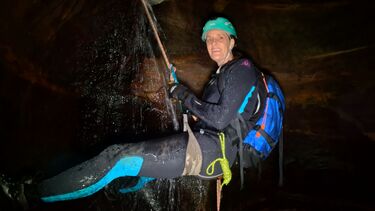
Find a suitable anchor, and drop into a pothole chamber, the abseil is about 3mtrs into a deep pool, though you can stand up in the pool.
There are two ways out of this pothole, under the wall and swim under if it is not blocked, or, up and over the rim of the pothole through the V groove.
A couple of pretty and deep pool, and you arrive at a slippery 3-4mtr abseil, you may be able to down climb, but it is very slippery, there is a convenient tree on true right for an anchor.
Just downstream from here, the creek opens up into a large chamber and turns left, it is only 5 minutes or so downstream to the end of the canyon.
Exit[edit]
There are 2 options, true left up into a giant overhang, around into a gully and up a fixed rope, then a track back to the power lines. This is the quickest and easiest way, that track does become indistinct towards the end. Look for pink tape and chopped trees to help mark the way. You rejoin the power lines track quite close to where you went in.
The other option is exit up on true right, a feint track leads up the nose, from there, no track exists, and it is much longer and slower back up the ridgeline to Red Hill fire trail.
You could also exit down into South Bowens Creek, which is a few hundred mtrs further downstream
