Henline Creek Canyon
| Rating: | |||||||||||||||||||||||||||||||
|---|---|---|---|---|---|---|---|---|---|---|---|---|---|---|---|---|---|---|---|---|---|---|---|---|---|---|---|---|---|---|---|
| | Raps:6-10, max ↨165ft
Red Tape:Closed to entry Shuttle:Optional 5min Vehicle:Passenger | ||||||||||||||||||||||||||||||
| Location: | |||||||||||||||||||||||||||||||
| Condition Reports: | 13 Jul 2019
"Great outing in upper Henline, but last person discovered a core shot in the rope on the final rappel. Unclear what happened there; havent had iss |
||||||||||||||||||||||||||||||
| Best season: | May-Sept
|
||||||||||||||||||||||||||||||
| Regions: | |||||||||||||||||||||||||||||||
Introduction[edit]
Current Status: Closed. This creek was overrun by the Beachie/Santiam Fire in Sept 2020 and has been closed. Please check on local closures before planning a trip to this area. When the area eventually reopens, use extreme caution when descending the creek. Between landslides, fallen trees, and loose rocks, this area may be unstable and dangerous for years to come. The canyon may have changed dramatically. Do not rely on the beta below being accurate.
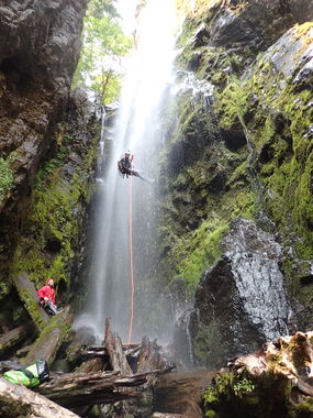
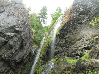
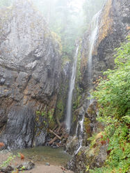
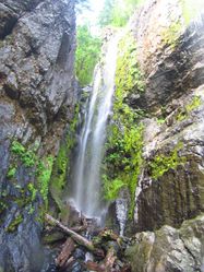
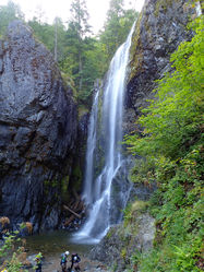
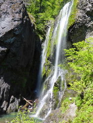
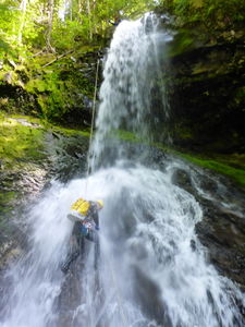
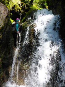
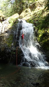
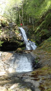
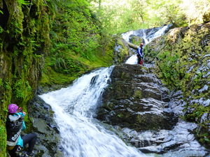
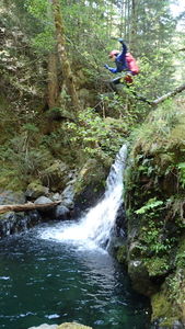
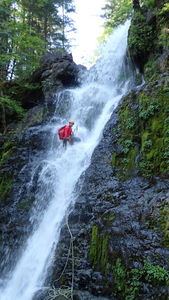
A pretty canyon with rapidfire rappels in the upper section to the bottom of Henline Falls. All rappels are rigged to be in the flow, but flow is relatively low and spread out in wide, gentle cascades making it a good early season candidate and good for beginners.
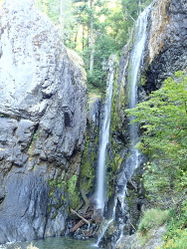
The checkpoint for the water flow is Henline Falls, which can be visited during the approach hike.
Best Practices[edit]
Henline Creek has been seeing increased visitation in recent years and showing signs of abuse. Please try to use anchors in or just adjacent to the watercourse whenever possible. Climbing up to trees higher up on the sides is attractive, but risks trampling vegetation and eroding away the banks. Riparian environments in the Pacific NW are extremely fragile.
- Teaching people to rappel for the first time in an aquatic canyon is not a good plan. Much better and safer to become fully proficient with rappel devices outside the canyon in a safe dry environment.
- Two strand rappels (as is done in alpine climbing) can be dangerous in aquatic canyons. Excess rope can be an entanglement hazard in deep pools. Strands can become coiled around one another to create an obstacle that a rappeller cannot pass, etc. Taking a class in aquatic canyon techniques is strongly recommended.
- Beginners "leading" beginners is a common cause of accidents in canyoneering. Enthusiasm is not a substitute for training by a competent qualified instructor.
- Please use natural-colored webbing for anchors that will blend in. Black, the color of shadows, works everywhere. Henline is visited by many waterfall photographers who will not appreciate bright red slings at the top of the waterfalls.
Approach[edit]
From the trailhead, follow the obvious trail along an old road grade for 0.5mi to a junction. The trail to the main falls branches off left; marked with a sign. The Henline Mountain trail goes right and is marked with a mysterious "X" sign on a tree. This junction is easy to miss.
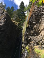
Follow the Henline Mountain trail steeply upwards through numerous switchbacks. After another half mile come to an obvious junction. There is another easy-to-miss sign on a tree reading "Trail" with an arrow pointing right. Go right. (If you go down you'll end out at R3.) Continue steeply upwards until ~2600'. Watch for a large obvious rock formation (pictured below) on the left side of the trail. Just after, break off the trail and make your way downward to the creek. Head downstream 100ft to the top of R1.
- There is some poison oak along the approach trail.
- Beware yellowjackets when entering & leaving the canyon in late summer; they often nest in ground burrows and rotten logs.
Descent[edit]
Henline canyon is wide and has plenty of trees. It can be run at high flow, but it's more fun to run in moderate or low flow as you can rappel right down the middle of the waterfalls. If rappelling out of the water, please do your best to avoid scraping off the moss and trampling vegetation. These falls are frequently visited by photographers who will not appreciate the ugly black streaks (aka "vertical trails") created by careless rappellers. This is particularly important in Upper Henline which is visited frequently by non-canyoner visitors.
It is recommended to exit the creek after the main falls (5h-6h) and follow the trail back out. Below Henline Falls there is a long stretch of creek walking with frequent boulder obstacles. If you have time, however, one can descend all the way to Opal Creek (6h-8h). You may can combine Henline with the descent of the "fabulous narrows" section of Opal Creek Narrows for a full day.
Upper Henline[edit]
- R1: 50ft from tree on right
- R2: 20ft downclimb right, or rappel on left
- R3: 50ft from bolts on right
- R4: 50ft from tree on left
- R5: 65ft from bolts in middle boulder
- R6: 75ft from tree on right
Next a very pleasant creek walk on soft moss and grippy white bedrock.
- R7: 100ft tree high left
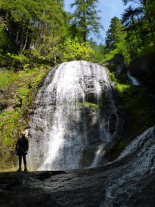
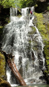
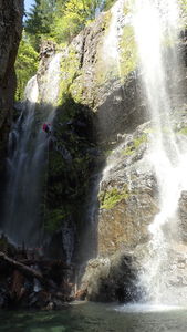
- R8 (Henline Falls): 165ft from log on left offers a freehang rappel direct to the pool and may be recommended at higher flows. Alternatively, from the top of the falls, use the log anchor to rappel (or carefully downclimb) the cascade of the main water channel DCR about 50ft to get down to reach a tree which is right on the edge. From this lower station, rappel 110ft to a massive pile of slick logs you must negotiate to reach the pool. Beware sharp edges on the final rappel. Several ropes have been core shot here.
You can exit here via the Henline Falls trail or continue downstream.
Lower Henline[edit]
Lower Henline is not quite as action-packed. Expect significant creek-walking. Up to six jumps from 5-18ft are possible but require skill, accuracy, and/or shallow entry techniques. As always, depth should be checked before attempting.
- R9 80 ft from a easy-to-miss bolt DCL or relatively easy DC DCR.
- 6ft jump into chest deep water
- Jump 18 ft - DCL or rappel.
- Downclimb: 15 ft by stepping over ledge DCR.
- 13ft jump to pothole with narrow landing zone. Must clear back submerged ledge while not jumping too far and hitting the submerged down canyon ledge.
- Downclimb: 15 ft.
- You can exit once reach Opal creek with a trail DCR or do one final rappel.
- R10 70 ft. If you're planning to hike back up to FR 2209, don't bother rigging the rope for retrieval. Tie the rope off to the tree, rappel -- and just follow the trail to the top of the falls to reclaim your rope afterwards (takes 2min). Or a better anchor to rappel in the falls is 40' straight back for a total of about 120ft. There is a cool natural arch DCR part way down the falls.
Exit[edit]
From the bottom of Henline Falls, take the well maintained hiker trail about 20 minutes back to the trailhead. From the bottom of the R10, look DCR to spot a trail. Follow it back up to the top of the falls and continue all the way back up to the road.
Red tape[edit]
Need to fill out a free self-issue wilderness use permit at the trailhead.
Beta sites[edit]
 CanyoneeringNorthwest.com (archive.org) : Henline Creek
 Super Amazing Map : Henline Creek Canyon
Trip reports and media[edit]
- https://www.facebook.com/media/set/?set=a.10153320448306103.1073742009.669366102&type=1&l=1d2c2bc8bd
