Idiot Creek
| Rating: | |||||||||||||||||||||||||||||||
|---|---|---|---|---|---|---|---|---|---|---|---|---|---|---|---|---|---|---|---|---|---|---|---|---|---|---|---|---|---|---|---|
| | Raps:3-4, max ↨120ft
Red Tape:No permit required Shuttle:None Vehicle:Passenger | ||||||||||||||||||||||||||||||
| Start: | |||||||||||||||||||||||||||||||
| Parking: | |||||||||||||||||||||||||||||||
| Condition Reports: | 29 Nov 2025
"The flow is very nice and only cold enough to induce an "ice cream" headache when youre directly in the flow. All three anchors were in good shape. T |
||||||||||||||||||||||||||||||
| Best season: | Jan-May
|
||||||||||||||||||||||||||||||
| Regions: | |||||||||||||||||||||||||||||||
Introduction[edit]
Well-known to waterfall photographers for years, Idiot Creek sports several big waterfalls which are quite impressive during the spring spate. The beta here describes a descent of the east fork of Idiot Creek. All the drops are fairly wide with options to rappel in or out of the flow depending on water conditions. Please use unobtrusive anchors as the falls are visited by photographers with some frequency. This is a great creek to run on a rainy winter day. Otherwise, it may not be worth your time.
- Watershed: 0.7mi^2.
Approach[edit]
Follow Hwy 6 from Portland and turn off onto Larch Mountain / Drift Creek Rd. Drive down the hill, cross the bridge, continue on up the road for ~3mi. At the junction where you'd turn off to Stafford Creek (right), continue another 0.6mi to a small pullout on the left (room for about three cars). If more parking is required, continue north about 500ft to a junction.
The approach starts at the front of the pullout, enter the woods, cross the mountain bike trail, and continue down an old overgrown logging grade. When it ends, bushwhack down the slopes west to Idiot Creek. Head downstream a short distance to the top of R1.
Descent[edit]
- R1: 60ft from a tree DCL.
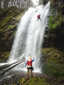
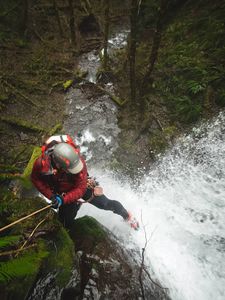
- R2: 50ft from a tree on the edge DCL. Rappel line slips right down the edge and under the falls. This line can be done safely even at high flow, although doesn't look it until you get into position to see down the pitch. There is also an anchor further DCL for a dry rappel.
Continue downstream a short distance to a nice cascade. Downclimb DCR or rappel. Continue a bit further to:
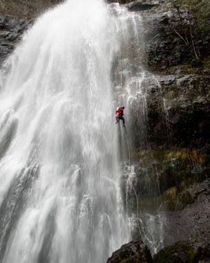
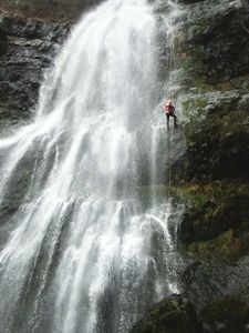
- R3: 145ft from a tree DCL. This is a gorgeous rappel, worth the price of admission.
Exit[edit]
From the bottom of the big rappel, head downstream about 300ft until it becomes relatively easy to climb out DCR. Clamber out of the creek and bushwhack up the slopes. It's steep at first, but the terrain soon moderates. Head climber's right following the path of least resistance until you top out on a narrow ridgecrest. Continue on up to about 2000ft elevation at the edge of the plateau. From here, bear right and contour over until you can drop back into the drainage above the first falls. Follow the approach route back to the cars. Declare victory.
Red tape[edit]
None.
Beta sites[edit]
Trip reports and media[edit]
https://youtu.be/PZclmHp6MHE Feb 2025
Background[edit]
Creek was first descended by Wade Hewitt and Kevin Clark in Feb 2020.
The creek gets its name from a former logging camp in the 1970's that was located about a half-mile upstream from the Wilson River. At the time, the area was so remote that it was said that only an idiot would want to work there. Later, the camp became known as "Idiotville." Today the creek is stuck with the unfortunate name, but don't let that stop you from visiting.


