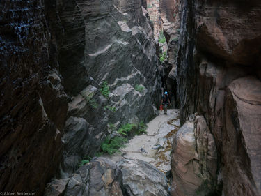
Isaac Canyon
| Rating: | ||||||||
|---|---|---|---|---|---|---|---|---|
| | Difficulty:4B V (v2a2 V) Raps:max ↨280ft
Red Tape:Permit required Shuttle: | |||||||
| Location: | ||||||||
| Condition Reports: | ||||||||
| Best season: | ||||||||
| Regions: | ||||||||
Introduction[edit]
Isaac is an interesting, rarely descended, fault based canyon that requires some effort to get to. It can either be approached from Phantom Valley or N Fork Heaps (Gunsight), the recommended approach. Approaching via Phantom Valley will require wet/dry suits and pothole escape tools/techniques.
It is a beautiful route and a fun multi-day trip in a rarely traveled canyon. You might be able to do it in a long day with a small fast group.
Approach[edit]
The two options to get to Isaac. 1: (Preferred) Descending Heaps Canyon (North Fork) (Gunsight) a nice route that will may require some short wades and perhaps a very short swim but in most conditions will not require a wetsuit/drysuit. Or 2: Descending Phantom Valley and going through the narrows which will require a wetsuit/drysuit and pothole escape gear/techniques.
Both routes will deposit you at the crossroads in Heaps. From here you must climb up the South Fork of Heaps to get to the top of Isaac.
If coming from Gunsight then turn right at the crossroads head up-canyon 50-100 feet and South Fork Heaps will be on your left (RDC). You have to go up this canyon to get to Isaac.
It starts as an easy walk but soon you'll be scrabbling up rocks. The crux of this canyon is one 30 foot section of low class 5 climbing, when the canyon starts getting steep. If you've got bigger packs on you'll probably have to take them off here and pass them up. This obstacle is fairly easily overcome and then you'll be hiking up a massive, steep, loose pile of dirt and rock. Be careful there are large loose rocks. This first slope flattens out and there are a bunch of thorny bushes, beyond this the canyon get's more narrow and there is one more section to climb (broken into 2 parts). It is more boulder scrambling with loose logs and lots of thorns, until you finally reach the top amongst a bunch of tree roots you can use to climb the last portion. At the top of this you will be looking down into Isaac. Nice view from here down both canyons.
Descent[edit]
From the head of Isaac the easiest path with the least amount of bushwhacking seems to be LDC. Scramble down rocks until you arrive at the top of the first rappel.
Rappel 1: Anchored from a large boulder RDC and extended into the hanging bowl to help with rope pull.
Rappel 2: Just after rap 1. You might be able to climb down the steep slope RDC but it may have sand and be slippery.
Rappel___: Original beta has this rappel at 280ft but it seems to be 260 or less. From the perch if you rappel RDC there is another anchor less than 200ft down on a ledge just above the last 100' or so, free-hanging portion. If you plan on using this be prepared to inspect the bolts and replace if needed.
Camping[edit]
There are a few good places to camp in the lower section of N Fork of Heaps (Gunsight), most likely near water. You can also choose to camp at the Heaps crossroads, where there will most likely be water although you may have to go up canyon or do a short rappel down canyon to get it, or go a short ways back up gunsight.
The other option would be to have an early dinner the first day, fill up on water and hike a short ways up South Fork of Heaps.
Exit[edit]
After the big rappel make your way boulder hoping down the creek. There will be one last rappel of about 30-40ft with a sprinkling of water. There may be a way around this rappel LDC but it's a fun rappel and worthy of the effort. Be careful on getting the rope stuck though. You may want to extend the webbing further to avoid a crack under the boulder.
Continue boulder hoping down the creek. Before long it will start to flatten out. At 37.2402, -112.9742 a trail crosses the creek. Take this (LDC) and follow it back to the Court of the Patriarchs shuttle stop.
Red tape[edit]
Entry to this area may be restricted; check for information regarding permits before attempting this trip
Beta sites[edit]
 CanyoneeringUSA.com : Isaac
 Zion Canyoneering Book by Tom Jones : Isaac Canyon via Gunsight
 Super Amazing Map : Isaac Canyon
 ZionCanyoneering.com : Isaac Canyon
Trip reports and media[edit]
- http://www.canyoneeringusa.com/rave/0509isaac/
- https://plus.google.com/photos/100678539310197157164/albums/6058692940837516913
