Labyrinth Creek
| Rating: | |||||||||||||||||||||||||||||||
|---|---|---|---|---|---|---|---|---|---|---|---|---|---|---|---|---|---|---|---|---|---|---|---|---|---|---|---|---|---|---|---|
| | Raps:3-4
Red Tape:No permit required Shuttle:None Vehicle:Passenger | ||||||||||||||||||||||||||||||
| Location: | |||||||||||||||||||||||||||||||
| Condition Reports: | 22 Oct 2017
"Hiking in the area; did not run. Flow appears low. Today was the tail-end of an atmospheric river event and massive precip dump in the Gorge. |
||||||||||||||||||||||||||||||
| Best season: | Jan-Apr
|
||||||||||||||||||||||||||||||
| Regions: | |||||||||||||||||||||||||||||||
Introduction[edit]
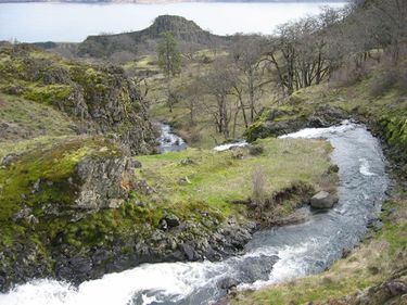
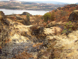
Labyrinth Creek is a minor seasonal drainage located between the Coyote Wall and Rowland Lake, east of Bingen, WA. The name “labyrinth” comes from the large number of odd rock formations in the area which form something of a natural maze. This creek is not a major objective, but might be a good one when other creeks in the area are running high. Labyrinth Creek dries up completely by mid-summer, so don't bother after that. The creek can be fairly brushy in the late season. Hit this one when it has good flow.
Beware poison oak throughout the area.
Approach[edit]
Directions[edit]
Head east on I-84 and cross the Hood River Bridge into Washington State. Turn right on Hwy 14 and continue for 5.8mi to a junction with the Lyle-White Salmon Rd (Old Hwy 8) on the left. Park on the left immediately before the junction in a large gravel pullout.
Approach[edit]
From the parking area follow the old road back west which runs parallel above Hwy 14. Along the way pass the base of Rowland Lake Falls which is a good place to check the flow. Eventually the cliffs subside and follow the obvious trail upwards, keeping right at all junctions. The trail winds upwards and eventually parallels the creek. Continue upwards, passing a small cave (goes back 20ft). Note the waterfall directly ahead through the trees; this is R2. Follow the trail as it switchbacks up above the falls and head over to the creek when you see the slide (R1).
Descent[edit]
Please do not leave anchors visible from the trail to discourage the unprepared from attempting to follow you.
- R1: 15ft. Low-angle slide.
- R2: 25ft. Anchored off a small tree high DCL. Beware some loose rock.
- Just ahead the creek swings left and drops 6ft into a narrow slot. Might be brushy. Follow the creek downstream 5-10min.
- R3: 20ft. Can be downclimbed carefully when dry.
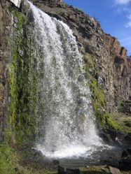
- R4: Labyrinth Falls. 30ft. Use caution as there may be a sharp edge where the creek goes over the lip. Anchored off a cairn DCL.
R4 has a lower tier just below the old highway, but rappelling here may not be recommended per close proximity to Hwy 14.
Exit[edit]
Walk back down the old road to your car.
Red tape[edit]
A NW Forest Pass may be required for parking.


