Lanbreabe
Jump to navigation
Jump to search
Also known as: Barranco de Lanbreabe.
| Rating: | |||||||||||||||||||||||||||||||
|---|---|---|---|---|---|---|---|---|---|---|---|---|---|---|---|---|---|---|---|---|---|---|---|---|---|---|---|---|---|---|---|
|
| |||||||||||||||||||||||||||||||
| | Raps:
Red Tape: Shuttle:Required Yes | ||||||||||||||||||||||||||||||
| Location: | APPROXIMATE LOCATION! "°5'0.00"N" can not be assigned to a declared number type with value 43."°45'29.00"W" can not be assigned to a declared number type with value 2.
|
||||||||||||||||||||||||||||||
| Condition Reports: | |||||||||||||||||||||||||||||||
| Best season: | Anytime
|
||||||||||||||||||||||||||||||
| Regions: | |||||||||||||||||||||||||||||||

Introduction
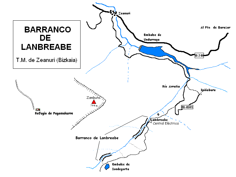
Acceso desde: ZEANURI
Información del caudal: Caudal permanente variable con el régimen de lluvias
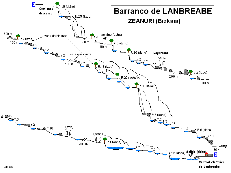
Material necesario: 2 de 30 m
Neopreno: En invierno y en época de lluvias neopreno completo
Material de instalación: Aconsejable llevar material de instalación de repuesto
Epoca: Todo el año
Horario de aproximación: Inmediato
Horario de descenso: variable según el caudal. Si se realiza íntegro prever 4 horas
Horario de retorno: Inmediato
Mapa: Macizo del Monte Gorbea. Departamento de Urbanismo Vivienda y Medio Ambiente del Gobierno Vasco. 1.25.000
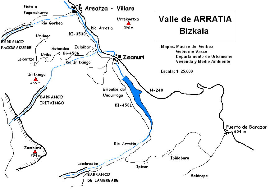
Zona o macizo: Monte Gorbea
Cuenca: Nervión
Carácter: Abierto
Combinable con el descenso de: Barranco Iritxin, Askotxi, Pagomakurre
Approach
Combinación de vehículos: Aconsejable. Un vehículo se deja junto a la central eléctrica de Lanbreabe y el otro cerca del embalse de Iondegorta
Desde el pueblo de Zeanuri (Bizkaia) tomar la carretera que bordea el embalse de Undurraga. Al final de este tramo, seguir la carretera hacia Lanbreabe. La carretera se convierte en este punto en una pista cementada que asciende por fuertes repechos hasta el embalse de Iondegorta. Justo antes de llegar a este punto se deja el vehículo en un borde de la pista junto a una borda situada cerca.
Descent
Barranco de carácter abierto. En su comienzo y en la parte inferior se concentran las mejores zonas. La zona intermedia tiene escaso interés deportivo.
Escapes: Es posible abandonar el barranco en muchos puntos
Exit
El descenso del barranco termina justo en la central eléctrica de Lanbreabe. Solo hay que subir a la carretera.
Red tape
Beta sites
 Barranquismo.net : Lanbreabe
- Wiki-Infobarrancos : Barranco de Lanbreabe (http://infobarrancos.es/)
Trip reports and media
Background
Primer descenso desconocido