Lena Creek Canyoneering Canyoning Caving
|
| Rating: |
Log in to rateLog in to rateLog in to rateLog in to rateLog in to rate 4.0 (1 rating) |
|
|
| |
Raps:7 + 1 jump, max ↨95ft | Overall: | 3-5h | ⟷2.5mi |
|---|
| 30min-1h | ⟷1.3mi | ↑700ft | | 2-4h | ⟷0.8mi | ↓600ft | | 15-30min | ⟷0.4mi | ↓100ft |
No Shuttle:Optional 0.5 mi Rock type:Basalt |
|---|
| Start: |
|
|---|
| Parking: | |
|---|
| Shuttle: | |
|---|
| |
|---|
| Condition Reports: |
(log in to submit report)
|
|---|
Weather: |
|
|---|
| Best season: |
Jul-Sept | winter | | spring | | summer | | fall |
|---|
| Dec | Jan | Feb | | Mar | Apr | May | | Jun | Jul | Aug | | Sep | Oct | Nov |
|
| Regions: |
|
47.6055, -123.160647.5996, -123.151147.5996, -123.1591https://ropewiki.com/images/c/c8/Lena_Creek.kmltopo
GPS data automatically extracted from [], please visit their site for more detailed information.
Automatic GPS data extraction NOT allowed, please visit [] to download GPX.
Reference photos
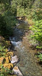
23 Jul 2025:
Moderate. Challenging but not dangerous for intermediate canyoneers (class C1 = a4). NF25 Bridge
These reference pictures are used in the
Waterflow analysis to predict current conditions. More reference pictures will produce a more reliable prediction.
(log in to submit reference picture) | Welcome! Canyons in the Pacific Northwest can be different from those you might be used to. Be ready for unlinked bolts, retrievable traverse lines, and challenging aquatic environments. For more on local practices, and the best way to get started in the region, check out the WCC Safety page.
- Unlinked Bolts - groups should be comfortable rigging unlinked bolts, either temporarily linking them for all but the last person, or using a passive redundancy method. Most importantly, if you find two bolts side by side that are unlinked, do not add webbing to them. Linking bolts designed to be unlinked will likely cause damage during seasonal floods.
- Traverse Lines - many canyons are rigged to allow traverse line access to an exposed anchor station. This should be done using self-belay or team belay techniques. Do not leave fixed lines in the canyons.
- Challenging Environments - the highly aquatic nature of PNW canyons can surprise many. Cold temperatures, slippery rocks, loud waterfalls, and strong currents all lead to unexpected problems. Do not underestimate the need for strong team work and technical proficiency. Belays are frequently not possible. Unattended gear will sink or float away. Sliding and jumping is the cause of most major injuries, so it's critical to effectively communicating water depth & submerged hazards.
|
Introduction[edit]
Lena Creek is a tributary of the Hamma Hamma River and originates from Lean Lake which is in turn fed from Upper Lena lake, a high alpine lake in Olympic National Park.
Water Flow
The watershed is about 10mi^2 with the highest point being The Brothers at ~6800' elevation. Be aware: this catchment holds snow well into July. The best time to visit the creek is probably July through September dependant on the snow levels.
Approach[edit]
From the Upper Approach, continue down canyon. There is a 0.5 mile creek walk with some small slides and jumps prior to the first rappel.
Utilizing the Lower Approach line saves approximately 0.5 mi on trail and 0.5 mi of creek walk without missing the technical portions of the canyon. Can be accessed without a rappel into the creek.
Descent[edit]
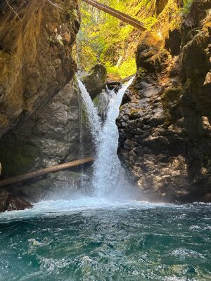
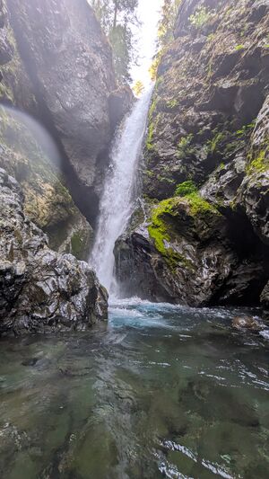
Single bolts are present on R1-R4. Rappelling from single bolts is not best practice. The canyon can be run utilizing natural anchors. A bolting plan is in progress.
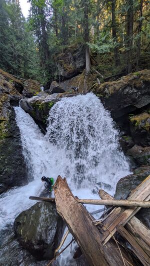
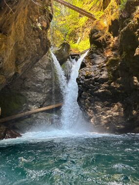
R1 - 40’ rappel from log DCR.
R2 - 25’ plus 10’ back from the edge from large logs.
R3 - 80’ plus 15’ back from edge. Rappel from the logjam. Exiting the pool at the base of the rappel may present difficulties in high flows.
J1 - 10’ jump from rock promontory, or walk the balance beam log and jump.
R4 - 15’ from upturned log DCL.
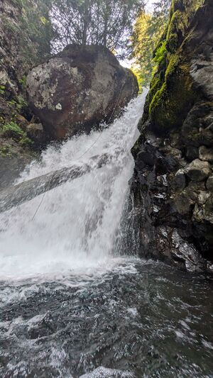
R5 - 45' from live tree on top of large boulder DCR.
R6 - 35' from log DCL.
R7 - 25' from logs DCC. Can be downclimbed as a safe alternative.
Continue down canyon through the boulder garden and creek scramble for 0.20 miles until you see the bridge where Lena Creek meets NF-25.
Red tape[edit]
USFS parking pass is required and day passes can be purchased on site with a credit card.
Beta sites[edit]
Trip reports and media[edit]
Background[edit]


