Little Viento Creek
| Rating: | |||||||||||||||||||||||||||||||
|---|---|---|---|---|---|---|---|---|---|---|---|---|---|---|---|---|---|---|---|---|---|---|---|---|---|---|---|---|---|---|---|
| | Raps:3, max ↨120ft
Red Tape:No permit required Shuttle:None Vehicle:Passenger | ||||||||||||||||||||||||||||||
| Location: | |||||||||||||||||||||||||||||||
| Condition Reports: | 10 Mar 2024
"Surprisingly low flow. Nice early season shortie creek. Cleaned out debris at the top of the falls to run the flow direct. The big falls is worth the |
||||||||||||||||||||||||||||||
| Best season: | Jan-Feb
|
||||||||||||||||||||||||||||||
| Regions: | |||||||||||||||||||||||||||||||
Introduction[edit]
A small tributary flowing into the Columbia River just west of Viento Creek. Little Viento is a good one to hit early season when other creeks are flowing too high. Best for local Portland obsessives who need their rappel fix. Recommend just visiting the last three drops on Little Viento; there are more drops further up the creek, but there's a long walk between them, so they may not be worth your time. This is a short objective which can be run in a couple of hours; perfect for a cold, rainy January day.
Watershed: 0.25mi^2.
Approach[edit]
Park in the Viento Creek trailhead on the south side of exit 56. Note the gate on the south side of the parking area just before the bridge over Viento Creek. Bypass the gate and hike up the track. It switchbacks once and opens into a flat area under the powerline. Little Viento is just ahead and around the corner; worth a quick detour to check the flow. Once satisfied, continue up the old track. At about 700ft elevation, the creek should be visible below you on the right. Break off wherever is easiest and drop right down to the top of R1.
- Beware poison oak throughout the area. Another good reason to visit early season.
Descent[edit]
- R1: 20ft. Walk down-canyon 100ft to the top of R2.
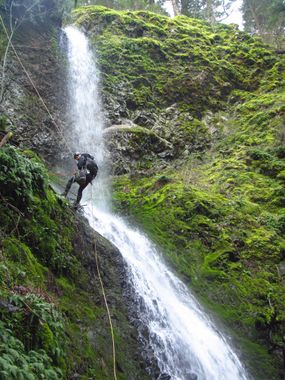
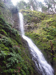
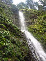
- R2: Waterworks Falls 120ft. A large fallen, yet living tree partially obstructs the top of the falls. Extended anchor off a log creek center. Watch for some old pipe remnants and wires around the top of the falls (possibly an old water supply to the campground below; hence the name of the falls). Beware loose rock. Any bottom belaying should be done well out of the line of fire.
- R3: 15ft. Tree DCR.
Exit[edit]
Continue downstream wherever is easiest and exit up the embankment DCR once under the powerline. Walk back to your car.
Red tape[edit]
None.
Beta sites[edit]
Trip reports and media[edit]
Background[edit]
First descent by Kevin Clark and Karl Helser in March 2016.


