M Creek
| Rating: | |||||||||||||||||||||||||||||||
|---|---|---|---|---|---|---|---|---|---|---|---|---|---|---|---|---|---|---|---|---|---|---|---|---|---|---|---|---|---|---|---|
| | Raps:6, max ↨164ft
Red Tape: Shuttle: Vehicle:Passenger | ||||||||||||||||||||||||||||||
| Location: | |||||||||||||||||||||||||||||||
| Condition Reports: | 21 Jun 2025
"Lots of technical down climbing and a bit more excitement then we were expecting and we did 10+ rappels entirely off natural anchors. Route descriptio |
||||||||||||||||||||||||||||||
| Best season: | Summer (avg for this region)
|
||||||||||||||||||||||||||||||
| Regions: | |||||||||||||||||||||||||||||||
Introduction
This descent involves 5 rappels of up to 20m and a grand finale with a 50m waterfall rappel into angry wasp territory.
Approach
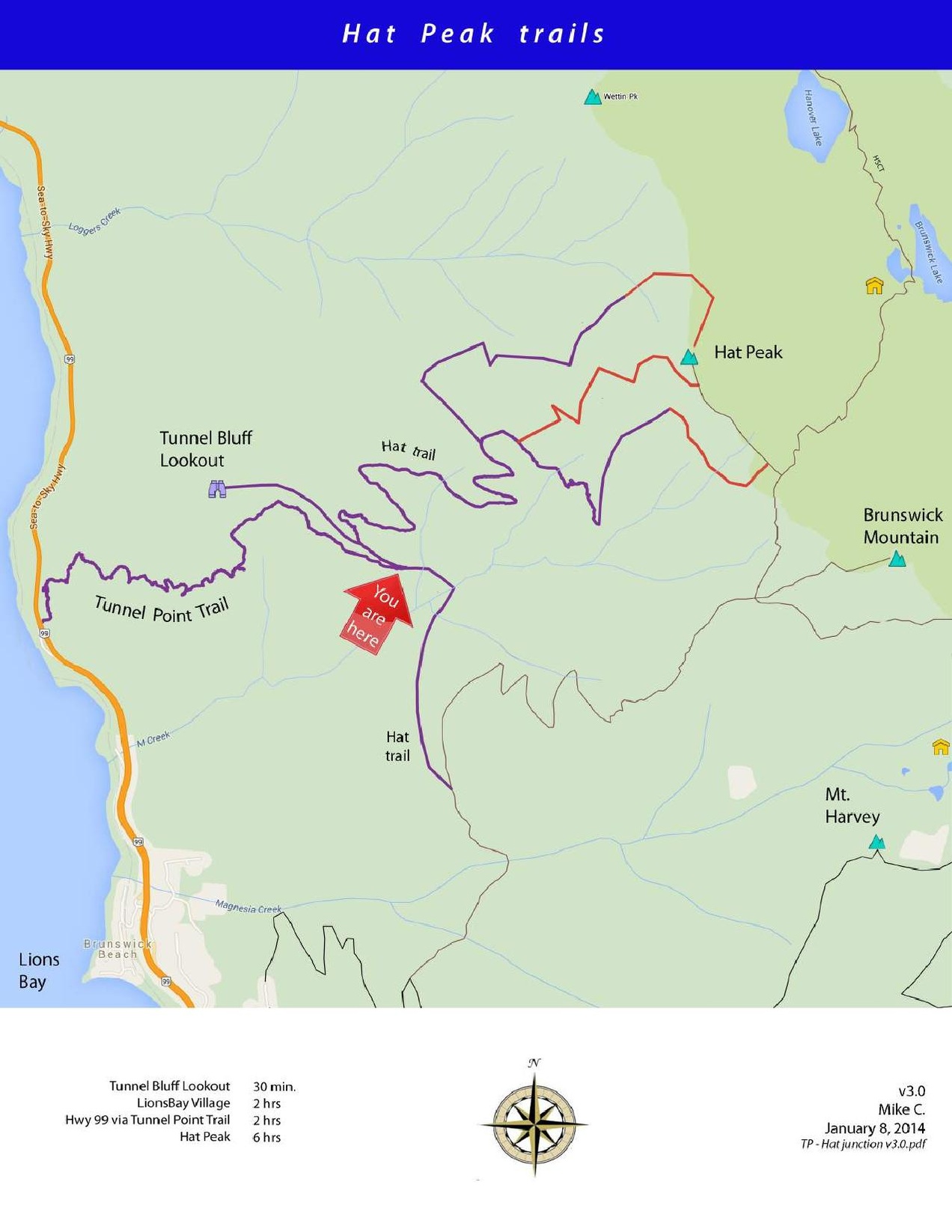
The first descent team approached the canyon bushwhacking 600m uphill through thick forests. They might not have realized it, but there are well established hiking trails intersecting the M Creek at the 700m elevation. These present a much better approach and a much more enjoyable adventure. The attached map shows two better approach routes:
- Tunnel Bluffs Trail: 1.5mi 2040ft elevation gain
- Brunswick Mountain Trail: 2.5mi 1460ft elevation gain
June 27th 2015: Access is easily gained via the Tunnel Bluffs Trail. Map below shows location where you leave the main trail, and then follow the overgrown logging road.

==
The following map shows the Hat Peak trails as of 2016 (see discussion).
Descent
The descent and exit are described in the Beta Sites listed below. The attached map was derived from interpreting their beta.
This Canyon is now bolted and good to go.
Longest Rappel is 50 meters.
Exit
Red tape
Beta sites
 CanyoneeringNorthwest.com (archive.org) : M Creek
Trip reports and media
- https://www.facebook.com/media/set/?set=a.10153326203738820.1073741871.500318819&type=1&l=fe81229398 June 27th 2015: Philippe Lapointe Photo Set.
Background
This Canyon was first explored by Chris Hood.
First full descent all the way to the ocean on June 27th 2015 by: Kevin Swanson, Kevin Mueller, Maarten Haenen, Chris Arnold and Philippe Lapointe.