Mackay's No4
| Rating: | |||||||||||||||||||||||||||||||
|---|---|---|---|---|---|---|---|---|---|---|---|---|---|---|---|---|---|---|---|---|---|---|---|---|---|---|---|---|---|---|---|
|
| |||||||||||||||||||||||||||||||
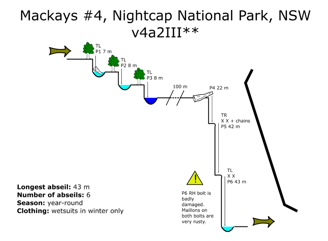
| | Difficulty:4B III (v4a2 III) Raps:6, max ↨43ft
Red Tape: Shuttle: | ||||||||||||||||||||||||||||||
| Location: | |||||||||||||||||||||||||||||||
| Condition Reports: | |||||||||||||||||||||||||||||||
| Best season: | Oct-Apr (avg for this region)
|
||||||||||||||||||||||||||||||
| Regions: | |||||||||||||||||||||||||||||||

Introduction[edit]
Three small waterfalls and a large waterfall running over an escarpment, abseiled in three stages. The walk in is not too gruelling and the walk out is pleasant creek walking.
Approach[edit]
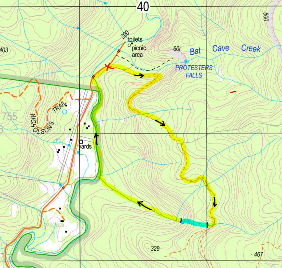
Follow the fire trail from the cars. The first 50 m are very rough and overgrown, but the trail soon becomes obvious. It is disused and has trees growing from it and fallen across it, but is relatively easy to follow.
- The trail follows the contour line for a few hundred metres, then veers sharply right and heads up
the hill.
- When you reach an eroded gully (304 391), cross the gully (heading right) and continue uphill –
the trail becomes obscured again briefly before resuming as an obvious fire trail.
- Once the trail crests the ridge, it drops down through pleasant shady forest. Continue until you
reach the second major flowing creek (supposedly the fourth creek, hence Mackays #4, but this is somewhat ambiguous depending on which creeks you count). Mackays #4 has a deteriorating log bridge across it with large gaps between the logs (310 383).
- Drop into the creek and follow it downstream about 100 m to the first pitch.
Descent[edit]
P1–P3 require BYO tape and maillons, or a retrievable anchor system (e.g. fiddlestick). P1–P3 are escapable.
P1: TL from tree, 7 m. Landing on log jam. Wade.
P2: TL from tree, 8 m. Landing in water. Wade.
P3: TL from tree, 8 m. Landing on ledge. Swim.
100 m creek walk.
P4: sling and maillon around tree fallen across the creek, 22 m. Lands on small ledge in waterfall.
P5: TR from chains bolted to the rock, 42 m.
P6: TL from bolts, 43 m. Bolts are just above an obvious ledge with a pale-coloured rock that looks like a log – the ledge is visible from top of P5. One of the two bolts is badly damaged (bent and loose) and needs replacing. The carabiners and maillons also need replacing as they are very rusty and one is bent. We added a y-hang tape and rappel ring to spread the load between the two bolts as a temporary measure. Ends in wade at base of waterfall.
Exit[edit]
- From the base of the waterfall, follow the creek down. You’ll pass the creek from ‘Mackays #3’
feeding in from the TR partway down.
- Continue walking along the creek until you reach the confluence with Terania Creek (301 386).
- Turn right and follow Terania Creek upstream, wading in the river. Note that the TL of the river is
private property.
- Continue until you reach the causeway. Pop up onto the road and turn right, heading up the road. The trailhead and cars should pop into view shortly.