Madison Falls
| Rating: | |||||||||||||||||||||||||||||||
|---|---|---|---|---|---|---|---|---|---|---|---|---|---|---|---|---|---|---|---|---|---|---|---|---|---|---|---|---|---|---|---|
| | Raps:6, max ↨100ft
Red Tape:No permit required Shuttle:None Vehicle:Passenger Rock type:Basalt | ||||||||||||||||||||||||||||||
| Start: | |||||||||||||||||||||||||||||||
| Parking: | |||||||||||||||||||||||||||||||
| Condition Reports: | 17 Jan 2026
"Some nice moderate flow today, also not as cold as anticipated. Lost a Carabiner, love to get it back if you find it |
||||||||||||||||||||||||||||||
| Best season: | Most of the year except for heavy rain
|
||||||||||||||||||||||||||||||
| Regions: | |||||||||||||||||||||||||||||||
Introduction[edit]
Madison Falls is a high-profile fall and receives high a visitation volume, due to this please ghost R4 to R6. Please consider not rappelling the last drop if there is a crowd, to avoid this go on weekdays or later in the evening. An exit is available from R4 to R6, so you can exit if the falls are too crowded. The checkpoint is easily accessible via a short 5-minute detour, there is a trail for most of the approach. This might be more considered a creekneering route.
Approach[edit]
Park at Madison Falls Trailhead, often is quite a full parking lot.
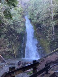
Checkpoint: Head up the trail for Madison Falls (it is a short 5-minute walk to the falls), at the end you’ll see R6.
Start heading up the road.
Turn off the road to start heading up the bypass trail.
Turn onto Cascade Rock Trail and start making your way up.
Use the pin to find the ridge that will take you down to the creek.
The approach could potentially be shortened a bit by continuing to navigate north instead of heading east up the switchbacks, the first rap is marked on the map. I have not explored that route but it looks like it would probably go with some careful navigation.
Descent[edit]
If doing the last rappel; please consider doing it during a time of low visitation, Madison Falls is quite popular.
We decided to ghost the canyon, since I don’t think many people will do this canyon. If you decided to leave anchor material, please don’t do so between R4 and R6(or at least make sure it isn’t visible), especially not R6. Minor downclimbs (DC) are not noted in this beta.
A meduim amount of logs are present throughout the canyon and they can get little annoying.
R1:1 50’ off tree DCR that is apart of the logjam. Slabby rappel with multiple logs in watercourse.
DC is a two-tiered drop with a potential water hazard, bypassable DCR. Between the drops is chockstone that looks like it would be a siphon in higher flows (Dec 2023 it was filled in). DC about 5’ then another 5’ after the chockstone.
DC Log jam to R2.
R2: 25’ DCR off tree outside water course, drop is short but more rope needed per horizontal length. Shorter rope length possible for in watercourse anchors but they looked like a higher risk of getting a rope stuck. Potentially able to DC via some trees but they seemed too slippery.
R3: 40’ of rope needed per horizontal length, used tree that spans canyon.
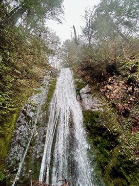
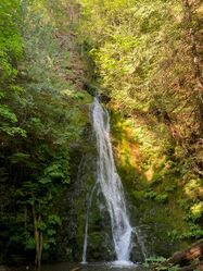
Please ghost R4-R6. A large quantity of social trails reaches most spots between R4-R6. Then the last drop is a very popular and often photographed fall, don’t disturb the moss rappel in the flow.
R4: ~80’ for two-tiered drop long horizontally, used a tree and log DCR that will most likely not be around next season, more natural anchors occur nearby. Bypass available. In moderate flows and above this might be best done as two raps if you can find a second anchor for the second drop. Also could be a pour over risk to R5 in higher flow.
R5: 100’ off curvy alder tree.
DC to final ledge above R6, if leaving webbing for R6 might be best to set your anchor up there so it is out of sight
R6: 85’ off log that spans canyon near the ground.
Exit[edit]
Walk back via the paved trail.
Red tape[edit]
The last rappel is the site of a popular waterfall that recives high visitation, consider bypassing the falls if busy.
This route is fully within the bounds of Olympic National Park. Some of this route is within a Wilderness area. It has odd boundaries since it is derived from the distance from the road. The Wilderness Bounds are marked in the KML.
Beta sites[edit]
Trip reports and media[edit]
Background[edit]
First descent team; Thomas Shaw, Geffen Agasi and Kayla Reynolds. Documentation and scouting by Thomas Shaw.
Probable first descent, no evidence of canyoneers. Most of the canyon can be entered and exited before each drop without technical gear, so definitely not the first people through here.
Potentially more drops upstream


