McCoy Creek Chutes (Colorado)
| Rating: | |||||||||||||||||||||||||||||||
|---|---|---|---|---|---|---|---|---|---|---|---|---|---|---|---|---|---|---|---|---|---|---|---|---|---|---|---|---|---|---|---|
| | Raps:5-7, max ↨140ft
Red Tape:No permit required Shuttle:Required 15 min Vehicle:4WD - High Clearance Rock type:Granite | ||||||||||||||||||||||||||||||
| Location: | |||||||||||||||||||||||||||||||
| Condition Reports: | |||||||||||||||||||||||||||||||
| Best season: | Aug-Sep
|
||||||||||||||||||||||||||||||
| Regions: | |||||||||||||||||||||||||||||||
Introduction[edit]
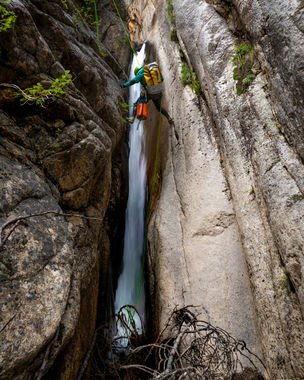
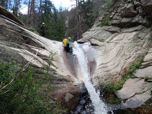
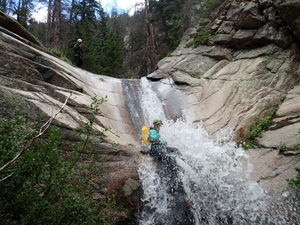
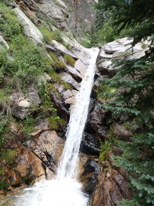
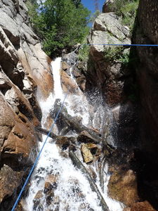
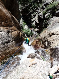
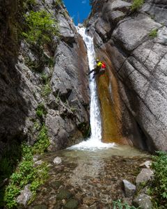
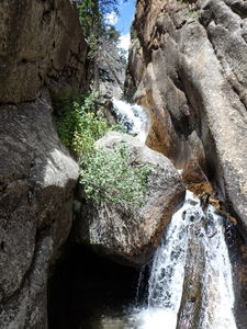
McCoy Creek is a great series of nicely-carved narrow granite waterfalls with the proper skills and equipment.
The Chaffee County SAR Facebook page continues to call out McCoy Gulch as a "notorious trouble spot on the flanks of Mt Tabeguache." 13Aug2017 "This is an almost yearly reminder of why all guide books and maps state 'Do not descend McCoy Gulch.' Deceivingly mellow high on the west ridges of Shavano and Tabeguache, it quickly turns into a steep, narrow canyon with slick waterfalls and loose, scree and talus filled sides. It is an unforgiving route." 29Jul2022
https://www.facebook.com/ChaffeeCountySearchAndRescueSouth
Approach[edit]
Drive: From Poncha Springs, head west on US 50 for about 6 miles passing the town of Maysville. At the west end of Maysville, turn right onto County Road 240 and follow it 6 miles to the parking location for McCoy Creek. The road begins as pavement and transitions to dirt. In good weather, high clearance 2WD vehicles may be sufficient, but 4WD HC is recommended.
Side trip at 4.0 miles from US 50: Park at a pullout on the north side of the road and follow social trails to the water level of the South Arkansas River to see it flow through a gorge section with small waterfalls and pools.
Side trip 0.5 miles west of the McCoy Creek parking: A waterfall in the South Arkansas River is marked on USGS topography maps. A small pullout and social trails provide access.
Hike: Given that the short sequence of rappels is so close to the exit parking, the preferred approach is to climb the forested East ridge from the bottom. While there is not a trail, the time and effort savings is substantial. McCoy Creek has been descended with a car shuttle via the Jennings Creek Trail using that trailhead a mile further up the road. This approach is 5.3 miles, gains 2900' and peaks at 13,500'.
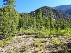
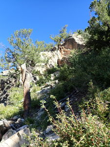
For the shortest approach, start from the parking at the bottom and strike north through the open forest for a quarter mile. Cross McCoy Creek (which may not be representative of the full waterflow at this location) and aim for the talus field seen from the parking location. Proceed uphill in the talus and keep aiming for a shoulder on the mountain above. Some granite scrambling moves may be required toward the top. Overall the scrambling and climbing is not difficult and if starting in the morning, this side is in shade.
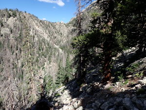
Once the elevation is gained, continue contouring around the hillside to enter McCoy after another drainage gully to the north of the technical sequence. A fin of rock descends toward R1 from the shoulder. It may be possible to descend in the gully behind the fin to drop in right at R1 and cut the approach even shorter. Some pretty upstream non-technical narrows would be skipped.
Descent[edit]
Assess the water level by hiking to the base of R5, which is also has the potential to be the most dangerous rappel in the descent.
R1: 40' from a small tree on Canyon Right to place the rappel line in the flow
R2: 65' from a large tree on Canyon Right immediately following R1
Optional 20ft low angle waterfall can be easily bypassed on Canyon Left. A tree could be used to make this a 45ft rappel.
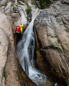
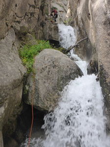
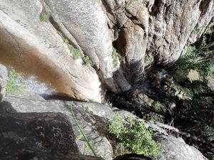
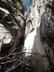
R3: 140' two stage rappel from a large boulder on Canyon Left. A large collection of willows is on Canyon Right at the top of this drop. First stage: angled 50ft, 20ft platform, then second stage: vertical 60ft with a narrow V-slot. Beware: Even in low water, the V-slot kicks feet out and the rock walls are quite slippery. Staging a team member at the top of the second stage will aid with hand signals and communication.
R3 could be broken up into two rappels with a mid-stage anchor.
R4: 60' from a large tree on Canyon Right. The first drop is 15' and a second 8' drop just downstream can use the same anchored rope.
An escape on Canyon Right is possible before R5.
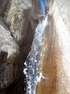
R5: 55ft from a small tree furthest downstream on Canyon Right. This waterfall also forms a narrower than shoulder-width carved V-slot and this anchor sets the rappel line just in front of the waterfall, but still landing in the narrows at the bottom of the falls. Using a tree more upstream will require a longer rope length and will place rappellers in the flow (Beware: foot entrapment and physically getting stuck), which may be more appropriate toward the end of the season when water is lowest.
Exit[edit]
Continuing downstream, trend to the right and avoid the overgrowth in the streambed by climbing up to the easy-travel pine forest twenty feet above on Canyon Right.
Walk the quarter mile to the parking location and undo wetsuits at the cars.
Red tape[edit]
Beta sites[edit]
Trip reports and media[edit]
First descended circa 2002?
27Jun2015: long approach up Jennings Creek; elevated water; bypassed the final rappel. Ira Lewis, Kelton Manzanares
14Aug2022: short approach up East hillside from the bottom; good water level. Ira Lewis, Andrew Tanasescu, Katie Wright
