Mel Slot (Tombstone)
| Rating: | |||||||||||||||||||||||||||||||
|---|---|---|---|---|---|---|---|---|---|---|---|---|---|---|---|---|---|---|---|---|---|---|---|---|---|---|---|---|---|---|---|
| | Difficulty:3A II (v3a1 II) Raps:3, max ↨130ft
Red Tape:No permit required Shuttle:None Vehicle:High Clearance Rock type:Sandstone | ||||||||||||||||||||||||||||||
| Start: | |||||||||||||||||||||||||||||||
| Parking: | |||||||||||||||||||||||||||||||
| Condition Reports: | 20 Feb 2023
"Took a drive down to take a look at snow conditions. Drove to just under a mile from the parking lot and decided to call it as we started to do more s |
||||||||||||||||||||||||||||||
| Best season: | Spring, Fall
|
||||||||||||||||||||||||||||||
| Regions: | |||||||||||||||||||||||||||||||
Introduction[edit]
Located South of the La Sal Mountains outside of Moab, Mel Slot is a short and narrow sandstone slot canyon.
Biological Soil Crusts This canyon is located in area with a large amount of cryptobiotic soil crusts. Please do your best to avoid stepping on these crusts while on the approach/exit, sticking to bare rock, sandstone benches, existing trails, and sandy washes where possible.
Further reading on soil crust: https://www.nps.gov/articles/seug-soil-crust.htm
Approach[edit]
Driving:
From Moab, drive south along Highway 191 towards Spanish Valley. Continue for around 20 miles until you reach SR-46, turning east towards La Sal. Continue on SR-46 for about 7 miles till you reach Hwy 113/Lisbon Valley Road. Turn right, heading south for approximately 2 miles until you reach Coyote Road. Cross the cattle guard and continue west. Coyote Road is a dirt road and may require high clearance in some areas and 4WD in inclement weather conditions. Follow the Coyote Road west for approximately 2.4 miles, staying left where the road splits into Rattlesnake Well Spur. Shortly after the split, a faint off-road trail appears to the south. This serves as the starting point for the canyon. High Clearance 4WD can decide to continue forward, but doing so doesn't reduce the approach by any significant amount of time.
Hiking:
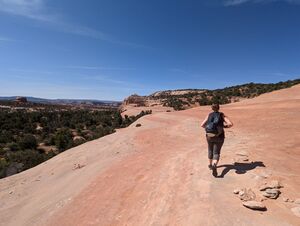
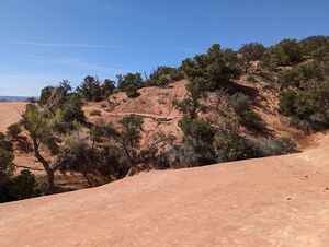
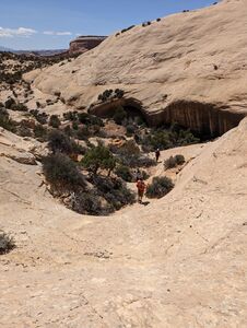
Once parked, follow the 4WD trail, switch-backing sharply once, towards the sandstone cliffs. Follow the sandstone cliffs as they contour around, heading south. Occasionally side drainages form small depressions, but small social trails exist that avoids damage to soil crusts, as picture below. Follow the sandstone cliffs around and down, occasionally linking up with old 4WD/ATV trails, until you reach the entrance of the canyon.
Descent[edit]
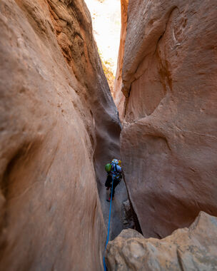
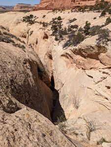
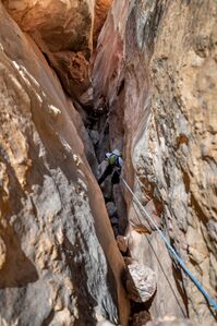
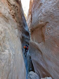
Once at the head of the canyon, the action starts quickly. The majority of the technical portion of the slot canyon can be seen in the few hundred feet in front. there are several boulders wedged throughout this canyon that can easily stick ropes and toggle devices. Be extra mindful of your rope pulls and be sure to extend your anchors past the edge in this canyon.
R1:Approximately 30' or greater, depending on anchor choice. multiple large trees and boulders surround the canyon entrance making suitable anchors. Some may choose to downclimb this rappel.
R2:60' from a natural anchor.
R3:130' from a cairn anchor down through a sculpted canyon
Exit[edit]
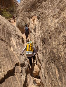
After the third rappel, the technical canyon is largely over and gear can be put away. Continue down the shallow canyon, occasionally reaching small obstacles that are easily navigated through. As the wall to the east continue to lower, keep an eye out for a small drainage. This will serve as the start of the exit trail that rides the ridge and eventually returns you the the approach trail. Once you've returned to the approach trail, retrace your steps back out till you reach your vehicle.
Red tape[edit]
Beta sites[edit]
https://www.summitpost.org/mel-slot-tombstone-canyon/1073749
