Merritt Falls Canyoneering Canyoning Caving descenso de barrancos Barranquismo
|
| Rating: |
Log in to rateLog in to rateLog in to rateLog in to rateLog in to rate 3.0 (3 ratings) |
|
|
| |
Raps:3, max ↨180ft No Shuttle: |
|---|
| Start: |
|
|---|
| Parking: | |
|---|
| |
|---|
| Condition Reports: |
(log in to submit report)
|
|---|
Weather: |
|
|---|
| Best season: |
June | winter | | spring | | summer | | fall |
|---|
| Dec | Jan | Feb | | Mar | Apr | May | | Jun | Jul | Aug | | Sep | Oct | Nov |
|
| Regions: |
|
47.7692, -120.842447.7728, -120.8324topo
GPS data automatically extracted from [], please visit their site for more detailed information.
Automatic GPS data extraction NOT allowed, please visit [] to download GPX.
(log in to submit reference picture)
| Welcome! Canyons in the Pacific Northwest can be different from those you might be used to. Be ready for unlinked bolts, retrievable traverse lines, and challenging aquatic environments. For more on local practices, and the best way to get started in the region, check out the WCC Safety page.
- Unlinked Bolts - groups should be comfortable rigging unlinked bolts, either temporarily linking them for all but the last person, or using a passive redundancy method. Most importantly, if you find two bolts side by side that are unlinked, do not add webbing to them. Linking bolts designed to be unlinked will likely cause damage during seasonal floods.
- Traverse Lines - many canyons are rigged to allow traverse line access to an exposed anchor station. This should be done using self-belay or team belay techniques. Do not leave fixed lines in the canyons.
- Challenging Environments - the highly aquatic nature of PNW canyons can surprise many. Cold temperatures, slippery rocks, loud waterfalls, and strong currents all lead to unexpected problems. Do not underestimate the need for strong team work and technical proficiency. Belays are frequently not possible. Unattended gear will sink or float away. Sliding and jumping is the cause of most major injuries, so it's critical to effectively communicating water depth & submerged hazards.
|
Introduction
Approach
Park at the Lake Ethel Trailhead and hike up the steep trail until it flattens out at around 3800ft. Then cut off to the right, easy bushwacking, until you reach the creek.
Descent
Make your way down the creek doing a lot of down-climbing or rappels off trees, or bushwhacking around to the left. This could perhaps be bypassed and made more interesting by doing a big 150-200ft-ish rap from the cliffs down into the creek at about 47.7692, -120.8408.

The main section starts soon after:
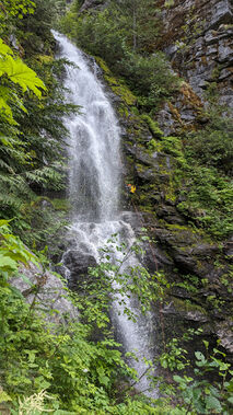
- R1. 150ft rappel from a tree
- R2. 180ft rappel from two bolts underneath a ledge center canyon
Then a bit more creek walking to:
- Bonus rappel. 40ft from a tree
As you head towards R1, there are several areas that could be turned into rappels for the more enterprising canyoneer or may be of more intrigue during higher flow. Particularly, there is a two tier cascading falls immediately at drop in point.
Exit
Red tape
Beta sites
Trip reports and media
Background
First descent by Eric Jorgenson, Amy Kolor and Maurice Kirejczyk on 25 June 2023.

