Middle Fork Big Creek (Olympic Peninsula)
| Rating: | |||||||||||||||||||||||||||||||
|---|---|---|---|---|---|---|---|---|---|---|---|---|---|---|---|---|---|---|---|---|---|---|---|---|---|---|---|---|---|---|---|
| | Raps:4-5, max ↨25ft
Red Tape:No permit required Shuttle:None Vehicle:Passenger Rock type:Basalt | ||||||||||||||||||||||||||||||
| Location: | |||||||||||||||||||||||||||||||
| Condition Reports: | 23 Jul 2023
"This canyon is a great short day. Five rapid fire rappels and jumps through a beautiful canyon. Its a shame its so short. Placed bolts at R1 and R2. |
||||||||||||||||||||||||||||||
| Best season: | Jul-Sept
|
||||||||||||||||||||||||||||||
| Regions: | |||||||||||||||||||||||||||||||
Introduction[edit]
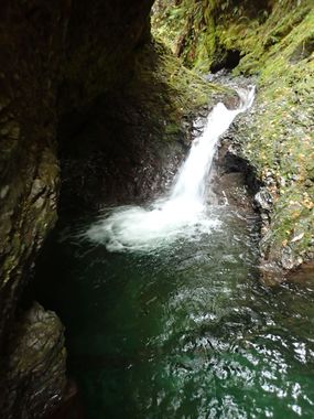
A nice short technical canyon in the Wynoochee Valley with easy access and can be descended in a couple of hours. It's committing and there's some cool geology and deep pools inside. Natural anchors are sparse on some of the drops; be prepared. Some rappels are now bolted, but others will still require natural anchor building skills.
- The Middle Fork can be combined with other destinations in the Wynoochee Valley - especially the Big Creek Narrows which is literally 2mi away down the road. It's possible to easily visit 2-3 of them in a single day.
Directions[edit]
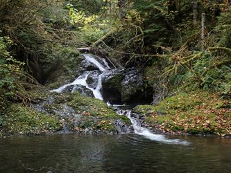
From the intersection of FR 22 and FR 2294, follow FR 2294 for 2.5mi to a Y-junction. Go left for 0.3mi to a second Y-junction. Park here. There's enough room for 1-2 vehicles. Do not block either branch of the road when parking. The last falls is visible just upstream from the parking area.
Approach[edit]
From the parking area, just walk up the road on the north side of the creek. Keep going up until the road flattens out and bends right (all of five minutes). Break off the road and thrash down into the creek wherever is easiest.
- You could shuttle, but parking is limited up there. It's so short, why bother?
- Checkpoint is the falls visible from the parking area.
- The road is right above the canyon all the way up. It's possible to take a peek down into the canyon in places to see what you're in for.
Descent[edit]
Pass through a short micro-narrows. The creek opens up a bit, but continue on another minute or so. The creek swings left, climb down a short drop to the top of R1.
- R1/J1: 10ft from single bolt DCL, or jump DCL into deep pool (check for debris first). Descending this rappel commits you to the descent.
- A big logjam bars the way. Bypass DCR.
- R2: 20' from single bolt DCR. Downclimb two short drops (4' each) before arriving at the bolt station and the rappel. Some great pools between the tiers, interesting geology, and could possibly be jumped.
- R3/J2: 12ft from cairn, DCL. This is a very deep pothole that can be jumped if no debris has entered. Climb over logpile at the bottom and downclimb the short step immediately below. Might be able to climb up the wall DCR to bypass. A stream enters DCR at the bottom of this falls.
- R4: 20ft per the horizontal (8ft vertical) from a log spanning the canyon into a cool mini-slot / pothole from giant log leaning against the canyon wall DCL. Rappel is a bit awkward as it's overhung.
- R5: 20ft ramp from a logjam across the creek. Can be downclimbed DCR but don't slip. Some interesting potholes DCL at the bottom.
Exit[edit]
Upon reaching the culvert, look DCR to find a user trail leading directly up to the road.
Red tape[edit]
None.
Beta sites[edit]
Trip reports and media[edit]
Background[edit]
First descended by Kevin Clark in Oct 2020. Found the creek while looking for a campsite in the area. Came back the next day to run it.

