Moonshine Creek
| Rating: | |||||||||||||||||||||||||||||||
|---|---|---|---|---|---|---|---|---|---|---|---|---|---|---|---|---|---|---|---|---|---|---|---|---|---|---|---|---|---|---|---|
| | Raps:8-9, max ↨310ft
Red Tape:No permit required Shuttle:Optional 5min Vehicle:Passenger Rock type:Gneiss | ||||||||||||||||||||||||||||||
| Start: | |||||||||||||||||||||||||||||||
| Parking: | |||||||||||||||||||||||||||||||
| Shuttle: | |||||||||||||||||||||||||||||||
| Condition Reports: | 27 Aug 2022
"Left rope at first rappel and retrieved after completing canyon. One wore shorty other 3mm wetsuit, both wore just wool socks, and felt great. Water |
||||||||||||||||||||||||||||||
| Best season: | Jul-Sep
|
||||||||||||||||||||||||||||||
| Regions: | |||||||||||||||||||||||||||||||
Introduction[edit]
A rugged Pinaleno Mountains canyon.
Approach[edit]
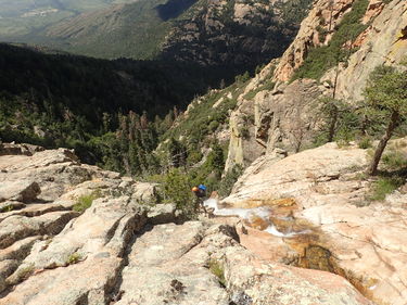
Walk up or drive up FR-4998 about quart mile to end of road along side Moonshine Creek. Walk over hill and down to first big rappel.
Descent[edit]
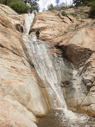
R1: 310' off of large tree LDC. Recommend leaving rope to go back and get after finishing canyon. Rappel is all on rock to large ledge pool next to house size boulder.
R2: 150' off of large boulder to stay in water flow. Also possible to rappel 40' RDC out of flow to area that can be downclimbed. Starts with about 30' drop followed by rest being low angle walk down.
R3: 90' off of large tree RDC. Drops about 50' into pool, then 40's down to next pool. Not deep enough to slide.
R4: Optional 150' off of large tree RDC. Possible to downclimb LDC and avoid falls.
R5: 150' off of large tree RDC.
R6: 30' off of large log or boulder directly after R5. Goes through narrow water flow which can be stemmed over while on rappel.
R7: 80' off of small tree directly in water flow.
R8: 60' off of large tree LDC.
R9: 50' off of large log directly in water flow. Rappel goes down narrow flow drop.
Exit[edit]
At confluence with Post Creek, head up gully just before confluence LDC. Head up traversing a little right to meet up with Grant Creek Trail #305. Follow trail to road. Follow road back to vehicle. Don't forget to get rope on R1, if left it.
Red tape[edit]
Beta sites[edit]
Trip reports and media[edit]
Background[edit]
Unlikely a first descent, but first known beta gathering descent by Jacob Cowan and Erek Burek on August 27, 2022.

