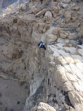
Mosaic Canyon (West Fork)
| Rating: | |||||||||||||||||||||||||||||||
|---|---|---|---|---|---|---|---|---|---|---|---|---|---|---|---|---|---|---|---|---|---|---|---|---|---|---|---|---|---|---|---|
| | Difficulty:3A III (v3a1 III) Raps:9-12, max ↨175ft
Red Tape:No permit required Shuttle:None | ||||||||||||||||||||||||||||||
| Location: | |||||||||||||||||||||||||||||||
| Condition Reports: | 28 Dec 2024
"2 decent downclimbs, but most of the obstacles can be avoided which made the canyon less interesting. Bring a rope sheath for the last rappel, its a |
||||||||||||||||||||||||||||||
| Best season: | Nov-Mar (avg for this region)
|
||||||||||||||||||||||||||||||
| Regions: | |||||||||||||||||||||||||||||||
Introduction[edit]
Approach[edit]
If taking the sneak approach (yellow track on the KML) you'll cross the main drainage, climb a ridge east of the drainage, then drop in. 2.5 hours and 2600' on the sneak route which drops you at the top of the first rap. Recommended.
Descent[edit]
R1: 60' - boulder DCR
R2: 175' - cairn
The sneak approach crosses the drainage downstream of R2.
- All drops after R2 are either bypassable with fairly minimal effort and/or downclimable, though at least 2 DCs will be spicier than most are willing to attempt. Only the 30' chute DC was high quality**
R3: 50' - possible to bypass DCL
R4: 40' - cairn
R5: 50' - possible to bypass DCL
R6: 80' - pinch
R7: 60' - possible to bypass DCL
R8: 15' - meat anchor / downclimb
R9: 50' - pinch
R10: 45' - pinch DCL
R11: 150' - cairn (This anchor has rough/sharp edges at the top of the rappel as currently set up. Part of the first edge was smoothed off. The second part was protected. Prepare and and act accordingly.)
R12: 50' - possible to bypass DCL
Exit[edit]
Short exit down the Mosaic Canyon tourist trail.
Red tape[edit]
Beta sites[edit]
 Super Amazing Map : Mosaic Canyon - West Fork
Trip reports and media[edit]
FIRST DESCENT TRIP 1-29-12:
- Probable 2nd descent trip 11-24-22 – by Swaney group - rebuilt all anchors. A few hours after going through it again after 10 years, a solo canyoneer following our route down and was killed after dropping off his rope in the overhang where his rope was 30' short. He was missing many days there before he was found.
Background[edit]
Originally explored by Scott Swaney & team on 01-29-12
EXPLORED WITH RICK KENT, ET AL, SEE TRIP REPORT ABOVE (for more details)
