Mudcut Branch Canyon
| Rating: | |||||||||||||||||||||||||||||||
|---|---|---|---|---|---|---|---|---|---|---|---|---|---|---|---|---|---|---|---|---|---|---|---|---|---|---|---|---|---|---|---|
| | Raps:7-9, max ↨100ft
Red Tape:No permit required Shuttle: Vehicle:Passenger Rock type:Granite | ||||||||||||||||||||||||||||||
| Start: | |||||||||||||||||||||||||||||||
| Parking: | |||||||||||||||||||||||||||||||
| Condition Reports: | |||||||||||||||||||||||||||||||
| Best season: | Fall Spring Winter
|
||||||||||||||||||||||||||||||
| Regions: | |||||||||||||||||||||||||||||||
Introduction[edit]
WOW! Spectacular Class IIIC2R
More fun than Leadbetter! but with a bushwhhack!
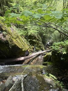
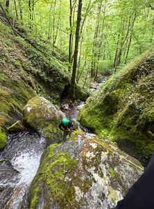
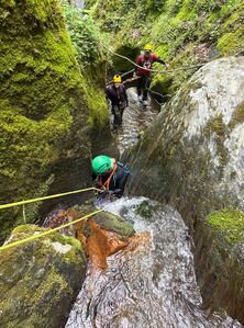
Although still a true bushwhack at an hour approach and nearly a mile it’s well worth it! Your want to take your time to descend the .2 typically 3-4 hours which tells you something Buttsliding and rappelling-So Much Fun!- some minor deadfall to deal with up higher but so pretty and green. if water is too high in Ledbetter this is the go to for sure. Although it’s wider than Ledbetter it does have its narrow sections too and is not to be taken lightly, in high water expect 3 more rappels than the standard 7 This is a special place so limit webbing please, natural anchors only suggested.
This canyon is a New Discovery by Capt. John Podlewski, David Wester 2022, and Professor Scott Burns, please treat it wild. It’s only been run by me and a handful of friends, enjoy and be safe, do not fall in the steep canyon trying to side hill as there are there approximately 7-9 rappels in less than .2, Spectacular. Before R3 is the last bail out opportunity to take the bushwhack back sidehilling the way you came.
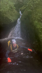
Wet suit is optional but highly suggested in anything other than low flow at height of Summer which flow will be too low to enjoy other than a training canyon, the back half of canyon is completely covered by canopy and the last part is walled in within the canyon so either way not much sunlight. Your want to take your time and enjoy this .1 descent and not hurry through it because you are cold..
You should not enter this canyon until you understand how to build natural anchors preferably ghosting techniques CEM, Macrame etc..if deemed appropriate for safety, as well as contingency anchors for your group, Converting to LAMAR
If you get hurt or stuck in this canyon, SAR may not be able to get you out. Do Not expect Anchors to be here. Know what you are doing, this is absolutely not the place to learn. If you need to leave anchors (black) behind, only do so if safety is jeopardized.
Approach[edit]
2 ways either park @ Ledbetter TH and hike the Bartham Trail for 7 miles then bushwhack down and into Mudcut follow it til the last .3 which is Vertical and Spectacular but exhausting doing 11 miles with gear. Or park at Freebe Picnic area walk out to Hwy 64 crossing over bridge and walk up gravel road toward Quarry, cross over tracks half way up the road to Mudcut Branch DO NOT PARK anywhere on this road! Do yourself a huge 6 hour favor and take the shortcut and go upstream. Just before Before the Quarry gate is Mudcut Branch on left head up river left staying on public land then after a few hundred feet cross to river right and head uphill once the terrain brings you back to creek at approximately .1 cross the creek here (35.30521,-83.65556) for the second and final time and head upstream on river left staying as close to the creek, without going too high, as it is extremely steep. When you get to a vertical rock slab (5.4) you will have to climb that (good crack hand holds) keep heading upstream but not too high til approx .25 miles from the tracks this should take about 50 minutes at moderate pace. Then head for creek once around the corner you will see the extremely large rock creating the cave and open slot section you’ve arrived.
Mudcut dumps into the Nantahala across from Ferebee it’s a short walk, then full on bushwhack for then next 3/4 mile The choice is yours but do not trespass.
Unlike Ledbetter There is no trail but I’ve been enough times where there is a start of a path.
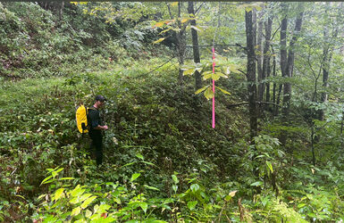
If coming from the bottom as most would, hug river left then right then cross to left again that’s it, but don’t get too high for 1 mile total distance (1 hour approx.) About halfway there is some class 5 scrambling unassisted on a sloping cliffface on the river left and the penalty would be a broken ankle at the very least. This is not a place to get hurt as rescue would prove extremely difficultyou can get around that obstacle the going gets a little easier. Stay relatively level with slight uphill til it’s time to drop in. Your want to make sure you hit this point (35.30744,-* Bulleted list item 83.65793) as it goes slightly downhill and turns then continues slightly level.
Continue to bushwhack once your able to see the hill side and creek levels out after nearly an hour you can finally get in the stream bed then your reach Cut Throat Cave upstream which is at the start of the goods (.3 mile) as the crow flies from the bottom.
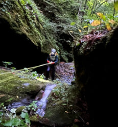
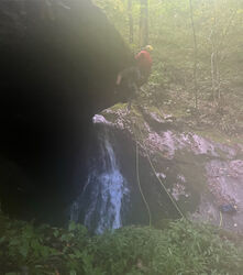
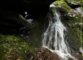
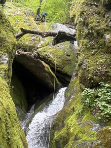
Do not bushwhack on river right its impassible only after the initial start are you on that side til the creek crossing. Which is early in only. As long as you stay on river left you should make it eventually. Cut Throat Cave it a huge rock that blocks most of the stream creating a mini slot below, so it’s worth looking from above plus you could rap off the top, hence the name and start the Canyon or better option rappel sliding(ERROR:name missing in {{pic|name}}) down the slot next to it is ideal.
Descent[edit]
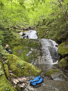
All rappels are in Quick Fire succession within .1
- R1 Cut Throat Cave (Optional) Top of cave 50ft. Rappel (35.30752,-8365822)
- R1a 20 ft. Rappel in creek off a tree in watercourse
- R2 Off Tree in Watercourse 30’ Rappel (35.30661, -83.65759)
Then walk 40 feet to anchor on tree LDC
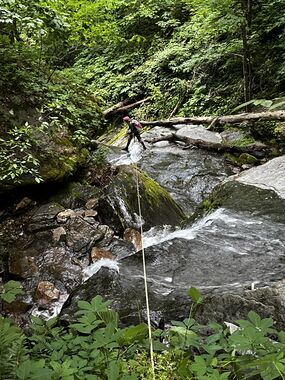
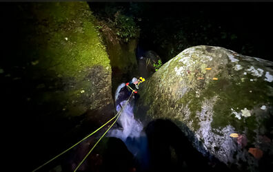
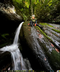
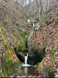
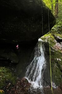
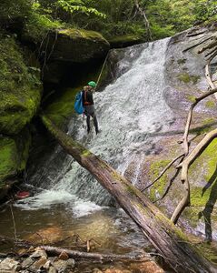
- R3 Off Tree DCL 100’ Rappel down a multi layered waterfall (last 10’ is mossy slab w/o rope) (35.30638,-83.65736)
Then walk 20 feet to next anchor LDC
- R4 Off Tree DCL 40’ Rappel (35.30606,-83.65710)
Walk 20 feet down creek
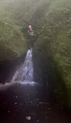
- R5 Off Tree in watercourse DCL 80’ Rappel waterfall into a deep pool (35.30596,-8365666)
Then walk 15 feet to a sketchy transverse LDC
- R6 Off Tree Watercourse 90’ Rappel(or if flow is low enough a True Class C Off a tree LDC Slot multi tier waterfall (35.30598,-83.65647)
}
Walk 30 feet
- R7 Off tree LDC 90’ down sloping waterfall (35.30577, -83.65610)
Walk 100’ to next station
- R8 Off tree RDC rappel 40’ down 2 waterfalls (35.30575, -83.65614)
Walk 10 feet
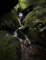
- R9 Off tree LDC rappel 15 feet into Slotted Muddy Waters Exit Falls (Spectacular) into small water pothole (35.30564, -83.65589)
Visit the Guardian
Creekwalk .1 back to tracks then to parking lot
Exit[edit]
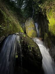
After R7 Muddy Water Exit Falls admire the slot and view as this is as far one can get traveling up canyon in the watercourse. The Standing Stone keeps guard, I suppose. Go ahead and bag up gear and creek walk out .1 to the gravel road and back to car or shuttle car., if that’s where you came from? Average Time if coming in from below car to car is 4 hours and 2 miles RT It can be done in less time If not going all the way up canyon as others have done.
Red tape[edit]
Stay off private property. Do not park on the access road.
Beta sites[edit]
Trip reports and media[edit]
Background[edit]
1st known technical descent by Capt. John Podlewski and David Wester and location provided by Prof. Scott Burns
