Northwoods Creek
| Rating: | |||||||||||||||||||||||||||||||
|---|---|---|---|---|---|---|---|---|---|---|---|---|---|---|---|---|---|---|---|---|---|---|---|---|---|---|---|---|---|---|---|
| | Raps:4-8, max ↨200ft
Red Tape:Permit required Shuttle:None Vehicle:Passenger | ||||||||||||||||||||||||||||||
| Start: | |||||||||||||||||||||||||||||||
| Parking: | |||||||||||||||||||||||||||||||
| Condition Reports: | 24 Apr 2022
"Perfect flow for this creek. The bedrock stretches are pretty amazing with surprisingly nice traction despite the flow. Anchored DCL and rapped DCR on |
||||||||||||||||||||||||||||||
| Best season: | Mar-May
|
||||||||||||||||||||||||||||||
| Regions: | |||||||||||||||||||||||||||||||
Introduction[edit]
Something of a seasonal creek located just outside Northwoods, WA. The creek has a bit of a hike in & out, but is likely a good one for beginners with competent leadership. The flow seems to become low and beginner-friendly in May. More experienced folks might like to hit it in higher water conditions. Creek is probably not worth visiting in late summer.
Area seems to be visited by hunters, so wearing bright colors on the hike in may be a good idea.
- Watershed: 1.15mi^2.
Directions[edit]
From the small community of Northwoods, WA, locate the Eagle Cliff store & campground. Across the street take the No 10 Rd (not signed) downwards for 0.4mi to a gate and turnaround. Park here, but don't block the gate. The flow here may or may not be a great representation of what's going on higher up on the creek as it seems to go underground near the bottom. This is the same trailhead for Able Creek.
Approach[edit]
Follow the road upward through a giant clear cut ("leave no tree behind!"). Map and GPS useful here as there's a few side-turns and it's easy to walk off down the wrong spur. On entering the woods at the top of the clear cut, reach a junction and go left. Go left at the next junction. This road quickly becomes overgrown, but push on through and persist until you reach the end of the grade. From here, make your way down-slope to the east wherever is easiest. You will reach a small stream first. Follow this tributary downstream until it intersects the main creek just below a small boulder garden. This is a good place to suit up.
Descent[edit]
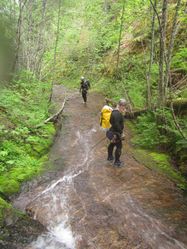
From the drop-in, just follow the creek downstream back to the car. Northwoods Creek is somewhat unique for the amazing amount of bedrock which has been completely swept clean of rocks and other obstacles. Virtually from the drop-in all the way to the top of R6 is one continuous swath of bedrock. Makes for some very mellow, pleasant creek walking.
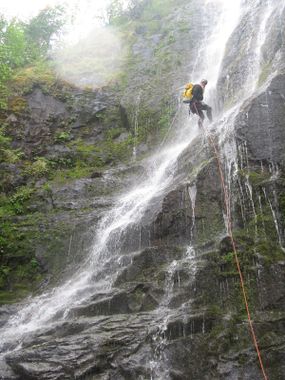
Most of the drops on Northwoods Creek are low angle... we've tried to guestimate the vertical height, but sometimes more rope will be required for the rappel given the horizontal distance involved. Be aware when rigging.
- 10ft ramp. Downclimb DCL.
- R1: 10ft. Possible dirty downclimb DCL.
- R2: 50ft low-angle drop to a platform. R3 comes immediately.
- R3: 30ft low-angle drop. A deviation in the DCL wall would be nice to allow rappellers to stay in the flow (i.e. use R2 anchor for both drops).
- R4: 12ft step.
- R5: 35ft photogenic ramp-falls.
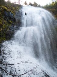
- R6: Northwoods Falls. The world suddenly drops away underneath you. 200ft+ depending on where you rappel from. We anchored on tree DCL and rappelled a nice line down the DCR side of the falls. Can land on a platform 150ft below, or run the rope out a full 200ft rope (single strand) to the very bottom. Stay on the DCR side of the falls or you risk a pendulum. One can downclimb from the platform, but it's pretty slippery. Use caution. The next two rappels come in rapid succession.
- R7: 55ft. Anchored on a tree far DCL.
- R8: 40ft.
Not far below R8, reach a dumped bullet-marked sports car in the middle of the drainage. Yay.
Exit[edit]
Continue down the drainage for 0.25mi to the bridge where you parked. In 2019, there were lots of downed trees in the drainage, just make your way through wherever is easiest. Sometimes it's easier to make your way out of the drainage to one side or the other to make forward progress. In low flow the creek may vanish into the rocks leaving a dry channel until you pick up a tributary entering DCR just before the bridge.
Red tape[edit]
Free non-hunting recreational permit from Rayonier Hunting & Recreation is required. "Pope Swift South Non-Hunting Individual" is what you need.


