Packsaddle Creek
| Rating: | |||||||||||||||||||||||||||||||
|---|---|---|---|---|---|---|---|---|---|---|---|---|---|---|---|---|---|---|---|---|---|---|---|---|---|---|---|---|---|---|---|
| | Raps:7, max ↨65ft
Red Tape:No permit required Shuttle:None Vehicle:Passenger | ||||||||||||||||||||||||||||||
| Start: | |||||||||||||||||||||||||||||||
| Parking: | |||||||||||||||||||||||||||||||
| Condition Reports: | 30 Jun 2019
"Checking out a new prospect. Decent creek, good for beginners. Would be fun with more flow. Probably better to hit this one in April or May for mor |
||||||||||||||||||||||||||||||
| Best season: | spring
|
||||||||||||||||||||||||||||||
| Regions: | |||||||||||||||||||||||||||||||
Introduction[edit]
This creek was overrun by the Beachie/Santiam Fire in Sept 2020 but has reopened. Use extreme caution when descending the creek. Between landslides, fallen trees, and loose rocks, this area may be unstable and dangerous for years to come. The canyon may have changed dramatically. Do not rely on the beta below being accurate.
A nice short creek, good for beginners. Good for training. Best visited in the spring for decent water. Don't bother after June. Possibly a good one to visit when everything else in the area is running high.
Approach[edit]
From Gates, OR, head east on Hwy 22 for ~2mi and turn off onto an unsigned gravel road on the left (44.75566, -122.37628). Follow the road upward for ~2.9mi to where it crosses Packsaddle Creek. Road is a notch overgrown, but otherwise in good shape as of 2019. Park just past the creek in a wide grassy area on the left.
From the parking area, proceed east down the road maybe 100ft and look for a flat area on the left/north where it’s easy to get into the forest. Follow a game trail up onto the ridge (steep at first) and then upwards wherever is easiest. Gain 600ft vertical and on nearing 2800ft elevation the terrain eases off. Bear left and keep going until you reach Packsaddle Creek. First rappel comes immediately after the drop-in.
Descent[edit]
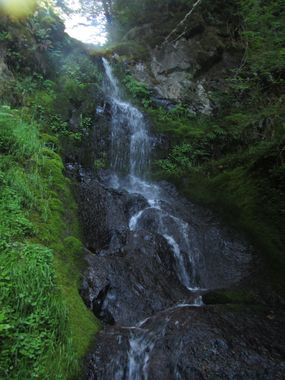
- R1:50ft from tree DCR. Need about 80ft of rope per anchor location. A tributary joins at the bottom and the creek’s volume doubles.
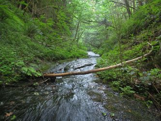
- Long bedrock “slide-walk”.
- 8ft step. Easy bypass DCL.
- R2: 40ft from tree DCL.
- R3:Two stage. 20ft through mini-slot, horizontal segment, followed by 10ft drop. Anchored tree DCL.
- R4: 25ft from fallen log.
- 6ft step. Downclimb DCL.
- R5: 40ft? Two stage: Narrow chute to 4ft drop, horizontal segment and then 20ft drop. Anchored on a tree DCR. Need additional rope per the horizontal distance.
- R6: 65ft on tree DCR. Giant old growth log in the landing zone.
- R7: 20ft on tree DCL. (Possibly downclimb DCR?)
- 15ft slide. Downclimb or rappel. Big mess just after the bottom where a landslide has come in DCR. Easily bypassed.
Walk down through one last bedrock section. Road is visible ahead, so thrash out wherever is easiest.
Exit[edit]
Red tape[edit]
None.
Beta sites[edit]
Trip reports and media[edit]
Background[edit]
First descent in June 2019 by Kevin Clark.

