Paradise Gorge
| Rating: | |||||||||||||||||||||||||||||||
|---|---|---|---|---|---|---|---|---|---|---|---|---|---|---|---|---|---|---|---|---|---|---|---|---|---|---|---|---|---|---|---|
| | Difficulty:3B I (v4a3 II) Raps:1, max ↨135ft
Red Tape:No permit required Shuttle: Vehicle:High Clearance Rock type:Gneiss | ||||||||||||||||||||||||||||||
| Start: | |||||||||||||||||||||||||||||||
| Parking: | |||||||||||||||||||||||||||||||
| Condition Reports: | |||||||||||||||||||||||||||||||
| Best season: | Jun-Oct
|
||||||||||||||||||||||||||||||
| Regions: | |||||||||||||||||||||||||||||||
Introduction[edit]
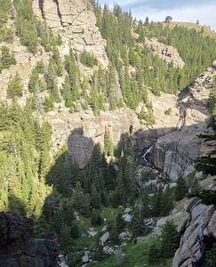
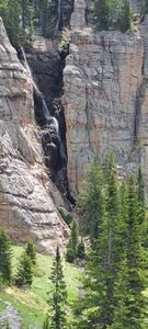
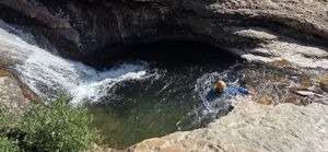
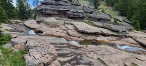
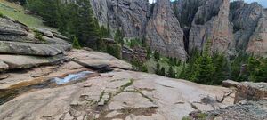
Paradise Falls in North Beaver Creek is a popular hike with a few potholes before a short waterfall. Just down valley on the East is Paradise Gorge, an unnamed waterfall tributary to North Beaver Creek someone described as being even more impressive.
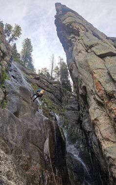
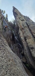
Paradise Gorge is a pretty stunt rappel with a short approach and return.
Approach[edit]
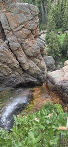
From the dirt parking area (44.76813, -107.79602), a half mile off Hwy 14, hike East cross country to an old road, which provides a better trail. Depart the old road and hike down the drainage through the forest to the top of the Paradise Gorge waterfall.
Descent[edit]
R1: 135' from a tree DCR. Because the waterfall flows at an angle, it is difficult to find a line which coincides with being in the flow for the duration of the rappel. The flow was minimal in late July.
Exit[edit]
Follow a trail from the base of Paradise Gorge leading North toward Paradise Falls. Playing in the upper potholes of Paradise Falls might be a fun option, but beware the final pothole contains a rock fin and probably wouldn't make a safe slide.
Red tape[edit]
Beta sites[edit]
Alltrails.com hike to Paradise Falls
Trip reports and media[edit]
2025-07-27 Explored by Ira Lewis, Carl Bern, Wayne Herrick
