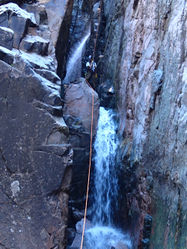
Parallel Play Canyon
| Rating: | |||||||||||||||||||||||||||||||
|---|---|---|---|---|---|---|---|---|---|---|---|---|---|---|---|---|---|---|---|---|---|---|---|---|---|---|---|---|---|---|---|
| | Difficulty:3B IV (v3a2 IV) Raps:4-7, max ↨150ft
Red Tape:No permit required Shuttle:None Vehicle:Passenger Rock type:Quartzite | ||||||||||||||||||||||||||||||
| Start: | |||||||||||||||||||||||||||||||
| Parking: | |||||||||||||||||||||||||||||||
| Condition Reports: | 8 Apr 2024
"We replaced most anchors. Flow was moderate making this route one of the best in the area. Although the creek walking on the exit is long, its very p |
||||||||||||||||||||||||||||||
| Best season: | BEST in Oct;Nov;Feb;Mar;Apr
|
||||||||||||||||||||||||||||||
| Regions: | |||||||||||||||||||||||||||||||
Introduction[edit]
Approach[edit]
There is a decent social trail leading straight up to the drop in on the left side of the canyon. There is a little bit of bush-wacking at the very end through some cat claw, and during more heavily vegetated times of year the trail will be faint and more difficult to follow. Sun protection recommended as the approach is highly exposed for the entire length.
Descent[edit]
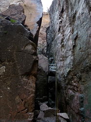
R1: 50' off rock pinch high RDC.
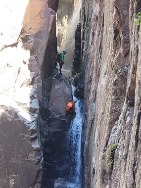
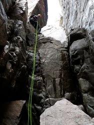
R2: Big 2-stage. 150' off of rock pinch. The R3 rebelay is located off a rock pinch LDC outside of the watercourse. It is easy to miss if not actively looking for the anchor.
R3: 2nd stage. 100' off of rock pinch high LDC to the bottom of the gorge.
R4: 35’ from piton LDC into deep pool. Piton is about 20’ back from the lip.
R5: 40’ LDC off of rock pinch or large tree. Possible to downclimb out of the watercourse RDC.
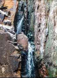
R6: 90' RDC off of rock pinch in waterflow down a series of ledges. Careful with rope position for pull. Anchor is located beyond a pile of chockstones and is accessed with a semi-exposed downclimb. Alternatively, possible anchor opportunities LDC outside of the watercourse.
R7: 75' off of large boulder high RDC (out of watercourse) or 90' off of boulder (in watercourse) down steep angled falls. Potential swimmer at the bottom.
Exit[edit]
2+ miles of boulder hopping and downclimbing. Possible jumps into a few pools, biggest jump about 12'. Eventually exit LDC as it opens up and navigate brush another half mile back to road.
Red tape[edit]
Beta sites[edit]
 Super Amazing Map : Parallel Play Canyon
 HikeArizona.com : Parallel Play Canyon
 OnRopeCanyoneering.com : Parallel Play Canyon
