Penin Canyon
| Rating: | |||||||||||||||||||||||||||||||
|---|---|---|---|---|---|---|---|---|---|---|---|---|---|---|---|---|---|---|---|---|---|---|---|---|---|---|---|---|---|---|---|
| | Difficulty:3B IV (v3a2 IV) Raps:5, max ↨
Red Tape:No permit required Shuttle: Vehicle:Passenger | ||||||||||||||||||||||||||||||
| Location: | |||||||||||||||||||||||||||||||
| Condition Reports: | |||||||||||||||||||||||||||||||
| Best season: | Apr - May
|
||||||||||||||||||||||||||||||
| Regions: | |||||||||||||||||||||||||||||||
Introduction[edit]
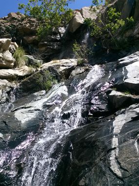
During a narrow Spring window melting water flows through the canyon, giving rise to the best of San Diego water routes. The water sheets nicely off the rock and forms minor turbulences. Above the canyon, a myriad of occupied and active private fenced lots preserve the canyon and spectacular ridge top views from public access.
Approach[edit]
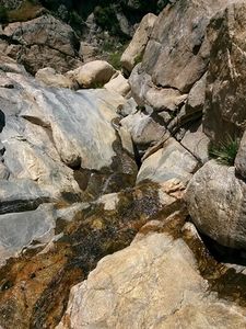
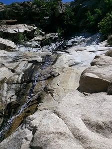
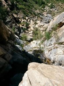
The only legal approach is temporary access via a ridge off the San Diego River made passable by the Cedar Fire of 2003. Hike up the north side/ridge of the canyon off a trail that runs above the San Diego River. The current condition of this ridge allows 800 feet of gain to get to the start of a ridge descent down to a semi-technical section at elevation 2750 in Penin canyon. Once the area fully recovers from the fire of 2003, this access will likely be lost. Above this elevation, the creek is a slow and tedious trek through marshes, slippery shallow granite pools, and cumbersome edged boulders to elevation 2800. Above that is a section of easy slick rock travel.
Descent[edit]
Jammed rocks and deadmen anchors are available. A 200ft rope should suffice (depending on waterflow. With large waterflow, two 200 foot ropes may be necessary. The first section starts off with a slippery 2-stage rappel, the first stage is low angle, the next steep. There are a few short drops after that, difficulty will vary with water flow and how slippery the rock is.
At elevation 2300 a long low angle chute begins a long waterfall rappel sequence. The water splits around a jutting rock and drops into a short freehang down to a wide ledge. Use the the tree RDC on this ledge to rappel another 30 feet to the next ledge. This is followed by a steep 50ft watery down-climb and finally another two-stage rappel both about 30-40ft.
There is another drop downcanyon, but after that drop the creek is back to long bushwacking to the San Diego River.
Current conditions allow the north ridge to be easily gained after the long waterfall and jaunt cross country back to the San Diego river cascade at elevation 2000.
Exit[edit]
This would be filed under the beta for the upper San Diego River. To to the narrow time window the canyon is open, also be aware of weather conditions such as whiteout fog.
Red tape[edit]
The San Diego River Foundation purchased 75 acres of the upper watershed in 2016. This doesn't affect the location unless several other purchases occur. Caltopo has a land management option that gives an approximate location of all the private property. It should be clear that any access from the top crosses private property. In 2013, the the board of supervisors amended San Diego County Ordinance 364.1 to allow for the reimbursement of costs during Search and Rescue operations. Bills for emergency rescue would include costs for becoming lost or injured as a result of violating federal, state or local laws. A civil process could collect up to $12,000 in recovery expenses from individuals, and law-breakers could also be arrested or cited. In addition, a search and rescue here would be well beyond the normal scope of operations.
Map added for proposed descent that minimizes trespassing any private land and can be done as a loop. The approach is mostly on a trail that is often used by hunters or hikers heading to the cemetery on a hill, one would meet this same trail upon exiting.
Trip reports and media[edit]
The canyon under high waterflow in Jan of 2011.


