Peter's Creek
| Rating: | |||||||||||||||||||||||||||||||
|---|---|---|---|---|---|---|---|---|---|---|---|---|---|---|---|---|---|---|---|---|---|---|---|---|---|---|---|---|---|---|---|
| | Difficulty:3B II (v3a2 II) Raps:3-7+, max ↨60ft
Red Tape: Shuttle:None Vehicle:Passenger Rock type:Sandstone | ||||||||||||||||||||||||||||||
| Start: | |||||||||||||||||||||||||||||||
| Parking: | |||||||||||||||||||||||||||||||
| Condition Reports: | 4 Jul 2025
"Conditions were mild with temps in the mid 60s to low 70s. Quite a bit of brush and overturned trees and branches and weeds all over the place. I beli |
||||||||||||||||||||||||||||||
| Best season: | Winter and Spring (avg for this region)
|
||||||||||||||||||||||||||||||
| Regions: | |||||||||||||||||||||||||||||||
Introduction[edit]
Cool little canyon right next to Silicon Valley. It's a great spot to practice ghosting techniques or to bring new friends so they have some idea what canyoneering is about. There are also many rock climbing spots right by the first rap, so a combined sports day is viable.
Not super exciting in the dry season but it can be a lot of fun during winter downpours.
Approach[edit]
From the parking spot, follow the trail parallel to the road and turn into the offshoot that leads to the falls/climbing area (only labeled as something like "Not a through trail").
Descent[edit]
Don't expect any webbing pre-placed - the area has climbing regulations that discourage the placement of permanent anchors. If you need to set up webbing, please remove it on the way out - the tops of most drops are accessible by the exit route.
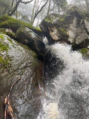
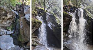
In low flow, there are 3 main raps and several optional ones or downclimbs, but almost everything is also bypassable by taking the faint steep trail RDC (Exit route). We suspect that many other spots will require rope as well if the flow is significantly higher.
In a couple places (R1 and R3), the creek splits into two different sections that have different obstacles, so you can chose whichever side looks better for that particular flow, or just do laps in the canyon to experience the whole thing.
One of the rappels (R3, RDC) drops you into an area that might be a 6ft deep pool in higher flows (judging by water marks on the walls).
The 60ft rappel listed is right after the pool, and it is likely to be downclimbable LDC in low flow. The other raps are 20-40ft.
Exit[edit]
Take the faint steep trail RDC after the last optional rappel and make your way back to the top, then follow the approach route back to the parking spot.
Red tape[edit]
Parking is allowed until 30 min past sunset. There is some private property and roads around, so just stick to the official trails from the preserve.

