Pickaxe Canyon
| Rating: | |||||||||||||||||||||||||||||||
|---|---|---|---|---|---|---|---|---|---|---|---|---|---|---|---|---|---|---|---|---|---|---|---|---|---|---|---|---|---|---|---|
| | Difficulty:3A III (v3a1 III) Raps:2-3, max ↨230ft
Red Tape:No permit required Shuttle:None Vehicle:Passenger Watercraft:Yes | ||||||||||||||||||||||||||||||
| Location: | |||||||||||||||||||||||||||||||
| Condition Reports: | 21 Mar 2020
"Little flow from recent rains. Lightly used trail made approach easy. Fun and scenic packraft was nice. Did it in 2 rappels. Remeasured rappel #1 t |
||||||||||||||||||||||||||||||
| Best season: | BEST in Nov;Dec;Jan;Feb;Mar
|
||||||||||||||||||||||||||||||
| Regions: | |||||||||||||||||||||||||||||||
Introduction[edit]
A decent canyon in the Superstitions with a few big rappels and a watercraft exit. Though the canyon itself isn't terribly scenic, the hiking is nice and the big, fun rappels and packraft exit make for a unique enough day to make this trip worthwhile.
From Phoenix, drive east on US60, then east on state route 88. From Tortilla Flat, continue east on SR88 for 4.3 miles, then turn left on NF80 (not signed) and drive for 1.7 miles to park before a locked gate.
Approach[edit]
From the parking area, follow a fairly well defined trail as it travels north, then west around the head of Crucifix canyon. The trail continues west, then up to gain the ridge above. Once on the ridge the trail splits left and right, ignore both directions of the trail and go straight through this junction heading northeast toward the upper drainage of Pickaxe Canyon.
Descent[edit]
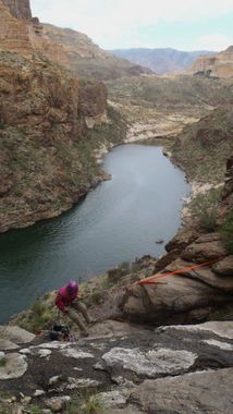
After not too much bushwacking and scrambling around in the upper drainage, the first rappel of about 90 feet is encountered. Hang your packs for this one as the drop is overhung and you're probably carrying heavy watercraft gear. More scrambling and downclimbing (and maybe a short rappel) will eventually lead to a small section of shallow narrows, and finally the big drop that takes you almost to lake level. This last rappel is about 230 feet. This rappel is also overhung for about half of its length and is more comfortable when hanging packs. Downclimb up and LDC to avoid possible pool. Some more bushwacking and downclimbing takes you to the lake.
Exit[edit]
Inflate packrafts and paddle right and upriver from the put-in for about .6 of a mile to a takeout beach on the right before scrambling up the hill to find the SRP road that heads up and south the 2.2 miles and 1300 feet elevation gain back to your car.
Red tape[edit]
Please do not attempt to drive down past the gate at the top of the hill at 33.560229, -111.354189 where the warning sign is; and please do not hike north past Punchbowl Canyon at 33.579780, -111.351727. These areas are managed by SRP and access rights are sensitive.
Beta sites[edit]
 Super Amazing Map : Pickaxe Canyon
 HikeArizona.com : Pickaxe Canyon
