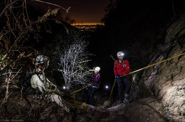
Pine Canyon (San Gabriels Front Range)
| Rating: | ||||||||||||||||
|---|---|---|---|---|---|---|---|---|---|---|---|---|---|---|---|---|
| | Difficulty:3A I (v3a1 I) Raps:2, max ↨45ft
Red Tape:No permit required Shuttle:None | |||||||||||||||
| Location: | ||||||||||||||||
| Condition Reports: | 24 Mar 2023
"With all the rain in the past month, this canyon has a little bit of water flow. I was able to keep my shoes dry although my rope got wet. I did som |
|||||||||||||||
| Best season: | ||||||||||||||||
| Regions: | ||||||||||||||||
Introduction[edit]
A short canyon just East of Rubio with 2 small rappels and 2 interesting mines worth checking out.
Approach[edit]
Park in the vicinity of the junction of Rubio Crest Drive and Rubio Canyon Road. There is generally plenty of parking on Rubio Crest Drive. Head East on Rubio Canyon Road and then immediately North on Camp Huntington Road. Take the first dirt road on your left which goes down into Rubio canyon and eventually turns into a trail. This trail goes up Rubio canyon for a short ways the takes a hard right (East) and climbs the ridge. Follow this trail (old road) to the canyon drop-in at 34.2032, -118.1124.
Descent[edit]
Drop In: very loose dirt going down 20ft, fun sliding with butt protectors
Rappel 1: 40ft anchored from a stout shrub RDC.
Rappel 2: 30ft from a bush LDC.
After the second and final rappel the Surprise mine is on the left.
"It is 477 feet long including two side passages of 90 and 25 feet. The main passage is 362 feet long. It is 4 feet wide, 6 feet high and normally dry."
More information can be found on the mines here: http://www.lagoldmines.com/index.php?page=845364.txt
Exit[edit]
The canyon ends at a series of flood control dams and eventually intersects with the Altadena Crest Trail. There are probably a few ways to follow this trail out to the public street but it's a little confusing. Until an exact route is established for the exit you can use the following at your own risk. Follow the watercourse until the fences appear on either side of the cement drainage. Find the dirt road to the left (LDC) of this drainage and follow it back to E Loma Alta Dr (Turns into Rubio Canyon Rd.). There is a fence here blocking access to the road, that will have to be scaled. Go right (West) and follow E Loma Alta Drive (curves North) back to your car.
11/22/15 Alternate Trail Exit instead of going into the cement drainage with the fence that you can use at your own risk: The Alta Crest Trail will take you back to E Loma Alta Dr. At the control dam junction, the Alta Crest Trail goes right towards the water tower & skirts around the fence of a house. It is the house with the questionable gate that blocks access at Zane Grey Terrace. Follow the trail switchbacks down below & to the right of the house. There will be a junction with one trail going down Zane Grade Terrace and another one going to the backside of the houses of E Loma Alta. I will post a GPS file once I figure out how to extract it of the alternate exit.
Red tape[edit]
The house at the top of Zane Grey Terrace has a gate that blocks access along the easement road. The homeowner may try to mislead hikers and say that there is no trail. A different homeowner at the bottom of the hill claims that gate is illegal and the trail access is legal. There is nice single track trail that bypasses that house and avoids having to exit through the water drainage.
