Pipe Canyon
| Rating: | ||||||||||||
|---|---|---|---|---|---|---|---|---|---|---|---|---|
| | Difficulty:3A II (v3a1 II) Raps:1, max ↨60ft
Red Tape:No permit required Shuttle:None | |||||||||||
| Location: | ||||||||||||
| Condition Reports: | ||||||||||||
| Best season: | ||||||||||||
| Regions: | ||||||||||||
Introduction[edit]
Pipe Canyon might more appropriately be called "Five Feet in Front" canyon because that is usually the distance one is able to see through the brush. There are occasional small, faint use trails through some of the brush, probably created by marijuana farmers based on the hose and fertilizer bags that can be found in the bottom of this canyon.
- As with all the Big T canyons your help is needed to keep access open. This entire area is still seeing a slow recovery from the old station fire which means lots of invasive plants and overgrowth in general can quickly close off access to these areas and/or make your time in them miserable. Consider adding a pair of hand shears and/or small bypass loppers to your gear list when descending these places.
Educate yourself on how and why [1]
BIG TUJUNGA CANYON RESTORATION
Approach[edit]
Exit the 210 at Sunland, head west on Sunland, turn left on Oro Vista, then bear right onto Big Tujunga. Park and proceed up a fire road until the trail branches off to the left.
Descent[edit]
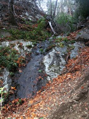
Follow use trails that descend into the canyon and proceed downstream. There is a small drop off where this fork of Pipe Canyon joins the other fork, but it is easily bypassed LDC. Much bushthrashing later, R1 appears.
R1: A two stage rappel ~60 ft, anchored from a bush LDC about 20 ft from the first stage lip.
Continue bushthrashing until a faint trail slowly develops near the end. The final down climb can be in the water flow path.
Exit[edit]
Big Tujunga is visible from above the last down climb; turn left and head down canyon to your vehicle.
