Pleiades Canyon
| Rating: | |||||||||||||||||||||||||||||||
|---|---|---|---|---|---|---|---|---|---|---|---|---|---|---|---|---|---|---|---|---|---|---|---|---|---|---|---|---|---|---|---|
| | Raps:4-6, max ↨70ft
Red Tape:No permit required Shuttle: Vehicle:Passenger Rock type:Sandstone | ||||||||||||||||||||||||||||||
| Location: | |||||||||||||||||||||||||||||||
| Condition Reports: | 22 Sep 2023
"Fun, short canyon! Shoulda run another lap. Chilly up at 9k feet... we all enjoyed at least 4/3 insulation plus rain jackets. |
||||||||||||||||||||||||||||||
| Best season: | July-October
|
||||||||||||||||||||||||||||||
| Regions: | |||||||||||||||||||||||||||||||
Introduction[edit]
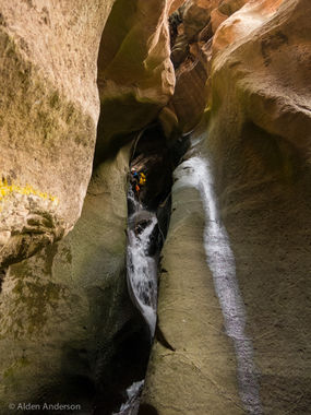
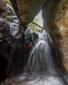
Located in the La Sal mountains, just outside of Moab, Pleiades is A short but amazing canyon that follows Brumley creek as it cuts through a sandstone layer.
Brumley creek is a spring fed creek located in the La Sals and maintains a fairly cold temperature year round when it flows. Wetsuits are highly recommended when the canyon is flowing, which can be at anytime its not frozen. The Mill Creek Gauge in Moab has been suggested as a way to evaluate relative flow in Brumley creek. Mill Creek Gauge readings of 3-8 CFS suggests that there could be flow suitable for intermediate level canyoneers with C Class experience. 0-3 CFS indicates lower flow, suitable for more levels of canyoneers comfortable with the possibility of some flowing water. 8-20 CFS suggests higher levels of waters, potentially not suitable for canyoneering or for experts only. Do not use this as a hard rule. Groups should evaluate the flow of the canyon prior to descending to make sure its suitable for them.
Mill Creek Gauge: https://waterdata.usgs.gov/nwis/uv?site_no=09183500&fbclid=
Approach[edit]
Driving:
From Moab, drive south along Highway 191 towards Spanish Valley. Take Old Airport Road East until you reach La Sal Loop Road. Take La Sal Loop road south, up into the mountains, eventually turning off onto Geyser Pass Road, a graded dirt road, suitible for 2WD/low clearance vehicles. Take Geyser pass road up just short of 3 miles till you reach a small parking lot and trailhead for the Squaw Springs Trail.
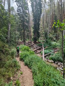
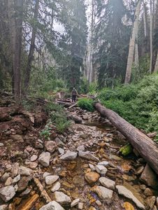
Hiking: Hike south along the trail for about 0.5 miles, -130'. The trail works its way down till it reaches Brumley creek. Depart the trail, following the creek downstream for a short while until the canyon begins to briefly narrow. This small narrow indicates that you're near the first rappel, and is a good spot to put your wetsuit on if the are appropriate for one.
Descent[edit]
Before descending R1, evaluate the flow and water temperature from above. See the Introduction section for more details.
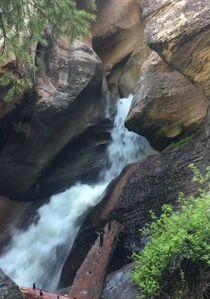
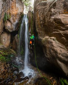
R1: 30' from a fallen tree in the watercourse. Several anchors may be present, some set up to avoid the waterfall. Please avoiding adding and using anchors far outside the watercourse to prevent unnecessary erosion
After descending R1, continue down the creek for another minute, downclimbing a small drop until the 2nd rappel is reached. This is the last place to exit the canyon before commiting to the rest of it.
R2: 60' from a tree down a two tiered drop. Some may choose to rig this as 2 rappels to avoid a difficult pull.
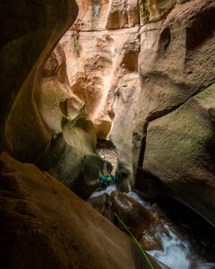
The canyon begins to deep and narrow, leading into a dark sculpted sandstone slot
R3: 30' from a boulder canyon left
R4: 65' from a boulder canyon left down a low angle chute
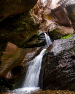
R5: 70' from bolts canyon right. additional bolts may exist canyon left which puts the rappeler more in the flow.
Exit[edit]
Immediately after the final rappel, the Brumley arch trail appears down canyon left. Follow the steep trail for about 0.3 miles till it reaches a small gate. Please sure to leave the gate closed after passing through. After the gate, take a left. heading back down to Brumley creek, and back up +600' to the trailhead
Red tape[edit]
Beta sites[edit]
 RoadTripRyan.com : Pleiades Canyon
 Climb-Utah.com : Pleiades - Moab
 Super Amazing Map : Pleiades Canyon
 Moab Canyoneering Book by Derek A. Wolfe : Pleiades Canyon
 CanyonCollective.com : Pleiades Canyon
Trip reports and media[edit]
- http://adamhaydock.blogspot.com/2015/09/pleiades-canyon-manti-la-sal-national.html
 Candition.com : Pleiades
