Prairie Creek
| Rating: | |||||||||||||||||||||||||||||||
|---|---|---|---|---|---|---|---|---|---|---|---|---|---|---|---|---|---|---|---|---|---|---|---|---|---|---|---|---|---|---|---|
| | Raps:4-6, max ↨70ft
Red Tape:No permit required Shuttle:Required 10 min Vehicle:Passenger Rock type:Basalt | ||||||||||||||||||||||||||||||
| Location: | |||||||||||||||||||||||||||||||
| Condition Reports: | 7 Aug 2024
"Fun creek! A couple of the rappels could use bolts to run the flow.. Probably best run in June-July timeframe for more water. Could be a good week |
||||||||||||||||||||||||||||||
| Best season: | June-July
|
||||||||||||||||||||||||||||||
| Regions: | |||||||||||||||||||||||||||||||
Introduction[edit]
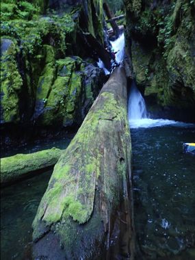
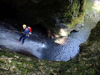
Prairie Creek is a pleasant, non-committing canyon off of Forest Road 23 in the Gifford Pinchot National Forest. Beautiful waterfalls and a set of mini-narrows make for great photos. Plenty of natural anchor options to put you in or out of the flow. A great canyon for beginners.
This creek is best run in early to mid-summer. Water levels typically become very low by the end of the season.
Pair with nearby Dark Creek or East Canyon Creek for a full day of canyoning.
- Watershed: 3.45mi^2.
Approach[edit]
Turn onto NF-2325 on the south side of NF-23. Cross the bridge over East Canyon Creek. Just past the large clearing on your left, take a right on the dirt road heading up the hill. Continue for several minutes until the road ends abruptly at a campsite. Park here for the exit.
Take a shuttle back down the dirt road, make a right, and continue for about 2.5 miles. Park your vehicle where the road crosses a stream. Just before the stream is a pullout with room for several vehicles.
Descent[edit]
Drop directly into the stream from the road, or head down the forest beside the stream for a short distance, dropping in as preferred when the brush gets too thick.
Follow the stream for .25 miles until the convergence with Prairie Creek. There is one small drop on this stream that may require a handline or rappel from a small tree on DCL.
R1: Rappel 35' off a tree on DCR.
Downclimb: Downclimb the large logjam.
R2: The Mini-Narrows: Rappel 15' to a logjam.
- High flow: Rappel off of a boulder on DCL. This boulder is about 10' back from the lip of the drop, and makes for an awkward pull around the corner. It is advised to do a test pull before the last person down.
- Moderate to low flow: It is possible to set up an anchor off of the logjam DCR and rappel directly through the flow, also making for an easier pull.
- Downclimb the logjam just below the rappel to complete the sequence. It is very slippery, so use caution.
R3: Rappel 35' from a tree DCL.
Jump: 10' into a shallow pool. Be sure to send someone to check pool for depth/debris before jumping. Low water: build a cairn to rappel.
R4: High water: Rappel 45' from a tree DCL. Low water: build an anchor in the watercourse to run the flow directly. Took us about 80ft of rope per the horizontal distance.
R5: The Dragon's Lair: This is a beautiful drop into a cool room set back in the rock. High water: bypass this drop. Low water: Anchor on a large log set well back creek-center. Need about 70ft of rope per the horizontal distance. Great rappel.
Downclimb Short downclimb under some logs to complete the technical part of the canyon.
Exit[edit]
After the last drop, there will be around a half hour of slippery creekwalking and logjam navigating. Soon you'll come to a significant logjam in the creek. The creek takes a sharp right after this logjam. Around 100' further downstream, cut up into the brush on CR. Expect some bushwhacking. Once it flattens out a bit, parallel the creek for a few minutes. You'll eventually come across a clearing that is an extension of the old road where you parked your shuttle vehicle. Although overgrown, it's easy walking back to the vehicle.
Red tape[edit]
None.
Beta sites[edit]
Trip reports and media[edit]
Background[edit]
First descent by Jake Huddleston and Michael Henson on 6/15/2019.

