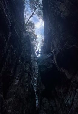
Pueblo Canyon (Lower)
| Rating: | ||||||||||||||||
|---|---|---|---|---|---|---|---|---|---|---|---|---|---|---|---|---|
| | Difficulty:3B III (v3a2 III) Raps:5-7, max ↨70ft
Red Tape: Shuttle:Optional Vehicle:4WD - High Clearance | |||||||||||||||
| Start: | ||||||||||||||||
| Parking: | ||||||||||||||||
| Shuttle: | ||||||||||||||||
| Condition Reports: | 10 May 2022
"So pretty. Did it in 6 raps. Moved the anchor at r2 to a pinch point in a secret rabbit hole chamber accessed RDC. Cairn is gone! One of the later cai |
|||||||||||||||
| Best season: | ||||||||||||||||
| Regions: | ||||||||||||||||
Introduction[edit]
An interesting canyon route deep in the Sierra Anchas Mountains, featuring a waterfall, several rappels, numerous downclimbs, a long, narrow hallway, and a well-preserved archaeological site to explore. As always, ruins, archaeological resources, and artifacts should never be tampered with, removed, or defamed. Please respect, preserve, and protect this special historical place.
All anchors are natural and many reside directly in the watercourse. Anchor construction and evaluation skills are required.
This page details ONLY the lower section and bottom up approach
For more info on the full canyon route and multiple approach options, see other Pueblo Canyon Page.
http://ropewiki.com/Pueblo_Canyon#Descent
Approach[edit]
The access trails listed here are accessible via a stock high clearance 4x4. Good AT/MT tires are highly recommended as is airing down to prevent tire damage. Cherry Creek Road conditions change frequently with the season and washouts can occur. In the wet season, Cherry Creek is often IMPASSABLE due to extreme flow. Cherry Creek Rd is fairly well maintained up until Ellison Ranch but then gets much rockier from there. After Devil's Chasm there is a small boulder field with a large rock in the middle. This is no problem for a skilled driver with a stock high clearance 4x4.
Turn off SR 288 and drive Cherry Creek Road (FR 203) for about 23.2 miles until eventually turning off on to the spur trail that leads up to Pueblo Canyon TH. (33.84071, -110.87279) Cherry Creek Road is well graded dirt until Ellison Ranch, but becomes significantly more rocky and narrow as you approach Devils Chasm. There are a few small places to camp nearby on this spur trail. Option to set up a short shuttle at next pocket forest drainage down the road, (See Shuttle Coordinates) to cut out 45min exit hike on Cherry Creek Rd.
Note that there is very little parking in the area where Pueblo Canyon trail splits from FR 203, and just beyond Devils Chasm trailhead is a large boulder partially blocking the road which may prevent larger vehicles from passing. For these reasons, some may need to park at the Devils Chasm trailhead and hike the rest of the way (about 2 miles). Despite these obstacles, the section of road between Devils Chasm TH and Pueblo Canyon TH is in no worse condition than the road you came in on.
Hike up the Pueblo Canyon trail until you reach the base of a large waterfall which marks the start of the descent. The approach trail is surprisingly well-maintained given its location but the hike is rugged and exposed and good route-finding / GPS is required. Continue traversing to the opposite wall of the canyon to reach the Pueblo ruins.
Visiting the ruins could add about an hour or more to your trip.
When ready, return to the base of the falls and gear up.
Descent[edit]
Continue down watercourse, downclimbing a series of small waterfalls.
R1: 20' Rock pinch RDC
R2: 50' Rock Pinch RDC
R3: 60' Rock cairn, into "The Great Hallway"
R4: 15' Rock cairn in water course
Downclimb crack RDC
R5: 50' Rock cairn
Downclimb crack LDC
R6: 70' Tree RDC
Rock-hop quite a ways, following creek.
R7: 30' Rock pinch RDC in watercourse
Exit[edit]
Continue following drainage, rock-hopping and downclimbing until reaching Cherry Creek Rd. Any parked shuttle vehicle will be found here, otherwise hike down Cherry Creek Rd back to Pueblo Canyon TH.
Red tape[edit]
Beta sites[edit]
https://www.onropecanyoneering.com/pueblo-canyon-az
Trip reports and media[edit]
Background[edit]
FD in 2017 by Jeremiah Beltran and William Lan
